Property Record
St Paul Rd, Mansfield, TX 76065
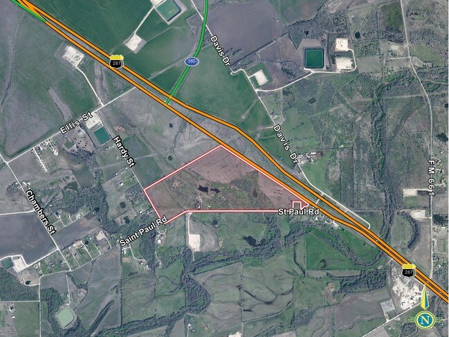

Property Detail
St Paul Rd
Dallas-Fort Worth-Arlington, TX
513 B F HOWARD 4.223 ACRES
185747
ELLIS
Farms
Texas
2024
4.22 AC
2025
Ellis County
060702
Dallas/Ft Worth
1,927 SF
NEARBY LISTINGS FOR SALE OR LEASE
DEMOGRAPHICS near St Paul Rd
1 mile
3 mile
5 mile
2025 Total Population
1,196
17,227
60,667
2030 Population
1,444
20,053
67,682
Pop Growth 2025-2030
+ 20.74%
+ 16.40%
+ 11.56%
Average Age
33
35
36
2025 Total Households
393
5,400
19,528
HH Growth 2025-2030
+ 20.61%
+ 16.59%
+ 11.66%
Median Household Inc
$101,250
$122,413
$112,400
Avg Household Size
3.10
3.20
3.10
2025 Avg HH Vehicles
2.00
2.00
2.00
Median Home Value
$423,451
$442,148
$431,220
Median Year Built
2011
2010
2008
Nearby Places
Map Layers
Map Styles
 Street
 Aerial
Transit
 Traffic
 Biking
Places
Listings with unknown addresses are not visible on the map
- Restaurants
- Banks
- Shops
- Fitness
- Groceries
PUBLIC TRANSPORTATION
AIRPORT
Dallas-Fort Worth International
Drive
Walk
Distance
Dallas-Fort Worth International
37 min
28.4 mi
Dallas Love Field
Drive
Walk
Distance
Dallas Love Field
47 min
36.1 mi
Freight Ports
Port of Shreveport
Drive
Walk
Distance
Port of Shreveport
237 min
220.5 mi
Nearby Properties
Address
Land Use
TOTAL SIZE
Lot Size
Zoning
Address
Land Use
TOTAL SIZE
Lot Size
Zoning
22.94 AC
Address
Land Use
TOTAL SIZE
Lot Size
Zoning
312,848 SF
17.20 AC
Address
Land Use
TOTAL SIZE
Lot Size
Zoning
441,213 SF
10.07 AC
Address
Land Use
TOTAL SIZE
Lot Size
Zoning
360,543 SF
10.34 AC
Address
Land Use
TOTAL SIZE
Lot Size
Zoning
330,444 SF
9.74 AC
Address
Land Use
TOTAL SIZE
Lot Size
Zoning
325,213 SF
8.20 AC
Address
Land Use
TOTAL SIZE
Lot Size
Zoning
117,918 SF
24.17 AC
Address
Land Use
TOTAL SIZE
Lot Size
Zoning
429,603 SF
25.79 AC
Address
Land Use
TOTAL SIZE
Lot Size
Zoning
304,638 SF
10.53 AC
Address
Land Use
TOTAL SIZE
Lot Size
Zoning
458,740 SF
28.66 AC
Address
Land Use
TOTAL SIZE
Lot Size
Zoning
265,620 SF
16.74 AC
Address
Land Use
TOTAL SIZE
Lot Size
Zoning
130,686 SF
20.02 AC
Address
Land Use
TOTAL SIZE
Lot Size
Zoning
11.99 AC
Address
Land Use
TOTAL SIZE
Lot Size
Zoning
115,150 SF
35.90 AC
Address
Land Use
TOTAL SIZE
Lot Size
Zoning
333.20 AC
Address
Land Use
TOTAL SIZE
Lot Size
Zoning
77,038 SF
12.56 AC
Address
Land Use
TOTAL SIZE
Lot Size
Zoning
82,365 SF
12.38 AC
Address
Land Use
TOTAL SIZE
Lot Size
Zoning
92,875 SF
12.36 AC
Address
Land Use
TOTAL SIZE
Lot Size
Zoning
288 SF
145.14 AC
Address
Land Use
TOTAL SIZE
Lot Size
Zoning
27,206 SF
22.01 AC
Address
Land Use
TOTAL SIZE
Lot Size
Zoning
53.48 AC
Address
Land Use
TOTAL SIZE
Lot Size
Zoning
1,430.54 AC
Address
Land Use
TOTAL SIZE
Lot Size
Zoning
75,980 SF
5.62 AC
Address
Land Use
TOTAL SIZE
Lot Size
Zoning
106,020 SF
8.65 AC
Address
Land Use
TOTAL SIZE
Lot Size
Zoning
32.70 AC
Address
Land Use
TOTAL SIZE
Lot Size
Zoning
79,076 SF
Address
Land Use
TOTAL SIZE
Lot Size
Zoning
99,840 SF
8.82 AC
Address
Land Use
TOTAL SIZE
Lot Size
Zoning
79,076 SF
Address
Land Use
TOTAL SIZE
Lot Size
Zoning
23,504 SF
2.50 AC
Address
Land Use
TOTAL SIZE
Lot Size
Zoning
4,482 SF
13.92 AC
The World's #1 Commercial Real Estate Marketplace
Connect with us
© 2026 CoStar Group
The information above has been obtained from sources believed reliable. While we do not doubt its accuracy we have not verified it and make no guarantee, warranty or representation about it. It is your responsibility to independently confirm its accuracy and completeness. Any projections, opinions, assumptions, or estimates used are for example only and do not represent the current or future performance of the property. The value of this transaction to you depends on tax and other factors which should be evaluated by your tax, financial, and legal advisors. You and your advisors should conduct a careful, independent investigation of the property to determine to your satisfaction the suitability of the property for your needs.