Property Record
Stantonsburg Rd, Greenville, NC 27834


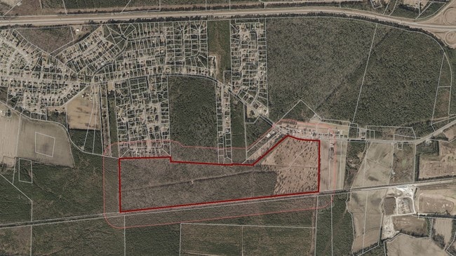
Property Detail
Stantonsburg Rd
025733
A. M. ALLEN & POCOSIN
Agriculturalland
PITT
RR
North Carolina
B and X Area of moderate flood hazard, usually the area between the limits of the 100-year and 500-year floods.
138.02 AC
2025
West Greenville
2025
Other Market Areas
000701
Greenville, NC
NEARBY LISTINGS FOR SALE OR LEASE
DEMOGRAPHICS near Stantonsburg Rd
1 mile
3 mile
5 mile
2025 Total Population
645
22,004
69,890
2030 Population
662
22,648
72,460
Pop Growth 2025-2030
+ 2.64%
+ 2.93%
+ 3.68%
Average Age
39
37
36
2025 Total Households
270
9,828
27,966
HH Growth 2025-2030
+ 2.96%
+ 2.98%
+ 4.13%
Median Household Inc
$73,778
$60,366
$56,141
Avg Household Size
2.40
2.20
2.20
2025 Avg HH Vehicles
2.00
2.00
2.00
Median Home Value
$184,506
$205,027
$224,477
Median Year Built
1988
2000
1995
Nearby Places
Map Layers
Map Styles
 Street
 Aerial
Layers
 Traffic
 Biking
Places
Listings with unknown addresses are not visible on the map
- Restaurants
- Banks
- Shops
- Fitness
- Groceries
PUBLIC TRANSPORTATION
AIRPORT
Pitt-Greenville
Drive
Walk
Distance
Pitt-Greenville
14 min
8.9 mi
Freight Ports
Port of Morehead City
Drive
Walk
Distance
Port of Morehead City
135 min
89.0 mi
SALE & LEASE HISTORY
LISTING DATE
SALE/LEASE

Sep 24, 2016
For Sale
Sep 02, 2020
For Sale
Jun 11, 2018
For Lease
Nearby Properties
Address
Land Use
TOTAL SIZE
Lot Size
Zoning
Address
Land Use
TOTAL SIZE
Lot Size
Zoning
184,433 SF
71.40 AC
MI
Address
Land Use
TOTAL SIZE
Lot Size
Zoning
130,632 SF
5.06 AC
MI
Address
Land Use
TOTAL SIZE
Lot Size
Zoning
204,828 SF
10 AC
MS
Address
Land Use
TOTAL SIZE
Lot Size
Zoning
18,932 SF
11.51 AC
MR
Address
Land Use
TOTAL SIZE
Lot Size
Zoning
23,772 SF
8.75 AC
MR
Address
Land Use
TOTAL SIZE
Lot Size
Zoning
189,690 SF
82.83 AC
CH
Address
Land Use
TOTAL SIZE
Lot Size
Zoning
94,176 SF
23.12 AC
R6
Address
Land Use
TOTAL SIZE
Lot Size
Zoning
97,638 SF
28.62 AC
R9S
Address
Land Use
TOTAL SIZE
Lot Size
Zoning
77,707 SF
6.37 AC
MS
Address
Land Use
TOTAL SIZE
Lot Size
Zoning
64,547 SF
28.84 AC
MO
Address
Land Use
TOTAL SIZE
Lot Size
Zoning
26,958 SF
7.67 AC
MR
Address
Land Use
TOTAL SIZE
Lot Size
Zoning
30,714 SF
7.79 AC
MR
Address
Land Use
TOTAL SIZE
Lot Size
Zoning
27,466 SF
7.57 AC
MR
Address
Land Use
TOTAL SIZE
Lot Size
Zoning
129,749 SF
13.56 AC
MCG
Address
Land Use
TOTAL SIZE
Lot Size
Zoning
54,430 SF
39.09 AC
RA20
Address
Land Use
TOTAL SIZE
Lot Size
Zoning
45,471 SF
10.69 AC
MO
Address
Land Use
TOTAL SIZE
Lot Size
Zoning
8,736 SF
6.91 AC
MR
Address
Land Use
TOTAL SIZE
Lot Size
Zoning
31,820 SF
4.61 AC
MR
Address
Land Use
TOTAL SIZE
Lot Size
Zoning
45,180 SF
7.16 AC
MO
Address
Land Use
TOTAL SIZE
Lot Size
Zoning
15,896 SF
9.90 AC
MR
Address
Land Use
TOTAL SIZE
Lot Size
Zoning
57,802 SF
25.57 AC
RA20
Address
Land Use
TOTAL SIZE
Lot Size
Zoning
56,729 SF
29.83 AC
MI
Address
Land Use
TOTAL SIZE
Lot Size
Zoning
5,370 SF
8.19 AC
R6
Address
Land Use
TOTAL SIZE
Lot Size
Zoning
8,736 SF
6.15 AC
MR
Address
Land Use
TOTAL SIZE
Lot Size
Zoning
7,680 SF
11.07 AC
MR
Address
Land Use
TOTAL SIZE
Lot Size
Zoning
42,100 SF
5.03 AC
CG
Address
Land Use
TOTAL SIZE
Lot Size
Zoning
32,489 SF
4.85 AC
MO
Address
Land Use
TOTAL SIZE
Lot Size
Zoning
46,448 SF
0.69 AC
MS
Address
Land Use
TOTAL SIZE
Lot Size
Zoning
13,391 SF
8.86 AC
R6
Address
Land Use
TOTAL SIZE
Lot Size
Zoning
48,112 SF
2 AC
MO
The World's #1 Commercial Real Estate Marketplace
Connect with us
© 2026 CoStar Group
The information above has been obtained from sources believed reliable. While we do not doubt its accuracy we have not verified it and make no guarantee, warranty or representation about it. It is your responsibility to independently confirm its accuracy and completeness. Any projections, opinions, assumptions, or estimates used are for example only and do not represent the current or future performance of the property. The value of this transaction to you depends on tax and other factors which should be evaluated by your tax, financial, and legal advisors. You and your advisors should conduct a careful, independent investigation of the property to determine to your satisfaction the suitability of the property for your needs.