Property Record
State Highway 121, Plano, TX 75024
Property Detail
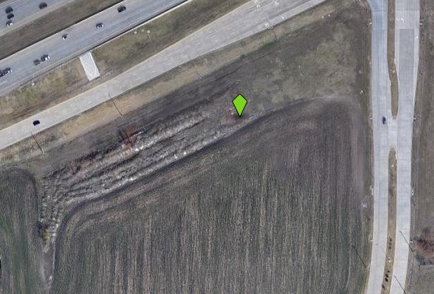
State Highway 121
Dallas-Fort Worth-Arlington, TX
Mustang Square Addition (Cpl)
R-11369-00A-0060-1
MUSTANG SQUARE ADDITION, BLK A, LOT 6; (REPLAT)
Commercialacreage
Collin
X
Texas
48085C0360K
6
2024
2.82 AC
2025
Plano
031657
Dallas/Ft Worth
NEARBY LISTINGS FOR SALE OR LEASE
DEMOGRAPHICS near State Highway 121
1 mile
3 mile
5 mile
2024 Total Population
18,347
135,649
348,162
2029 Population
22,439
165,208
424,652
Pop Growth 2024-2029
+ 22.30%
+ 21.79%
+ 21.97%
Average Age
36
38
38
2024 Total Households
6,681
53,232
132,587
HH Growth 2024-2029
+ 22.66%
+ 22.24%
+ 22.35%
Median Household Inc
$131,693
$109,328
$115,764
Avg Household Size
2.70
2.50
2.60
2024 Avg HH Vehicles
2.00
2.00
2.00
Median Home Value
$446,834
$441,393
$454,259
Median Year Built
2005
2000
1999
Nearby Places
Map Layers
Map Styles
 Street
 Aerial
Transit
 Traffic
 Biking
Places
Listings with unknown addresses are not visible on the map
- Restaurants
- Banks
- Shops
- Fitness
- Groceries
PUBLIC TRANSPORTATION
AIRPORT
Dallas Love Field
Drive
Walk
Distance
Dallas Love Field
31 min
23.1 mi
Dallas-Fort Worth International
Drive
Walk
Distance
Dallas-Fort Worth International
28 min
23.9 mi
Freight Ports
Port of Shreveport
Drive
Walk
Distance
Port of Shreveport
234 min
216.4 mi
Nearby Properties
Address
Land Use
TOTAL SIZE
Lot Size
Zoning
Address
Land Use
TOTAL SIZE
Lot Size
Zoning
1,508,248 SF
49.26 AC
CE
Address
Land Use
TOTAL SIZE
Lot Size
Zoning
779,629 SF
56 AC
Address
Land Use
TOTAL SIZE
Lot Size
Zoning
958,318 SF
9.07 AC
CE
Address
Land Use
TOTAL SIZE
Lot Size
Zoning
1,316,483 SF
47.52 AC
Address
Land Use
TOTAL SIZE
Lot Size
Zoning
1,929,059 SF
55.12 AC
CE
Address
Land Use
TOTAL SIZE
Lot Size
Zoning
558,664 SF
20.14 AC
CE
Address
Land Use
TOTAL SIZE
Lot Size
Zoning
525,388 SF
5.01 AC
Address
Land Use
TOTAL SIZE
Lot Size
Zoning
358,447 SF
40.21 AC
Address
Land Use
TOTAL SIZE
Lot Size
Zoning
975,081 SF
15.33 AC
Address
Land Use
TOTAL SIZE
Lot Size
Zoning
525,405 SF
5.09 AC
Address
Land Use
TOTAL SIZE
Lot Size
Zoning
741,280 SF
90.87 AC
Address
Land Use
TOTAL SIZE
Lot Size
Zoning
420,131 SF
3.92 AC
COMM
Address
Land Use
TOTAL SIZE
Lot Size
Zoning
426,009 SF
3.60 AC
Address
Land Use
TOTAL SIZE
Lot Size
Zoning
358,496 SF
2.49 AC
Address
Land Use
TOTAL SIZE
Lot Size
Zoning
426,009 SF
3.60 AC
Address
Land Use
TOTAL SIZE
Lot Size
Zoning
325,179 SF
4.74 AC
COMM
Address
Land Use
TOTAL SIZE
Lot Size
Zoning
440,034 SF
2.11 AC
CE
Address
Land Use
TOTAL SIZE
Lot Size
Zoning
455,432 SF
2.55 AC
MULTI-FAMI
Address
Land Use
TOTAL SIZE
Lot Size
Zoning
356,196 SF
3.71 AC
CB-1
Address
Land Use
TOTAL SIZE
Lot Size
Zoning
337,550 SF
8.73 AC
Address
Land Use
TOTAL SIZE
Lot Size
Zoning
584,998 SF
23.45 AC
Address
Land Use
TOTAL SIZE
Lot Size
Zoning
318,230 SF
5.52 AC
Address
Land Use
TOTAL SIZE
Lot Size
Zoning
761,346 SF
75.86 AC
Address
Land Use
TOTAL SIZE
Lot Size
Zoning
320,098 SF
20 AC
CE
Address
Land Use
TOTAL SIZE
Lot Size
Zoning
375,848 SF
5.76 AC
Address
Land Use
TOTAL SIZE
Lot Size
Zoning
1,578,500 SF
91.04 AC
Address
Land Use
TOTAL SIZE
Lot Size
Zoning
351,604 SF
3.17 AC
Address
Land Use
TOTAL SIZE
Lot Size
Zoning
306,200 SF
4.33 AC
Address
Land Use
TOTAL SIZE
Lot Size
Zoning
318,619 SF
5.65 AC
COMM
Address
Land Use
TOTAL SIZE
Lot Size
Zoning
454,511 SF
52.88 AC
COMM
The World's #1 Commercial Real Estate Marketplace
Connect with us
© 2026 CoStar Group
The information above has been obtained from sources believed reliable. While we do not doubt its accuracy we have not verified it and make no guarantee, warranty or representation about it. It is your responsibility to independently confirm its accuracy and completeness. Any projections, opinions, assumptions, or estimates used are for example only and do not represent the current or future performance of the property. The value of this transaction to you depends on tax and other factors which should be evaluated by your tax, financial, and legal advisors. You and your advisors should conduct a careful, independent investigation of the property to determine to your satisfaction the suitability of the property for your needs.