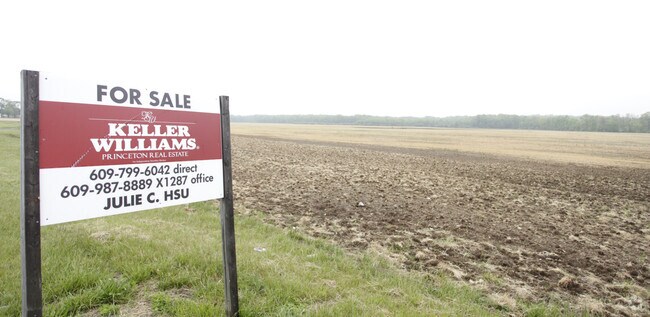
Property Record
State Highway 33, Millstone Twp, NJ 08535

NEARBY LISTINGS FOR SALE OR LEASE
-
-
No Photo
-
-
-
-
-
-
View all Millstone Twp listings for sale on LoopNet.com
Property Detail
State Highway 33
33-00017-0000-00006-0000-QFARM
Monmouth
Farms
New Jersey
X
6
34023C0268F
111 AC
2024
Western Monmouth
2025
Northern New Jersey
812501
New York-Jersey City-White Plains, NY-NJ
DEMOGRAPHICS near State Highway 33
1 Mile
3 Mile
5 Mile
2024 Total Population
573
12,810
59,805
2029 Population
567
12,865
59,504
Pop Growth 2024-2029
(1.05%)
+ 0.43%
(0.50%)
Average Age
41
41
46
2024 Total Households
173
4,331
23,008
HH Growth 2024-2029
(1.16%)
+ 0.28%
(0.91%)
Median Household Inc
$186,666
$162,161
$114,593
Avg Household Size
3.10
2.90
2.50
2024 Avg HH Vehicles
3.00
2.00
2.00
Median Home Value
$621,428
$624,414
$473,473
Median Year Built
1991
2003
1992
Nearby Places
Map Layers
Map Styles
 Street
 Aerial
- Restaurants
- Banks
- Shops
- Fitness
- Groceries
PUBLIC TRANSPORTATION
AIRPORT
Trenton Mercer
DRIVE
WALK
Distance
Trenton Mercer
41 min
27.4 mi
Freight Ports
New York Container Terminal
DRIVE
WALK
Distance
New York Container Terminal
53 min
40.9 mi
SALE & LEASE HISTORY
LISTING DATE
SALE/LEASE

Sep 24, 2016
For Sale
Nearby Properties
Address
Land Use
TOTAL SIZE
Lot Size
Zoning
Address
Land Use
TOTAL SIZE
Lot Size
Zoning
3,060 SF
114.66 AC
PCD
Address
Land Use
TOTAL SIZE
Lot Size
Zoning
220,000 SF
25.42 AC
PCD
Address
Land Use
TOTAL SIZE
Lot Size
Zoning
12.27 AC
PCD
Address
Land Use
TOTAL SIZE
Lot Size
Zoning
63.69 AC
HD
Address
Land Use
TOTAL SIZE
Lot Size
Zoning
56.30 AC
Address
Land Use
TOTAL SIZE
Lot Size
Zoning
2,611 SF
5.23 AC
HDRA
Address
Land Use
TOTAL SIZE
Lot Size
Zoning
9.63 AC
SED2W
Address
Land Use
TOTAL SIZE
Lot Size
Zoning
1,914 SF
12 AC
HD
Address
Land Use
TOTAL SIZE
Lot Size
Zoning
46,930 SF
12.39 AC
HC
Address
Land Use
TOTAL SIZE
Lot Size
Zoning
11.78 AC
HD
Address
Land Use
TOTAL SIZE
Lot Size
Zoning
113,700 SF
7.15 AC
HD
Address
Land Use
TOTAL SIZE
Lot Size
Zoning
2,816 SF
1 AC
SED2
Address
Land Use
TOTAL SIZE
Lot Size
Zoning
149.06 AC
RAG4
Address
Land Use
TOTAL SIZE
Lot Size
Zoning
9.56 AC
SED/
Address
Land Use
TOTAL SIZE
Lot Size
Zoning
10.04 AC
BP
Address
Land Use
TOTAL SIZE
Lot Size
Zoning
80 AC
FHC
Address
Land Use
TOTAL SIZE
Lot Size
Zoning
34,260 SF
3.40 AC
PCD
Address
Land Use
TOTAL SIZE
Lot Size
Zoning
1.93 AC
HD
Address
Land Use
TOTAL SIZE
Lot Size
Zoning
7.91 AC
BP
Address
Land Use
TOTAL SIZE
Lot Size
Zoning
5 AC
SED2W
Address
Land Use
TOTAL SIZE
Lot Size
Zoning
Address
Land Use
TOTAL SIZE
Lot Size
Zoning
2,744 SF
43.38 AC
PCD
Address
Land Use
TOTAL SIZE
Lot Size
Zoning
54.15 AC
SF80
Address
Land Use
TOTAL SIZE
Lot Size
Zoning
24.46 AC
CDKH
Address
Land Use
TOTAL SIZE
Lot Size
Zoning
9,180 SF
11.96 AC
PDAH
Address
Land Use
TOTAL SIZE
Lot Size
Zoning
5.11 AC
I10
Address
Land Use
TOTAL SIZE
Lot Size
Zoning
3 AC
SED5
Address
Land Use
TOTAL SIZE
Lot Size
Zoning
3 AC
SED5
Address
Land Use
TOTAL SIZE
Lot Size
Zoning
15,760 SF
2.70 AC
Address
Land Use
TOTAL SIZE
Lot Size
Zoning
43,530 SF
9.17 AC
FHC
The World's #1 Commercial Real Estate Marketplace
Connect with us
© 2025 CoStar Group
The information above has been obtained from sources believed reliable. While we do not doubt its accuracy we have not verified it and make no guarantee, warranty or representation about it. It is your responsibility to independently confirm its accuracy and completeness. Any projections, opinions, assumptions, or estimates used are for example only and do not represent the current or future performance of the property. The value of this transaction to you depends on tax and other factors which should be evaluated by your tax, financial, and legal advisors. You and your advisors should conduct a careful, independent investigation of the property to determine to your satisfaction the suitability of the property for your needs.