Property Record
State Highway 334, Mabank, TX 75156


Property Detail
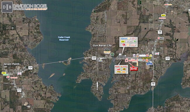
State Highway 334
Athens, TX
TRS 14E & 14J AB 483 B MEDRO SUR, TRS 14E & 14J
0483-0140-0E00-53
HENDERSON
Privatepreserveopenspacevacantlandforestlandconservation
Texas
B and X Area of moderate flood hazard, usually the area between the limits of the 100-year and 500-year floods.
5.08 AC
2024
Henderson County
2025
Dallas/Ft Worth
950905
NEARBY LISTINGS FOR SALE OR LEASE
DEMOGRAPHICS near State Highway 334
1 mile
3 mile
5 mile
2025 Total Population
1,404
14,172
28,664
2030 Population
1,509
15,493
32,243
Pop Growth 2025-2030
+ 7.48%
+ 9.32%
+ 12.49%
Average Age
43
42
43
2025 Total Households
571
5,635
11,427
HH Growth 2025-2030
+ 7.53%
+ 8.91%
+ 11.59%
Median Household Inc
$65,454
$60,082
$59,459
Avg Household Size
2.40
2.50
2.40
2025 Avg HH Vehicles
2.00
2.00
2.00
Median Home Value
$231,200
$242,582
$234,868
Median Year Built
1990
1989
1988
Nearby Places
Map Layers
Map Styles
 Street
 Aerial
Layers
 Traffic
 Biking
Places
Listings with unknown addresses are not visible on the map
- Restaurants
- Banks
- Shops
- Fitness
- Groceries
SALE & LEASE HISTORY
LISTING DATE
SALE/LEASE

Nov 21, 2022
For Sale
Nearby Properties
Address
Land Use
TOTAL SIZE
Lot Size
Zoning
Address
Land Use
TOTAL SIZE
Lot Size
Zoning
35,697 SF
9.21 AC
Address
Land Use
TOTAL SIZE
Lot Size
Zoning
161,900 SF
17.83 AC
Address
Land Use
TOTAL SIZE
Lot Size
Zoning
148,456 SF
21.41 AC
Address
Land Use
TOTAL SIZE
Lot Size
Zoning
45,576 SF
5.58 AC
Address
Land Use
TOTAL SIZE
Lot Size
Zoning
60,260 SF
21 AC
Address
Land Use
TOTAL SIZE
Lot Size
Zoning
6,514 SF
3.77 AC
Address
Land Use
TOTAL SIZE
Lot Size
Zoning
6,115 SF
3.07 AC
Address
Land Use
TOTAL SIZE
Lot Size
Zoning
6,629 SF
6.40 AC
Address
Land Use
TOTAL SIZE
Lot Size
Zoning
6,734 SF
1.07 AC
Address
Land Use
TOTAL SIZE
Lot Size
Zoning
6,374 SF
1.35 AC
Address
Land Use
TOTAL SIZE
Lot Size
Zoning
6,617 SF
1.01 AC
Address
Land Use
TOTAL SIZE
Lot Size
Zoning
6,608 SF
1.04 AC
Address
Land Use
TOTAL SIZE
Lot Size
Zoning
5,650 SF
2.03 AC
Address
Land Use
TOTAL SIZE
Lot Size
Zoning
19,120 SF
4 AC
Address
Land Use
TOTAL SIZE
Lot Size
Zoning
Address
Land Use
TOTAL SIZE
Lot Size
Zoning
5,760 SF
1.35 AC
Address
Land Use
TOTAL SIZE
Lot Size
Zoning
61,419 SF
5.19 AC
Address
Land Use
TOTAL SIZE
Lot Size
Zoning
90,493 SF
3.45 AC
Address
Land Use
TOTAL SIZE
Lot Size
Zoning
5,938 SF
1 AC
Address
Land Use
TOTAL SIZE
Lot Size
Zoning
5,378 SF
1.21 AC
Address
Land Use
TOTAL SIZE
Lot Size
Zoning
3,717 SF
1.39 AC
Address
Land Use
TOTAL SIZE
Lot Size
Zoning
6,935 SF
1.95 AC
Address
Land Use
TOTAL SIZE
Lot Size
Zoning
63,811 SF
6.29 AC
Address
Land Use
TOTAL SIZE
Lot Size
Zoning
13,836 SF
1.83 AC
Address
Land Use
TOTAL SIZE
Lot Size
Zoning
4,893 SF
1.47 AC
Address
Land Use
TOTAL SIZE
Lot Size
Zoning
6,101 SF
2 AC
Address
Land Use
TOTAL SIZE
Lot Size
Zoning
6,164 SF
1.69 AC
Address
Land Use
TOTAL SIZE
Lot Size
Zoning
5,685 SF
1.40 AC
Address
Land Use
TOTAL SIZE
Lot Size
Zoning
5,074 SF
1.01 AC
Address
Land Use
TOTAL SIZE
Lot Size
Zoning
5,496 SF
1.56 AC
The World's #1 Commercial Real Estate Marketplace
Connect with us
© 2026 CoStar Group
The information above has been obtained from sources believed reliable. While we do not doubt its accuracy we have not verified it and make no guarantee, warranty or representation about it. It is your responsibility to independently confirm its accuracy and completeness. Any projections, opinions, assumptions, or estimates used are for example only and do not represent the current or future performance of the property. The value of this transaction to you depends on tax and other factors which should be evaluated by your tax, financial, and legal advisors. You and your advisors should conduct a careful, independent investigation of the property to determine to your satisfaction the suitability of the property for your needs.