Property Record
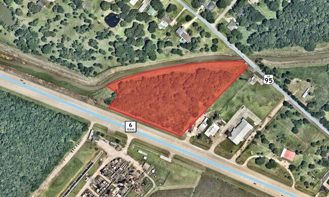
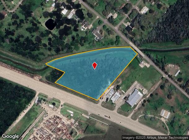
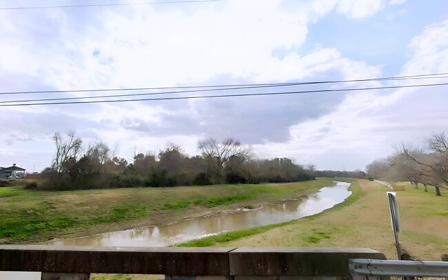
Highway 6, Manvel, TX 77578
This Property Is For Sale
NEARBY LISTINGS FOR SALE OR LEASE
Property Detail
Highway 6
Houston-The Woodlands-Sugar Land, TX
H T & B R R
0231-1024-118
A0231 H T & B R R TRACT 2C4L-2D2 ACRES 6.71 (MANVEL)
Agriculturalland
Brazoria
AE
Texas
48039C0130K
6.71 AC
2024
South
2025
Houston
660708
DEMOGRAPHICS near Highway 6
1 Mile
3 Mile
5 Mile
2024 Total Population
1,192
9,079
37,891
2029 Population
1,330
10,226
42,824
Pop Growth 2024-2029
+ 11.58%
+ 12.63%
+ 13.02%
Average Age
39
40
38
2024 Total Households
392
3,083
12,634
HH Growth 2024-2029
+ 11.48%
+ 12.81%
+ 13.17%
Median Household Inc
$63,393
$79,687
$78,529
Avg Household Size
2.90
2.80
2.90
2024 Avg HH Vehicles
2.00
2.00
2.00
Median Home Value
$254,545
$294,431
$254,364
Median Year Built
1983
1993
1998
Nearby Places
Map Layers
Map Styles
 Street
 Aerial
- Restaurants
- Banks
- Shops
- Fitness
- Groceries
PUBLIC TRANSPORTATION
AIRPORT
William P Hobby
DRIVE
WALK
Distance
William P Hobby
34 min
17.7 mi
Freight Ports
Port of Houston
DRIVE
WALK
Distance
Port of Houston
42 min
29.3 mi
Nearby Properties
Address
Land Use
TOTAL SIZE
Lot Size
Zoning
Address
Land Use
TOTAL SIZE
Lot Size
Zoning
114.04 AC
Address
Land Use
TOTAL SIZE
Lot Size
Zoning
120,380 SF
15.56 AC
Address
Land Use
TOTAL SIZE
Lot Size
Zoning
93,990 SF
15.73 AC
Address
Land Use
TOTAL SIZE
Lot Size
Zoning
21.99 AC
0258
Address
Land Use
TOTAL SIZE
Lot Size
Zoning
172,015 SF
18.36 AC
Address
Land Use
TOTAL SIZE
Lot Size
Zoning
17.17 AC
Address
Land Use
TOTAL SIZE
Lot Size
Zoning
41,510 SF
20.52 AC
Address
Land Use
TOTAL SIZE
Lot Size
Zoning
46,732 SF
8.64 AC
0752
Address
Land Use
TOTAL SIZE
Lot Size
Zoning
21,300 SF
12.92 AC
Address
Land Use
TOTAL SIZE
Lot Size
Zoning
48,750 SF
2.82 AC
Address
Land Use
TOTAL SIZE
Lot Size
Zoning
11,628 SF
1.86 AC
0009
Address
Land Use
TOTAL SIZE
Lot Size
Zoning
50,400 SF
8.40 AC
0013
Address
Land Use
TOTAL SIZE
Lot Size
Zoning
162,100 SF
24.51 AC
0056
Address
Land Use
TOTAL SIZE
Lot Size
Zoning
14,768 SF
1.30 AC
Address
Land Use
TOTAL SIZE
Lot Size
Zoning
12,240 SF
1.46 AC
0240
Address
Land Use
TOTAL SIZE
Lot Size
Zoning
34,368 SF
4.32 AC
Address
Land Use
TOTAL SIZE
Lot Size
Zoning
3,504 SF
187.33 AC
0027
Address
Land Use
TOTAL SIZE
Lot Size
Zoning
9,020 SF
3.12 AC
Address
Land Use
TOTAL SIZE
Lot Size
Zoning
3,257 SF
105.55 AC
0428
Address
Land Use
TOTAL SIZE
Lot Size
Zoning
25,200 SF
5.08 AC
Address
Land Use
TOTAL SIZE
Lot Size
Zoning
50,958 SF
10.33 AC
Address
Land Use
TOTAL SIZE
Lot Size
Zoning
21,152 SF
34.11 AC
0007
Address
Land Use
TOTAL SIZE
Lot Size
Zoning
14,360 SF
1.99 AC
Address
Land Use
TOTAL SIZE
Lot Size
Zoning
14,771 SF
4.18 AC
Address
Land Use
TOTAL SIZE
Lot Size
Zoning
7,662 SF
1.11 AC
Address
Land Use
TOTAL SIZE
Lot Size
Zoning
74,352 SF
4.31 AC
Address
Land Use
TOTAL SIZE
Lot Size
Zoning
7,460 SF
1.75 AC
0002
Address
Land Use
TOTAL SIZE
Lot Size
Zoning
13,750 SF
12.42 AC
0222
Address
Land Use
TOTAL SIZE
Lot Size
Zoning
46,700 SF
6.41 AC
0022
Address
Land Use
TOTAL SIZE
Lot Size
Zoning
7,788 SF
2.03 AC
The World's #1 Commercial Real Estate Marketplace
Connect with us
© 2026 CoStar Group
The information above has been obtained from sources believed reliable. While we do not doubt its accuracy we have not verified it and make no guarantee, warranty or representation about it. It is your responsibility to independently confirm its accuracy and completeness. Any projections, opinions, assumptions, or estimates used are for example only and do not represent the current or future performance of the property. The value of this transaction to you depends on tax and other factors which should be evaluated by your tax, financial, and legal advisors. You and your advisors should conduct a careful, independent investigation of the property to determine to your satisfaction the suitability of the property for your needs.