Property Record
State Hwy, Kern County, CA 93249
Property Detail
State Hwy
Bakersfield-Delano, CA
SECTION 6 , TOWNSHIP 27 , RANGE 20 , QUARTER
057-180-45-00-8
KERN
Vacantlandnec
California
A Areas with a 1% annual chance of flooding and a 26% chance of flooding over the life of a 30-year mortgage.
1.47 AC
2025
NW Outlying Kern County
2025
Bakersfield
004500
NEARBY LISTINGS FOR SALE OR LEASE
-
-
View all Kern County listings for sale on LoopNet.com
DEMOGRAPHICS near State Hwy
1 mile
3 mile
5 mile
2025 Total Population
159
163
163
2030 Population
159
163
163
Pop Growth 2025-2030
0.00%
0.00%
0.00%
Average Age
31
31
31
2025 Total Households
39
40
40
HH Growth 2025-2030
0.00%
(2.50%)
(2.50%)
Median Household Inc
$65,625
$65,625
$65,625
Avg Household Size
4.20
4.20
4.20
2025 Avg HH Vehicles
2.00
2.00
2.00
Median Home Value
$359,999
$350,000
$350,000
Median Year Built
1977
1977
1977
Nearby Places
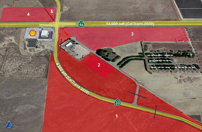
Map Layers
Map Styles
 Street
 Aerial
Layers
 Traffic
 Biking
Places
Listings with unknown addresses are not visible on the map
- Restaurants
- Banks
- Shops
- Fitness
- Groceries
SALE & LEASE HISTORY
LISTING DATE
SALE/LEASE

Oct 12, 2022
For Sale
Nearby Properties
Address
Land Use
TOTAL SIZE
Lot Size
Zoning
Address
Land Use
TOTAL SIZE
Lot Size
Zoning
1,848 SF
76.27 AC
A1
Address
Land Use
TOTAL SIZE
Lot Size
Zoning
773 SF
307.31 AC
A
Address
Land Use
TOTAL SIZE
Lot Size
Zoning
19,564 SF
3.83 AC
C2
Address
Land Use
TOTAL SIZE
Lot Size
Zoning
27,664 SF
48.12 AC
A
Address
Land Use
TOTAL SIZE
Lot Size
Zoning
476.83 AC
A
Address
Land Use
TOTAL SIZE
Lot Size
Zoning
306.88 AC
A
Address
Land Use
TOTAL SIZE
Lot Size
Zoning
1,137.50 AC
A
Address
Land Use
TOTAL SIZE
Lot Size
Zoning
73.94 AC
Address
Land Use
TOTAL SIZE
Lot Size
Zoning
3.47 AC
CO
Address
Land Use
TOTAL SIZE
Lot Size
Zoning
4.13 AC
C2
The World's #1 Commercial Real Estate Marketplace
Connect with us
© 2026 CoStar Group
The information above has been obtained from sources believed reliable. While we do not doubt its accuracy we have not verified it and make no guarantee, warranty or representation about it. It is your responsibility to independently confirm its accuracy and completeness. Any projections, opinions, assumptions, or estimates used are for example only and do not represent the current or future performance of the property. The value of this transaction to you depends on tax and other factors which should be evaluated by your tax, financial, and legal advisors. You and your advisors should conduct a careful, independent investigation of the property to determine to your satisfaction the suitability of the property for your needs.