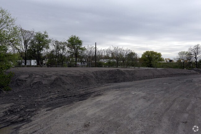
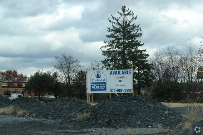
Property Record
State Hwy, Pittston, PA 18640

NEARBY LISTINGS FOR SALE OR LEASE
-
-
-
-
-
No Photo
-
-
View all Pittston listings for sale on LoopNet.com
Property Detail
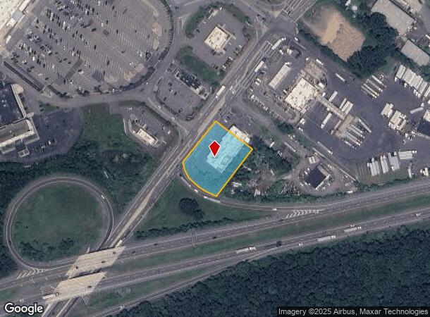
State Hwy
Scranton--Wilkes-Barre--Hazelton, PA
Pennsylvania Coal Company
51-E12S1-007-003-000
51-C-37-1-R-D1-3 STATE HWY
Hotelormotel
Luzerne
X
Pennsylvania
42079C0234E
3
2025
0.85 AC
2025
I-81 Corridor
210100
Philadelphia
DEMOGRAPHICS near State Hwy
1 Mile
3 Mile
5 Mile
2024 Total Population
2,265
31,846
61,913
2029 Population
2,236
31,741
61,571
Pop Growth 2024-2029
(1.28%)
(0.33%)
(0.55%)
Average Age
45
43
44
2024 Total Households
1,057
14,117
27,585
HH Growth 2024-2029
(1.32%)
(0.35%)
(0.55%)
Median Household Inc
$67,587
$64,559
$66,905
Avg Household Size
2.10
2.20
2.20
2024 Avg HH Vehicles
2.00
2.00
2.00
Median Home Value
$144,621
$145,764
$152,777
Median Year Built
1948
1948
1956
Nearby Places
Map Layers
Map Styles
 Street
 Aerial
- Restaurants
- Banks
- Shops
- Fitness
- Groceries
PUBLIC TRANSPORTATION
AIRPORT
Wilkes-Barre/Scranton International
DRIVE
WALK
Distance
Wilkes-Barre/Scranton International
7 min
2.4 mi
SALE & LEASE HISTORY
LISTING DATE
SALE/LEASE

May 12, 2017
For Sale
Nearby Properties
Address
Land Use
TOTAL SIZE
Lot Size
Zoning
Address
Land Use
TOTAL SIZE
Lot Size
Zoning
225.55 AC
Address
Land Use
TOTAL SIZE
Lot Size
Zoning
48.95 AC
Address
Land Use
TOTAL SIZE
Lot Size
Zoning
100 AC
Address
Land Use
TOTAL SIZE
Lot Size
Zoning
Address
Land Use
TOTAL SIZE
Lot Size
Zoning
130.63 AC
Address
Land Use
TOTAL SIZE
Lot Size
Zoning
92.99 AC
Address
Land Use
TOTAL SIZE
Lot Size
Zoning
59.28 AC
Address
Land Use
TOTAL SIZE
Lot Size
Zoning
58.45 AC
Address
Land Use
TOTAL SIZE
Lot Size
Zoning
46.01 AC
Address
Land Use
TOTAL SIZE
Lot Size
Zoning
51.15 AC
Address
Land Use
TOTAL SIZE
Lot Size
Zoning
43.65 AC
Address
Land Use
TOTAL SIZE
Lot Size
Zoning
50.85 AC
Address
Land Use
TOTAL SIZE
Lot Size
Zoning
67.25 AC
Address
Land Use
TOTAL SIZE
Lot Size
Zoning
46.47 AC
Address
Land Use
TOTAL SIZE
Lot Size
Zoning
42.72 AC
Address
Land Use
TOTAL SIZE
Lot Size
Zoning
24.33 AC
Address
Land Use
TOTAL SIZE
Lot Size
Zoning
34.07 AC
Address
Land Use
TOTAL SIZE
Lot Size
Zoning
15.60 AC
Address
Land Use
TOTAL SIZE
Lot Size
Zoning
28.06 AC
Address
Land Use
TOTAL SIZE
Lot Size
Zoning
27.12 AC
Address
Land Use
TOTAL SIZE
Lot Size
Zoning
24.30 AC
Address
Land Use
TOTAL SIZE
Lot Size
Zoning
8.61 AC
Address
Land Use
TOTAL SIZE
Lot Size
Zoning
21.31 AC
Address
Land Use
TOTAL SIZE
Lot Size
Zoning
5.93 AC
Address
Land Use
TOTAL SIZE
Lot Size
Zoning
13.59 AC
Address
Land Use
TOTAL SIZE
Lot Size
Zoning
14.35 AC
Address
Land Use
TOTAL SIZE
Lot Size
Zoning
4.56 AC
Address
Land Use
TOTAL SIZE
Lot Size
Zoning
9.70 AC
Address
Land Use
TOTAL SIZE
Lot Size
Zoning
The World's #1 Commercial Real Estate Marketplace
Connect with us
© 2025 CoStar Group
The information above has been obtained from sources believed reliable. While we do not doubt its accuracy we have not verified it and make no guarantee, warranty or representation about it. It is your responsibility to independently confirm its accuracy and completeness. Any projections, opinions, assumptions, or estimates used are for example only and do not represent the current or future performance of the property. The value of this transaction to you depends on tax and other factors which should be evaluated by your tax, financial, and legal advisors. You and your advisors should conduct a careful, independent investigation of the property to determine to your satisfaction the suitability of the property for your needs.