Property Record
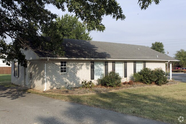
State Line Rd, , OK


NEARBY LISTINGS FOR SALE OR LEASE
Property Detail
State Line Rd
Other Market Areas
West Siloam-X Land
0071436
30-20-26 PT SE SE 1365-04 BEG 250.77' W & 1194.5' N OF THE SE COR OF SEC, N 120.5', E 183.78', SE 7 DEG 121.6', W 200.68' TO
Medicalbuilding
Delaware
2024
Oklahoma
2024
Oklahoma East Area
1,519 SF
DEMOGRAPHICS near State Line Rd
1 Mile
3 Mile
5 Mile
2024 Total Population
4,234
20,037
26,069
2029 Population
4,881
23,409
30,355
Pop Growth 2024-2029
+ 15.28%
+ 16.83%
+ 16.44%
Average Age
35
36
37
2024 Total Households
1,332
6,866
9,039
HH Growth 2024-2029
+ 15.17%
+ 16.85%
+ 16.41%
Median Household Inc
$55,839
$60,023
$60,783
Avg Household Size
2.60
2.70
2.70
2024 Avg HH Vehicles
2.00
2.00
2.00
Median Home Value
$167,318
$183,641
$189,561
Median Year Built
1981
1991
1992
Nearby Places
Map Layers
Map Styles
 Street
 Aerial
- Restaurants
- Banks
- Shops
- Fitness
- Groceries
PUBLIC TRANSPORTATION
AIRPORT
Northwest Arkansas Ntl
DRIVE
WALK
Distance
Northwest Arkansas Ntl
45 min
24.3 mi
Nearby Properties
Address
Land Use
TOTAL SIZE
Lot Size
Zoning
Address
Land Use
TOTAL SIZE
Lot Size
Zoning
85,903 SF
10 AC
Address
Land Use
TOTAL SIZE
Lot Size
Zoning
183,822 SF
23.62 AC
Address
Land Use
TOTAL SIZE
Lot Size
Zoning
190,712 SF
15.73 AC
Address
Land Use
TOTAL SIZE
Lot Size
Zoning
119,258 SF
16.25 AC
Address
Land Use
TOTAL SIZE
Lot Size
Zoning
30,542 SF
66.48 AC
Address
Land Use
TOTAL SIZE
Lot Size
Zoning
422,489 SF
57.90 AC
Address
Land Use
TOTAL SIZE
Lot Size
Zoning
53,071 SF
2.07 AC
Address
Land Use
TOTAL SIZE
Lot Size
Zoning
264,685 SF
14.13 AC
Address
Land Use
TOTAL SIZE
Lot Size
Zoning
23,133 SF
3 AC
Address
Land Use
TOTAL SIZE
Lot Size
Zoning
31,887 SF
1.61 AC
Address
Land Use
TOTAL SIZE
Lot Size
Zoning
98,492 SF
6.33 AC
Address
Land Use
TOTAL SIZE
Lot Size
Zoning
20,475 SF
19.62 AC
Address
Land Use
TOTAL SIZE
Lot Size
Zoning
21,974 SF
3.87 AC
Address
Land Use
TOTAL SIZE
Lot Size
Zoning
92,300 SF
6.35 AC
Address
Land Use
TOTAL SIZE
Lot Size
Zoning
144,166 SF
12.49 AC
Address
Land Use
TOTAL SIZE
Lot Size
Zoning
36,185 SF
0.78 AC
Address
Land Use
TOTAL SIZE
Lot Size
Zoning
57,502 SF
7.08 AC
Address
Land Use
TOTAL SIZE
Lot Size
Zoning
41,748 SF
5.44 AC
Address
Land Use
TOTAL SIZE
Lot Size
Zoning
20,714 SF
0.57 AC
Address
Land Use
TOTAL SIZE
Lot Size
Zoning
40,709 SF
4.24 AC
Address
Land Use
TOTAL SIZE
Lot Size
Zoning
63,439 SF
5.17 AC
Address
Land Use
TOTAL SIZE
Lot Size
Zoning
21,908 SF
6.44 AC
Address
Land Use
TOTAL SIZE
Lot Size
Zoning
244,674 SF
18.51 AC
Address
Land Use
TOTAL SIZE
Lot Size
Zoning
62,024 SF
4.99 AC
Address
Land Use
TOTAL SIZE
Lot Size
Zoning
64,710 SF
2.32 AC
Address
Land Use
TOTAL SIZE
Lot Size
Zoning
59,140 SF
4.38 AC
Address
Land Use
TOTAL SIZE
Lot Size
Zoning
68,306 SF
7.50 AC
Address
Land Use
TOTAL SIZE
Lot Size
Zoning
69,878 SF
3.69 AC
Address
Land Use
TOTAL SIZE
Lot Size
Zoning
20,484 SF
0.93 AC
Address
Land Use
TOTAL SIZE
Lot Size
Zoning
87,951 SF
9.20 AC
The World's #1 Commercial Real Estate Marketplace
Connect with us
© 2026 CoStar Group
The information above has been obtained from sources believed reliable. While we do not doubt its accuracy we have not verified it and make no guarantee, warranty or representation about it. It is your responsibility to independently confirm its accuracy and completeness. Any projections, opinions, assumptions, or estimates used are for example only and do not represent the current or future performance of the property. The value of this transaction to you depends on tax and other factors which should be evaluated by your tax, financial, and legal advisors. You and your advisors should conduct a careful, independent investigation of the property to determine to your satisfaction the suitability of the property for your needs.