Property Record
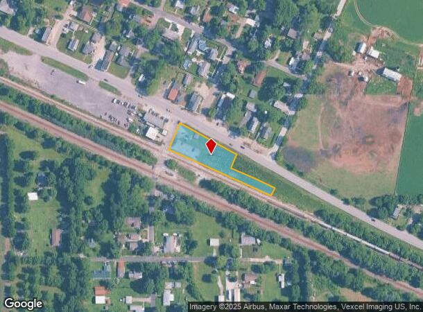
State Road 130, Wheeler, IN 46393


NEARBY LISTINGS FOR SALE OR LEASE
-
-
View all Wheeler listings for sale on LoopNet.com
Property Detail
State Road 130
64-08-01-310-001.000-019
PARC IN SW S ST RD 130 1-35-7 .86A WOCD
Parkinglot
Porter
X
Indiana
18127C0118D
0.86 AC
2023
Porter County
2024
Chicago
051006
Chicago-Naperville-Elgin, IL-IN-WI
DEMOGRAPHICS near State Road 130
1 Mile
3 Mile
5 Mile
2024 Total Population
193
12,956
70,318
2029 Population
190
13,081
71,311
Pop Growth 2024-2029
(1.55%)
+ 0.96%
+ 1.41%
Average Age
42
41
41
2024 Total Households
76
4,939
27,116
HH Growth 2024-2029
(1.32%)
+ 1.09%
+ 1.39%
Median Household Inc
$72,499
$66,070
$72,159
Avg Household Size
2.50
2.50
2.50
2024 Avg HH Vehicles
2.00
2.00
2.00
Median Home Value
$264,705
$160,928
$201,862
Median Year Built
1983
1980
1979
Nearby Places
Map Layers
Map Styles
 Street
 Aerial
- Restaurants
- Banks
- Shops
- Fitness
- Groceries
PUBLIC TRANSPORTATION
COMMUTER RAIL
Ogden Dunes (Portage) Station (South Shore Line - Northern Indiana Commuter Transportation District (South Shore Line))
DRIVE
WALK
Distance
Ogden Dunes (Portage) Station (South Shore Line - Northern Indiana Commuter Transportation District (South Shore Line))
22 min
9.3 mi
Miller (Gary) Station (South Shore Line - Northern Indiana Commuter Transportation District (South Shore Line))
DRIVE
WALK
Distance
Miller (Gary) Station (South Shore Line - Northern Indiana Commuter Transportation District (South Shore Line))
18 min
9.4 mi
AIRPORT
Chicago Midway International
DRIVE
WALK
Distance
Chicago Midway International
67 min
43.6 mi
Nearby Properties
Address
Land Use
TOTAL SIZE
Lot Size
Zoning
Address
Land Use
TOTAL SIZE
Lot Size
Zoning
169,427 SF
44 SF
Address
Land Use
TOTAL SIZE
Lot Size
Zoning
215,770 SF
87 SF
Address
Land Use
TOTAL SIZE
Lot Size
Zoning
112,216 SF
44 SF
Address
Land Use
TOTAL SIZE
Lot Size
Zoning
223,221 SF
87 SF
Address
Land Use
TOTAL SIZE
Lot Size
Zoning
50,382 SF
9.83 AC
Address
Land Use
TOTAL SIZE
Lot Size
Zoning
191,547 SF
87 SF
Address
Land Use
TOTAL SIZE
Lot Size
Zoning
70,762 SF
3.04 AC
Address
Land Use
TOTAL SIZE
Lot Size
Zoning
39,644 SF
2.84 AC
Address
Land Use
TOTAL SIZE
Lot Size
Zoning
89,232 SF
44 SF
Address
Land Use
TOTAL SIZE
Lot Size
Zoning
71,682 SF
4.40 AC
Address
Land Use
TOTAL SIZE
Lot Size
Zoning
108,527 SF
44 SF
Address
Land Use
TOTAL SIZE
Lot Size
Zoning
134,075 SF
44 SF
Address
Land Use
TOTAL SIZE
Lot Size
Zoning
50,712 SF
2.59 AC
Address
Land Use
TOTAL SIZE
Lot Size
Zoning
29,251 SF
25.96 AC
Address
Land Use
TOTAL SIZE
Lot Size
Zoning
37,252 SF
5.72 AC
Address
Land Use
TOTAL SIZE
Lot Size
Zoning
42,066 SF
13.06 AC
Address
Land Use
TOTAL SIZE
Lot Size
Zoning
15,568 SF
6.63 AC
R33
Address
Land Use
TOTAL SIZE
Lot Size
Zoning
48,153 SF
5.13 AC
Address
Land Use
TOTAL SIZE
Lot Size
Zoning
16,830 SF
2.30 AC
Address
Land Use
TOTAL SIZE
Lot Size
Zoning
26,580 SF
2.57 AC
Address
Land Use
TOTAL SIZE
Lot Size
Zoning
34,804 SF
14 AC
Address
Land Use
TOTAL SIZE
Lot Size
Zoning
20,831 SF
2.49 AC
Address
Land Use
TOTAL SIZE
Lot Size
Zoning
14,586 SF
2.40 AC
Address
Land Use
TOTAL SIZE
Lot Size
Zoning
49,947 SF
44 SF
Address
Land Use
TOTAL SIZE
Lot Size
Zoning
11,536 SF
3.08 AC
Address
Land Use
TOTAL SIZE
Lot Size
Zoning
15,953 SF
3.83 AC
Address
Land Use
TOTAL SIZE
Lot Size
Zoning
17,500 SF
2.08 AC
Address
Land Use
TOTAL SIZE
Lot Size
Zoning
16,000 SF
1.67 AC
Address
Land Use
TOTAL SIZE
Lot Size
Zoning
6,736 SF
2.80 AC
Address
Land Use
TOTAL SIZE
Lot Size
Zoning
12,160 SF
1.78 AC
The World's #1 Commercial Real Estate Marketplace
Connect with us
© 2025 CoStar Group
The information above has been obtained from sources believed reliable. While we do not doubt its accuracy we have not verified it and make no guarantee, warranty or representation about it. It is your responsibility to independently confirm its accuracy and completeness. Any projections, opinions, assumptions, or estimates used are for example only and do not represent the current or future performance of the property. The value of this transaction to you depends on tax and other factors which should be evaluated by your tax, financial, and legal advisors. You and your advisors should conduct a careful, independent investigation of the property to determine to your satisfaction the suitability of the property for your needs.