Property Record
State Road 44, Eustis, FL 32726


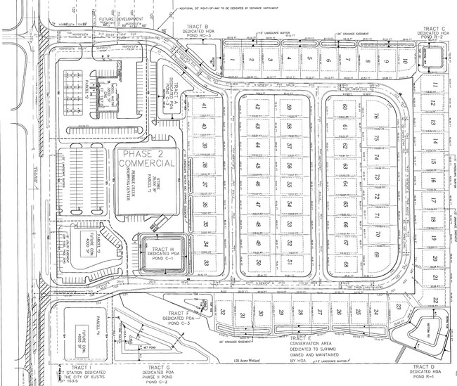
Current Lease Availabilities
Property Detail
State Road 44
Orlando-Kissimmee-Sanford, FL
FROM SW COR OF NE 1/4 RUN N 0-44-51 E 85.10 FT TO A POINT ON N'LY R/W OF SR 44-A N 89-59-57 E ALONG SAID R/W LINE 54.36 FT FOR POB THENCE FROM THE BEG OF RIGHT CURVE FROM WHICH THE RADIUS POINT BEARS N 0-0-03 W W'LY NW'LY & N'LY A DIST OF 39.27 FT AL
08-19-27-0001-000-06700
LAKE
Commercialacreage
Florida
A Areas with a 1% annual chance of flooding and a 26% chance of flooding over the life of a 30-year mortgage.
67
2024
7.28 AC
2026
Lake County
030204
Orlando
NEARBY LISTINGS FOR SALE OR LEASE
DEMOGRAPHICS near State Road 44
1 mile
3 mile
5 mile
2025 Total Population
3,380
27,124
70,559
2030 Population
3,849
30,797
80,183
Pop Growth 2025-2030
+ 13.88%
+ 13.54%
+ 13.64%
Average Age
48
45
44
2025 Total Households
1,370
11,068
29,412
HH Growth 2025-2030
+ 13.94%
+ 13.68%
+ 13.82%
Median Household Inc
$103,256
$74,830
$69,276
Avg Household Size
2.40
2.40
2.30
2025 Avg HH Vehicles
2.00
2.00
2.00
Median Home Value
$402,305
$337,038
$328,622
Median Year Built
2002
1993
1988
Nearby Places
Map Layers
Map Styles
 Street
 Aerial
Layers
 Traffic
 Biking
Places
Listings with unknown addresses are not visible on the map
- Restaurants
- Banks
- Shops
- Fitness
- Groceries
PUBLIC TRANSPORTATION
AIRPORT
Orlando Sanford International
Drive
Walk
Distance
Orlando Sanford International
50 min
31.9 mi
Freight Ports
Port Canaveral
Drive
Walk
Distance
Port Canaveral
110 min
90.1 mi
Nearby Properties
Address
Land Use
TOTAL SIZE
Lot Size
Zoning
Address
Land Use
TOTAL SIZE
Lot Size
Zoning
330,732 SF
35.24 AC
Address
Land Use
TOTAL SIZE
Lot Size
Zoning
308,464 SF
37.14 AC
PUD
Address
Land Use
TOTAL SIZE
Lot Size
Zoning
254,395 SF
20.59 AC
A
Address
Land Use
TOTAL SIZE
Lot Size
Zoning
132,800 SF
28.63 AC
A
Address
Land Use
TOTAL SIZE
Lot Size
Zoning
123,610 SF
6.96 AC
Address
Land Use
TOTAL SIZE
Lot Size
Zoning
72,852 SF
10.91 AC
Address
Land Use
TOTAL SIZE
Lot Size
Zoning
95,803 SF
6.13 AC
CP
Address
Land Use
TOTAL SIZE
Lot Size
Zoning
157,511 SF
15.28 AC
Address
Land Use
TOTAL SIZE
Lot Size
Zoning
36,462 SF
10.40 AC
Address
Land Use
TOTAL SIZE
Lot Size
Zoning
54,248 SF
4.56 AC
R3
Address
Land Use
TOTAL SIZE
Lot Size
Zoning
64,730 SF
6.38 AC
C3
Address
Land Use
TOTAL SIZE
Lot Size
Zoning
115,293 SF
8.45 AC
Address
Land Use
TOTAL SIZE
Lot Size
Zoning
70,525 SF
37.62 AC
R2
Address
Land Use
TOTAL SIZE
Lot Size
Zoning
44,275 SF
22.50 AC
C1
Address
Land Use
TOTAL SIZE
Lot Size
Zoning
2,000 SF
44.77 AC
CFD
Address
Land Use
TOTAL SIZE
Lot Size
Zoning
2,000 SF
21.47 AC
SR
Address
Land Use
TOTAL SIZE
Lot Size
Zoning
43,472 SF
3.52 AC
UR
Address
Land Use
TOTAL SIZE
Lot Size
Zoning
63,984 SF
18.89 AC
C3
Address
Land Use
TOTAL SIZE
Lot Size
Zoning
33,120 SF
1.65 AC
Address
Land Use
TOTAL SIZE
Lot Size
Zoning
65,868 SF
9.33 AC
MCR
Address
Land Use
TOTAL SIZE
Lot Size
Zoning
26,771 SF
3.94 AC
GC
Address
Land Use
TOTAL SIZE
Lot Size
Zoning
18,344 SF
6.89 AC
GC
Address
Land Use
TOTAL SIZE
Lot Size
Zoning
17.25 AC
Address
Land Use
TOTAL SIZE
Lot Size
Zoning
2,000 SF
13.42 AC
PLI
Address
Land Use
TOTAL SIZE
Lot Size
Zoning
17,171 SF
1.75 AC
C3
Address
Land Use
TOTAL SIZE
Lot Size
Zoning
30.38 AC
R6
Address
Land Use
TOTAL SIZE
Lot Size
Zoning
11,820 SF
1.97 AC
Address
Land Use
TOTAL SIZE
Lot Size
Zoning
776.54 AC
A
Address
Land Use
TOTAL SIZE
Lot Size
Zoning
11,729 SF
1.50 AC
GC
Address
Land Use
TOTAL SIZE
Lot Size
Zoning
60,524 SF
9.61 AC
RP
The World's #1 Commercial Real Estate Marketplace
Connect with us
© 2026 CoStar Group
The information above has been obtained from sources believed reliable. While we do not doubt its accuracy we have not verified it and make no guarantee, warranty or representation about it. It is your responsibility to independently confirm its accuracy and completeness. Any projections, opinions, assumptions, or estimates used are for example only and do not represent the current or future performance of the property. The value of this transaction to you depends on tax and other factors which should be evaluated by your tax, financial, and legal advisors. You and your advisors should conduct a careful, independent investigation of the property to determine to your satisfaction the suitability of the property for your needs.