Property Record
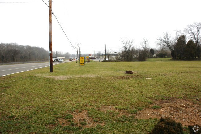
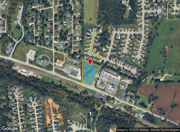
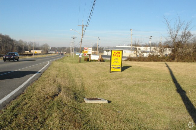
State Road 64, Georgetown, IN 47122
NEARBY LISTINGS FOR SALE OR LEASE
Property Detail
State Road 64
Louisville-Jefferson County, KY-IN
Copperfield Subdivision
22-02-03-400-112.000-003
SE 1/2 NE 1/4 34-2-5 2.7862 AC
Residentialacreage
Floyd
X
Indiana
18043C0112E
2.79 AC
2024
Outlying Floyd County
2024
Louisville
071101
DEMOGRAPHICS near State Road 64
1 Mile
3 Mile
5 Mile
2024 Total Population
2,636
11,662
23,606
2029 Population
2,657
11,731
23,718
Pop Growth 2024-2029
+ 0.80%
+ 0.59%
+ 0.47%
Average Age
40
41
41
2024 Total Households
965
4,301
8,772
HH Growth 2024-2029
+ 0.73%
+ 0.53%
+ 0.41%
Median Household Inc
$97,238
$90,224
$91,740
Avg Household Size
2.70
2.70
2.70
2024 Avg HH Vehicles
2.00
2.00
3.00
Median Home Value
$241,223
$238,880
$253,705
Median Year Built
1996
1991
1987
Nearby Places
Map Layers
Map Styles
 Street
 Aerial
- Restaurants
- Banks
- Shops
- Fitness
- Groceries
PUBLIC TRANSPORTATION
AIRPORT
Louisville Muhammad Ali International
DRIVE
WALK
Distance
Louisville Muhammad Ali International
32 min
19.5 mi
Freight Ports
Port of Toledo
DRIVE
WALK
Distance
Port of Toledo
367 min
316.9 mi
Nearby Properties
Address
Land Use
TOTAL SIZE
Lot Size
Zoning
Address
Land Use
TOTAL SIZE
Lot Size
Zoning
39,851 SF
19.68 AC
Address
Land Use
TOTAL SIZE
Lot Size
Zoning
26,864 SF
13.08 AC
Address
Land Use
TOTAL SIZE
Lot Size
Zoning
65,208 SF
6.70 AC
Address
Land Use
TOTAL SIZE
Lot Size
Zoning
7,096 SF
2 AC
Address
Land Use
TOTAL SIZE
Lot Size
Zoning
50,000 SF
7 AC
Address
Land Use
TOTAL SIZE
Lot Size
Zoning
13,858 SF
11.28 AC
Address
Land Use
TOTAL SIZE
Lot Size
Zoning
5,824 SF
2.69 AC
Address
Land Use
TOTAL SIZE
Lot Size
Zoning
16,128 SF
3.86 AC
Address
Land Use
TOTAL SIZE
Lot Size
Zoning
5,028 SF
3.33 AC
Address
Land Use
TOTAL SIZE
Lot Size
Zoning
25,660 SF
2.20 AC
Address
Land Use
TOTAL SIZE
Lot Size
Zoning
13,682 SF
5.66 AC
Address
Land Use
TOTAL SIZE
Lot Size
Zoning
39.70 AC
Address
Land Use
TOTAL SIZE
Lot Size
Zoning
3,808 SF
0.76 AC
Address
Land Use
TOTAL SIZE
Lot Size
Zoning
16,960 SF
1.32 AC
Address
Land Use
TOTAL SIZE
Lot Size
Zoning
4,340 SF
21.12 AC
Address
Land Use
TOTAL SIZE
Lot Size
Zoning
8,640 SF
1.31 AC
Address
Land Use
TOTAL SIZE
Lot Size
Zoning
11,200 SF
1.26 AC
Address
Land Use
TOTAL SIZE
Lot Size
Zoning
7,832 SF
4.76 AC
Address
Land Use
TOTAL SIZE
Lot Size
Zoning
10,240 SF
31.50 AC
Address
Land Use
TOTAL SIZE
Lot Size
Zoning
10,582 SF
0.68 AC
Address
Land Use
TOTAL SIZE
Lot Size
Zoning
23,372 SF
1.82 AC
Address
Land Use
TOTAL SIZE
Lot Size
Zoning
10,126 SF
5 AC
Address
Land Use
TOTAL SIZE
Lot Size
Zoning
9,504 SF
1.01 AC
Address
Land Use
TOTAL SIZE
Lot Size
Zoning
12,200 SF
1.18 AC
Address
Land Use
TOTAL SIZE
Lot Size
Zoning
8,490 SF
1.73 AC
Address
Land Use
TOTAL SIZE
Lot Size
Zoning
18,000 SF
2.74 AC
Address
Land Use
TOTAL SIZE
Lot Size
Zoning
16,308 SF
7.53 AC
Address
Land Use
TOTAL SIZE
Lot Size
Zoning
3,775 SF
2.69 AC
Address
Land Use
TOTAL SIZE
Lot Size
Zoning
15,000 SF
0.78 AC
Address
Land Use
TOTAL SIZE
Lot Size
Zoning
8,988 SF
1.70 AC
The World's #1 Commercial Real Estate Marketplace
Connect with us
© 2025 CoStar Group
The information above has been obtained from sources believed reliable. While we do not doubt its accuracy we have not verified it and make no guarantee, warranty or representation about it. It is your responsibility to independently confirm its accuracy and completeness. Any projections, opinions, assumptions, or estimates used are for example only and do not represent the current or future performance of the property. The value of this transaction to you depends on tax and other factors which should be evaluated by your tax, financial, and legal advisors. You and your advisors should conduct a careful, independent investigation of the property to determine to your satisfaction the suitability of the property for your needs.