Property Record
State Road 76, Neenah, WI 54956
NEARBY LISTINGS FOR SALE OR LEASE
-
-
View all Neenah listings for sale on LoopNet.com
Property Detail
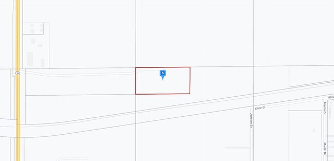
State Road 76
006-036001
APPROX 2 A N OF SOO RR NE SE 2.34 A.
Commercialnec
Winnebago
X
Wisconsin
55087C0425D
6.97 AC
2024
Appleton/Oshkosh
2024
Other Market Areas
003400
Oshkosh-Neenah, WI
DEMOGRAPHICS near State Road 76
1 Mile
3 Mile
5 Mile
2024 Total Population
459
12,506
53,451
2029 Population
463
12,501
53,566
Pop Growth 2024-2029
+ 0.87%
(0.04%)
+ 0.22%
Average Age
41
40
40
2024 Total Households
172
5,015
22,556
HH Growth 2024-2029
+ 0.58%
(0.22%)
+ 0.10%
Median Household Inc
$102,174
$87,204
$67,964
Avg Household Size
2.60
2.50
2.30
2024 Avg HH Vehicles
3.00
2.00
2.00
Median Home Value
$333,695
$264,247
$193,175
Median Year Built
1994
1989
1974
Nearby Places
Map Layers
Map Styles
 Street
 Aerial
- Restaurants
- Banks
- Shops
- Fitness
- Groceries
PUBLIC TRANSPORTATION
AIRPORT
Appleton International
DRIVE
WALK
Distance
Appleton International
9 min
4.4 mi
Green Bay/Austin Straubel International
DRIVE
WALK
Distance
Green Bay/Austin Straubel International
47 min
37.1 mi
Freight Ports
Port Milwaukee
DRIVE
WALK
Distance
Port Milwaukee
123 min
101.3 mi
Nearby Properties
Address
Land Use
TOTAL SIZE
Lot Size
Zoning
Address
Land Use
TOTAL SIZE
Lot Size
Zoning
68.77 AC
Address
Land Use
TOTAL SIZE
Lot Size
Zoning
156.36 AC
M1
Address
Land Use
TOTAL SIZE
Lot Size
Zoning
11.99 AC
Address
Land Use
TOTAL SIZE
Lot Size
Zoning
120.73 AC
M2
Address
Land Use
TOTAL SIZE
Lot Size
Zoning
11.22 AC
Address
Land Use
TOTAL SIZE
Lot Size
Zoning
9.40 AC
Address
Land Use
TOTAL SIZE
Lot Size
Zoning
6.75 AC
M1
Address
Land Use
TOTAL SIZE
Lot Size
Zoning
10.42 AC
Address
Land Use
TOTAL SIZE
Lot Size
Zoning
15.73 AC
B5
Address
Land Use
TOTAL SIZE
Lot Size
Zoning
17.55 AC
A2
Address
Land Use
TOTAL SIZE
Lot Size
Zoning
4.33 AC
Address
Land Use
TOTAL SIZE
Lot Size
Zoning
7.29 AC
Address
Land Use
TOTAL SIZE
Lot Size
Zoning
11.77 AC
R5
Address
Land Use
TOTAL SIZE
Lot Size
Zoning
32.60 AC
Address
Land Use
TOTAL SIZE
Lot Size
Zoning
4.71 AC
Address
Land Use
TOTAL SIZE
Lot Size
Zoning
4.41 AC
B5
Address
Land Use
TOTAL SIZE
Lot Size
Zoning
28.64 AC
Address
Land Use
TOTAL SIZE
Lot Size
Zoning
39.59 AC
M2
Address
Land Use
TOTAL SIZE
Lot Size
Zoning
13.84 AC
M1
Address
Land Use
TOTAL SIZE
Lot Size
Zoning
21.64 AC
B5
Address
Land Use
TOTAL SIZE
Lot Size
Zoning
1.62 AC
B5
Address
Land Use
TOTAL SIZE
Lot Size
Zoning
14.65 AC
M2
Address
Land Use
TOTAL SIZE
Lot Size
Zoning
5.97 AC
M2
Address
Land Use
TOTAL SIZE
Lot Size
Zoning
14.14 AC
M1
Address
Land Use
TOTAL SIZE
Lot Size
Zoning
5.91 AC
R5
Address
Land Use
TOTAL SIZE
Lot Size
Zoning
16.37 AC
M2
Address
Land Use
TOTAL SIZE
Lot Size
Zoning
3.56 AC
M2
Address
Land Use
TOTAL SIZE
Lot Size
Zoning
22.28 AC
M1
Address
Land Use
TOTAL SIZE
Lot Size
Zoning
53,115 SF
3.49 AC
I2
Address
Land Use
TOTAL SIZE
Lot Size
Zoning
19.23 AC
The World's #1 Commercial Real Estate Marketplace
Connect with us
© 2025 CoStar Group
The information above has been obtained from sources believed reliable. While we do not doubt its accuracy we have not verified it and make no guarantee, warranty or representation about it. It is your responsibility to independently confirm its accuracy and completeness. Any projections, opinions, assumptions, or estimates used are for example only and do not represent the current or future performance of the property. The value of this transaction to you depends on tax and other factors which should be evaluated by your tax, financial, and legal advisors. You and your advisors should conduct a careful, independent investigation of the property to determine to your satisfaction the suitability of the property for your needs.