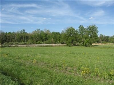
Property Record
State Route 32, Batavia, OH 45103

Property Detail
State Route 32
52-35-08D-098
CLERMONT
Commercialnec
Ohio
B and X Area of moderate flood hazard, usually the area between the limits of the 100-year and 500-year floods.
2 AC
2025
Outlying Cincinnati East
2025
Cincinnati/Dayton
041002
Cincinnati, OH-KY-IN
NEARBY LISTINGS FOR SALE OR LEASE
DEMOGRAPHICS near State Route 32
1 mile
3 mile
5 mile
2025 Total Population
779
8,205
16,923
2030 Population
793
8,443
17,362
Pop Growth 2025-2030
+ 1.80%
+ 2.90%
+ 2.59%
Average Age
44
40
41
2025 Total Households
322
3,010
6,233
HH Growth 2025-2030
+ 1.86%
+ 2.96%
+ 2.66%
Median Household Inc
$61,875
$62,972
$76,640
Avg Household Size
2.40
2.60
2.60
2025 Avg HH Vehicles
2.00
2.00
2.00
Median Home Value
$214,286
$183,365
$236,570
Median Year Built
1979
1983
1984
Nearby Places
Map Layers
Map Styles
 Street
 Aerial
Layers
 Traffic
 Biking
Places
Listings with unknown addresses are not visible on the map
- Restaurants
- Banks
- Shops
- Fitness
- Groceries
Nearby Properties
Address
Land Use
TOTAL SIZE
Lot Size
Zoning
Address
Land Use
TOTAL SIZE
Lot Size
Zoning
540,906 SF
192.49 AC
Address
Land Use
TOTAL SIZE
Lot Size
Zoning
540,906 SF
192.49 AC
Address
Land Use
TOTAL SIZE
Lot Size
Zoning
Address
Land Use
TOTAL SIZE
Lot Size
Zoning
58.36 AC
Address
Land Use
TOTAL SIZE
Lot Size
Zoning
23,380 SF
91.85 AC
Address
Land Use
TOTAL SIZE
Lot Size
Zoning
973,058 SF
61.50 AC
Address
Land Use
TOTAL SIZE
Lot Size
Zoning
Address
Land Use
TOTAL SIZE
Lot Size
Zoning
617,760 SF
46.80 AC
Address
Land Use
TOTAL SIZE
Lot Size
Zoning
1,197 SF
3.15 AC
Address
Land Use
TOTAL SIZE
Lot Size
Zoning
494,336 SF
65.71 AC
Address
Land Use
TOTAL SIZE
Lot Size
Zoning
6,987 SF
80.44 AC
Address
Land Use
TOTAL SIZE
Lot Size
Zoning
39.27 AC
Address
Land Use
TOTAL SIZE
Lot Size
Zoning
Address
Land Use
TOTAL SIZE
Lot Size
Zoning
481,944 SF
23.27 AC
Address
Land Use
TOTAL SIZE
Lot Size
Zoning
617,760 SF
46.80 AC
Address
Land Use
TOTAL SIZE
Lot Size
Zoning
158,700 SF
31.20 AC
Address
Land Use
TOTAL SIZE
Lot Size
Zoning
2,856 SF
36.20 AC
Address
Land Use
TOTAL SIZE
Lot Size
Zoning
228,888 SF
20.10 AC
Address
Land Use
TOTAL SIZE
Lot Size
Zoning
225,000 SF
9.48 AC
Address
Land Use
TOTAL SIZE
Lot Size
Zoning
4,272 SF
9.32 AC
Address
Land Use
TOTAL SIZE
Lot Size
Zoning
35,646 SF
12.52 AC
Address
Land Use
TOTAL SIZE
Lot Size
Zoning
147,180 SF
9.94 AC
Address
Land Use
TOTAL SIZE
Lot Size
Zoning
33.81 AC
Address
Land Use
TOTAL SIZE
Lot Size
Zoning
5.42 AC
Address
Land Use
TOTAL SIZE
Lot Size
Zoning
486,913 SF
88.21 AC
Address
Land Use
TOTAL SIZE
Lot Size
Zoning
33,696 SF
12.20 AC
Address
Land Use
TOTAL SIZE
Lot Size
Zoning
7,992 SF
7.93 AC
Address
Land Use
TOTAL SIZE
Lot Size
Zoning
5,776 SF
55.12 AC
Address
Land Use
TOTAL SIZE
Lot Size
Zoning
536.76 AC
Address
Land Use
TOTAL SIZE
Lot Size
Zoning
98,160 SF
5 AC
The World's #1 Commercial Real Estate Marketplace
Connect with us
© 2026 CoStar Group
The information above has been obtained from sources believed reliable. While we do not doubt its accuracy we have not verified it and make no guarantee, warranty or representation about it. It is your responsibility to independently confirm its accuracy and completeness. Any projections, opinions, assumptions, or estimates used are for example only and do not represent the current or future performance of the property. The value of this transaction to you depends on tax and other factors which should be evaluated by your tax, financial, and legal advisors. You and your advisors should conduct a careful, independent investigation of the property to determine to your satisfaction the suitability of the property for your needs.