Property Record
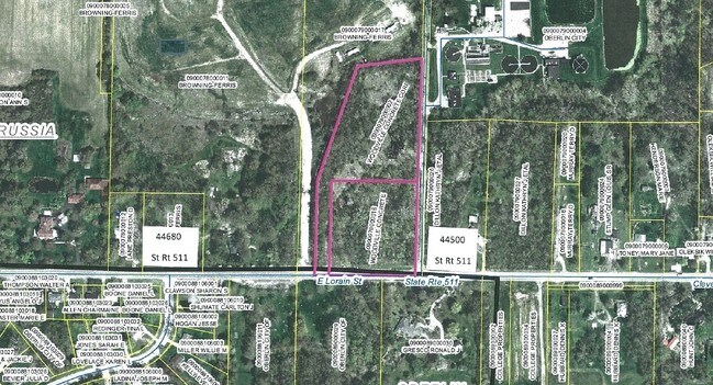
State Route 511, Oberlin, OH 44074
Property Detail
State Route 511
Cleveland-Elyria, OH
3.24 AC
09-00-079-000-016
LORAIN
Commercialacreage
Ohio
AE The base floodplain where base flood elevations are provided. AE Zones are now used on new format FIRMs instead of A1-A30 Zones.
79
2024
2.07 AC
2024
Lorain County
060100
Cleveland
NEARBY LISTINGS FOR SALE OR LEASE
DEMOGRAPHICS near State Route 511
1 mile
3 mile
5 mile
2025 Total Population
947
11,222
21,494
2030 Population
973
11,539
22,097
Pop Growth 2025-2030
+ 2.75%
+ 2.82%
+ 2.81%
Average Age
45
40
42
2025 Total Households
363
3,782
8,078
HH Growth 2025-2030
+ 3.58%
+ 3.57%
+ 3.26%
Median Household Inc
$88,169
$86,218
$80,182
Avg Household Size
2.20
2.20
2.20
2025 Avg HH Vehicles
2.00
2.00
2.00
Median Home Value
$241,964
$243,570
$230,757
Median Year Built
1972
1970
1974
Nearby Places
Map Layers
Map Styles
 Street
 Aerial
Layers
 Traffic
 Biking
Places
Listings with unknown addresses are not visible on the map
- Restaurants
- Banks
- Shops
- Fitness
- Groceries
PUBLIC TRANSPORTATION
COMMUTER RAIL
Elyria Amtrak (Capitol Limited - Amtrak, Lake Shore Limited - Amtrak)
Drive
Walk
Distance
Elyria Amtrak (Capitol Limited - Amtrak, Lake Shore Limited - Amtrak)
13 min
8.5 mi
AIRPORT
Cleveland-Hopkins International
Drive
Walk
Distance
Cleveland-Hopkins International
29 min
21.8 mi
Freight Ports
Port of Toledo
Drive
Walk
Distance
Port of Toledo
109 min
88.0 mi
Nearby Properties
Address
Land Use
TOTAL SIZE
Lot Size
Zoning
Address
Land Use
TOTAL SIZE
Lot Size
Zoning
291,775 SF
95.89 AC
Address
Land Use
TOTAL SIZE
Lot Size
Zoning
149,607 SF
2.78 AC
Address
Land Use
TOTAL SIZE
Lot Size
Zoning
92,998 SF
2.66 AC
Address
Land Use
TOTAL SIZE
Lot Size
Zoning
13.20 AC
Address
Land Use
TOTAL SIZE
Lot Size
Zoning
61,554 SF
60.08 AC
Address
Land Use
TOTAL SIZE
Lot Size
Zoning
83,979 SF
2.36 AC
Address
Land Use
TOTAL SIZE
Lot Size
Zoning
87,116 SF
13.44 AC
Address
Land Use
TOTAL SIZE
Lot Size
Zoning
48,146 SF
3.91 AC
Address
Land Use
TOTAL SIZE
Lot Size
Zoning
201,983 SF
48.98 AC
Address
Land Use
TOTAL SIZE
Lot Size
Zoning
57,732 SF
2.12 AC
Address
Land Use
TOTAL SIZE
Lot Size
Zoning
75,984 SF
1.67 AC
Address
Land Use
TOTAL SIZE
Lot Size
Zoning
104,155 SF
3.49 AC
Address
Land Use
TOTAL SIZE
Lot Size
Zoning
102,839 SF
5.51 AC
Address
Land Use
TOTAL SIZE
Lot Size
Zoning
80,519 SF
2.71 AC
Address
Land Use
TOTAL SIZE
Lot Size
Zoning
112,071 SF
1.48 AC
Address
Land Use
TOTAL SIZE
Lot Size
Zoning
38,350 SF
1.66 AC
Address
Land Use
TOTAL SIZE
Lot Size
Zoning
49,290 SF
2.80 AC
Address
Land Use
TOTAL SIZE
Lot Size
Zoning
48,471 SF
2.76 AC
Address
Land Use
TOTAL SIZE
Lot Size
Zoning
160,255 SF
23.01 AC
Address
Land Use
TOTAL SIZE
Lot Size
Zoning
84,783 SF
9.50 AC
Address
Land Use
TOTAL SIZE
Lot Size
Zoning
79,127 SF
4.71 AC
Address
Land Use
TOTAL SIZE
Lot Size
Zoning
51,675 SF
3.83 AC
Address
Land Use
TOTAL SIZE
Lot Size
Zoning
50,996 SF
1.80 AC
Address
Land Use
TOTAL SIZE
Lot Size
Zoning
16,902 SF
7.50 AC
Address
Land Use
TOTAL SIZE
Lot Size
Zoning
47,503 SF
3.60 AC
Address
Land Use
TOTAL SIZE
Lot Size
Zoning
44,194 SF
17.80 AC
Address
Land Use
TOTAL SIZE
Lot Size
Zoning
65,280 SF
1.24 AC
Address
Land Use
TOTAL SIZE
Lot Size
Zoning
25,950 SF
1.89 AC
Address
Land Use
TOTAL SIZE
Lot Size
Zoning
45,788 SF
1.52 AC
Address
Land Use
TOTAL SIZE
Lot Size
Zoning
19,964 SF
5.05 AC
The World's #1 Commercial Real Estate Marketplace
Connect with us
© 2026 CoStar Group
The information above has been obtained from sources believed reliable. While we do not doubt its accuracy we have not verified it and make no guarantee, warranty or representation about it. It is your responsibility to independently confirm its accuracy and completeness. Any projections, opinions, assumptions, or estimates used are for example only and do not represent the current or future performance of the property. The value of this transaction to you depends on tax and other factors which should be evaluated by your tax, financial, and legal advisors. You and your advisors should conduct a careful, independent investigation of the property to determine to your satisfaction the suitability of the property for your needs.