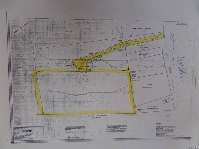
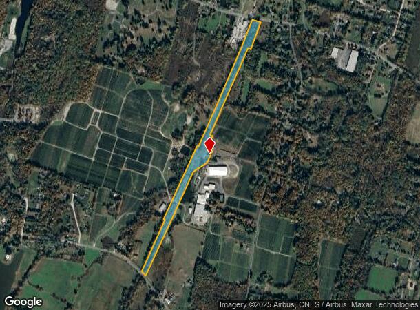
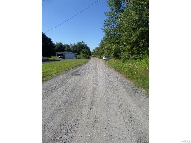
Property Record
State Route 52, Walden, NY 12586
NEARBY LISTINGS FOR SALE OR LEASE
Property Detail
State Route 52
334289-014-000-0001-036.100-0000
Orange
Orchard
New York
X
36.10
36071C0120E
13.60 AC
2024
Middletown
2024
Northern New Jersey
010702
Kiryas Joel-Poughkeepsie-Newburgh, NY
DEMOGRAPHICS near State Route 52
1 Mile
3 Mile
5 Mile
2024 Total Population
1,067
12,197
26,165
2029 Population
1,081
12,373
26,535
Pop Growth 2024-2029
+ 1.31%
+ 1.44%
+ 1.41%
Average Age
41
40
40
2024 Total Households
387
4,218
9,336
HH Growth 2024-2029
+ 1.29%
+ 1.47%
+ 1.46%
Median Household Inc
$103,442
$104,198
$97,454
Avg Household Size
2.70
2.70
2.70
2024 Avg HH Vehicles
2.00
2.00
2.00
Median Home Value
$371,428
$330,095
$313,976
Median Year Built
1967
1977
1974
Nearby Places
Map Layers
Map Styles
 Street
 Aerial
- Restaurants
- Banks
- Shops
- Fitness
- Groceries
PUBLIC TRANSPORTATION
AIRPORT
New York Stewart International
DRIVE
WALK
Distance
New York Stewart International
16 min
7.2 mi
Freight Ports
Port Newark Container Terminal
DRIVE
WALK
Distance
Port Newark Container Terminal
100 min
73.4 mi
SALE & LEASE HISTORY
LISTING DATE
SALE/LEASE

Sep 09, 2019
For Sale
Jul 28, 2017
For Sale
Nearby Properties
Address
Land Use
TOTAL SIZE
Lot Size
Zoning
Address
Land Use
TOTAL SIZE
Lot Size
Zoning
1,015,632 SF
187.20 AC
I1
Address
Land Use
TOTAL SIZE
Lot Size
Zoning
100,300 SF
22.50 AC
I1
Address
Land Use
TOTAL SIZE
Lot Size
Zoning
221,958 SF
12.10 AC
ID
Address
Land Use
TOTAL SIZE
Lot Size
Zoning
109,108 SF
15.60 AC
B2
Address
Land Use
TOTAL SIZE
Lot Size
Zoning
89,960 SF
10.90 AC
I1
Address
Land Use
TOTAL SIZE
Lot Size
Zoning
32,505 SF
15.10 AC
I1
Address
Land Use
TOTAL SIZE
Lot Size
Zoning
38,624 SF
11.50 AC
I1
Address
Land Use
TOTAL SIZE
Lot Size
Zoning
80,260 SF
9.30 AC
I1
Address
Land Use
TOTAL SIZE
Lot Size
Zoning
72,852 SF
2.20 AC
Address
Land Use
TOTAL SIZE
Lot Size
Zoning
102,239 SF
62.90 AC
RA2
Address
Land Use
TOTAL SIZE
Lot Size
Zoning
64,191 SF
10 AC
06
Address
Land Use
TOTAL SIZE
Lot Size
Zoning
85,275 SF
70.20 AC
RA-.5
Address
Land Use
TOTAL SIZE
Lot Size
Zoning
Address
Land Use
TOTAL SIZE
Lot Size
Zoning
28,443 SF
34.70 AC
04OP
Address
Land Use
TOTAL SIZE
Lot Size
Zoning
149,051 SF
14.10 AC
I1
Address
Land Use
TOTAL SIZE
Lot Size
Zoning
18,386 SF
54.70 AC
RA-.5
Address
Land Use
TOTAL SIZE
Lot Size
Zoning
74,046 SF
58.30 AC
Address
Land Use
TOTAL SIZE
Lot Size
Zoning
195,821 SF
27.50 AC
I1
Address
Land Use
TOTAL SIZE
Lot Size
Zoning
111,517 SF
0.32 AC
R3
Address
Land Use
TOTAL SIZE
Lot Size
Zoning
Address
Land Use
TOTAL SIZE
Lot Size
Zoning
Address
Land Use
TOTAL SIZE
Lot Size
Zoning
87,952 SF
9.80 AC
I1
Address
Land Use
TOTAL SIZE
Lot Size
Zoning
82,465 SF
14.40 AC
I1
Address
Land Use
TOTAL SIZE
Lot Size
Zoning
81,563 SF
5.70 AC
B4
Address
Land Use
TOTAL SIZE
Lot Size
Zoning
60.60 AC
06
Address
Land Use
TOTAL SIZE
Lot Size
Zoning
49,918 SF
5 AC
I1
Address
Land Use
TOTAL SIZE
Lot Size
Zoning
26,988 SF
53 AC
RA2
Address
Land Use
TOTAL SIZE
Lot Size
Zoning
2.10 AC
R5
Address
Land Use
TOTAL SIZE
Lot Size
Zoning
78,179 SF
30.50 AC
I1
Address
Land Use
TOTAL SIZE
Lot Size
Zoning
52,267 SF
4.60 AC
RM2
The World's #1 Commercial Real Estate Marketplace
Connect with us
© 2026 CoStar Group
The information above has been obtained from sources believed reliable. While we do not doubt its accuracy we have not verified it and make no guarantee, warranty or representation about it. It is your responsibility to independently confirm its accuracy and completeness. Any projections, opinions, assumptions, or estimates used are for example only and do not represent the current or future performance of the property. The value of this transaction to you depends on tax and other factors which should be evaluated by your tax, financial, and legal advisors. You and your advisors should conduct a careful, independent investigation of the property to determine to your satisfaction the suitability of the property for your needs.