Property Record
Ste, Palmdale, CA 93552


Property Detail
Ste
Los Angeles-Long Beach-Glendale, CA
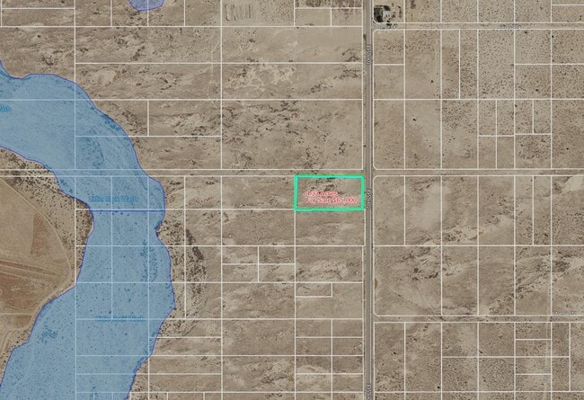
N 1/2 OF NE 1/4 OF NE 1/4 OF SE 1/4 EX OF STS OF SEC 35 T 7N R 11W
3386-025-016
LOS ANGELES
Industrialacreage
California
PDM4*
35
B and X Area of moderate flood hazard, usually the area between the limits of the 100-year and 500-year floods.
4.33 AC
2024
NE LA County Outlying
2025
Los Angeles
910714
NEARBY LISTINGS FOR SALE OR LEASE
DEMOGRAPHICS near Ste
1 mile
3 mile
5 mile
2025 Total Population
4
149
17,259
2030 Population
4
154
17,197
Pop Growth 2025-2030
0.00%
+ 3.36%
(0.36%)
Average Age
0
39
36
2025 Total Households
1
46
4,367
HH Growth 2025-2030
0.00%
+ 2.17%
(0.48%)
Median Household Inc
$0
$61,500
$83,704
Avg Household Size
.00
3.10
3.80
2025 Avg HH Vehicles
.00
3.00
2.00
Median Home Value
$0
$466,666
$442,333
Median Year Built
0
1981
1996
Nearby Places
Map Layers
Map Styles
 Street
 Aerial
Layers
 Traffic
 Biking
Places
Listings with unknown addresses are not visible on the map
- Restaurants
- Banks
- Shops
- Fitness
- Groceries
SALE & LEASE HISTORY
LISTING DATE
SALE/LEASE

Mar 14, 2024
For Sale
Nearby Properties
Address
Land Use
TOTAL SIZE
Lot Size
Zoning
Address
Land Use
TOTAL SIZE
Lot Size
Zoning
74,797 SF
15.44 AC
LCA21*
Address
Land Use
TOTAL SIZE
Lot Size
Zoning
3,874 SF
38.70 AC
PDM2 1/2-A
Address
Land Use
TOTAL SIZE
Lot Size
Zoning
279.67 AC
LCA21*
Address
Land Use
TOTAL SIZE
Lot Size
Zoning
325.63 AC
LCA11*
Address
Land Use
TOTAL SIZE
Lot Size
Zoning
5,482 SF
98.77 AC
POM11/2-A2
Address
Land Use
TOTAL SIZE
Lot Size
Zoning
73.50 AC
LCA11*
Address
Land Use
TOTAL SIZE
Lot Size
Zoning
160.73 AC
LRR2.5
Address
Land Use
TOTAL SIZE
Lot Size
Zoning
158.16 AC
LCC4-R1750
Address
Land Use
TOTAL SIZE
Lot Size
Zoning
20.48 AC
LCA21*
Address
Land Use
TOTAL SIZE
Lot Size
Zoning
79.30 AC
PDM*
Address
Land Use
TOTAL SIZE
Lot Size
Zoning
184.51 AC
LCM11/2*
Address
Land Use
TOTAL SIZE
Lot Size
Zoning
159.23 AC
LCA21*
Address
Land Use
TOTAL SIZE
Lot Size
Zoning
158.45 AC
LCA25*
Address
Land Use
TOTAL SIZE
Lot Size
Zoning
1,830 SF
9.53 AC
LCM2
Address
Land Use
TOTAL SIZE
Lot Size
Zoning
153.12 AC
LCA25*
Address
Land Use
TOTAL SIZE
Lot Size
Zoning
700 SF
77.66 AC
LCA21*
Address
Land Use
TOTAL SIZE
Lot Size
Zoning
80.15 AC
LCA21*
Address
Land Use
TOTAL SIZE
Lot Size
Zoning
2,331 SF
81.64 AC
LCA21*
Address
Land Use
TOTAL SIZE
Lot Size
Zoning
40.28 AC
PDLI
Address
Land Use
TOTAL SIZE
Lot Size
Zoning
40.27 AC
PDLI
Address
Land Use
TOTAL SIZE
Lot Size
Zoning
79.76 AC
LCA21*
Address
Land Use
TOTAL SIZE
Lot Size
Zoning
78.75 AC
LCA21*
Address
Land Use
TOTAL SIZE
Lot Size
Zoning
4,924 SF
159.17 AC
PDM4
Address
Land Use
TOTAL SIZE
Lot Size
Zoning
168.12 AC
LCM11/2-A2
Address
Land Use
TOTAL SIZE
Lot Size
Zoning
74.10 AC
LCA11-A22-
Address
Land Use
TOTAL SIZE
Lot Size
Zoning
157.60 AC
PDMA-A11*
Address
Land Use
TOTAL SIZE
Lot Size
Zoning
82.03 AC
PDA11*
Address
Land Use
TOTAL SIZE
Lot Size
Zoning
9.79 AC
LCN-2*
Address
Land Use
TOTAL SIZE
Lot Size
Zoning
41.02 AC
PDA25*
Address
Land Use
TOTAL SIZE
Lot Size
Zoning
20.07 AC
PDM4
The World's #1 Commercial Real Estate Marketplace
Connect with us
© 2026 CoStar Group
The information above has been obtained from sources believed reliable. While we do not doubt its accuracy we have not verified it and make no guarantee, warranty or representation about it. It is your responsibility to independently confirm its accuracy and completeness. Any projections, opinions, assumptions, or estimates used are for example only and do not represent the current or future performance of the property. The value of this transaction to you depends on tax and other factors which should be evaluated by your tax, financial, and legal advisors. You and your advisors should conduct a careful, independent investigation of the property to determine to your satisfaction the suitability of the property for your needs.