Property Record
Stetson Ct, Dayton, OH 45458
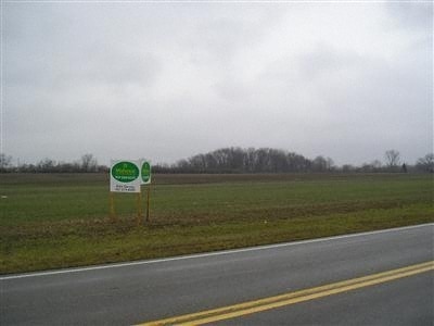
Property Detail
Stetson Ct
Dayton, OH
18 WOODLAND GREENS SECTION ONE
O68-01119-0043
MONTGOMERY
Residentialacreage
Ohio
B and X Area of moderate flood hazard, usually the area between the limits of the 100-year and 500-year floods.
0.19 AC
2024
South Dayton
2025
Cincinnati/Dayton
040406
NEARBY LISTINGS FOR SALE OR LEASE
DEMOGRAPHICS near Stetson Ct
1 mile
3 mile
5 mile
2025 Total Population
5,010
55,732
115,826
2030 Population
5,091
56,316
116,570
Pop Growth 2025-2030
+ 1.62%
+ 1.05%
+ 0.64%
Average Age
44
40
42
2025 Total Households
1,900
22,535
47,404
HH Growth 2025-2030
+ 1.58%
+ 0.62%
+ 0.41%
Median Household Inc
$136,655
$108,440
$98,235
Avg Household Size
2.60
2.50
2.40
2025 Avg HH Vehicles
2.00
2.00
2.00
Median Home Value
$380,144
$364,177
$338,247
Median Year Built
1999
1992
1986
Nearby Places
Map Layers
Map Styles
 Street
 Aerial
Layers
 Traffic
 Biking
Places
Listings with unknown addresses are not visible on the map
- Restaurants
- Banks
- Shops
- Fitness
- Groceries
PUBLIC TRANSPORTATION
AIRPORT
James M Cox Dayton International
Drive
Walk
Distance
James M Cox Dayton International
41 min
27.9 mi
Freight Ports
Port of Toledo
Drive
Walk
Distance
Port of Toledo
197 min
168.1 mi
Nearby Properties
Address
Land Use
TOTAL SIZE
Lot Size
Zoning
Address
Land Use
TOTAL SIZE
Lot Size
Zoning
25,715 SF
23.28 AC
Address
Land Use
TOTAL SIZE
Lot Size
Zoning
42.40 AC
Address
Land Use
TOTAL SIZE
Lot Size
Zoning
446,592 SF
4.33 AC
Address
Land Use
TOTAL SIZE
Lot Size
Zoning
142,758 SF
11.15 AC
Address
Land Use
TOTAL SIZE
Lot Size
Zoning
47,552 SF
47.55 AC
Address
Land Use
TOTAL SIZE
Lot Size
Zoning
507,846 SF
23.90 AC
Address
Land Use
TOTAL SIZE
Lot Size
Zoning
39,404 SF
55.59 AC
Address
Land Use
TOTAL SIZE
Lot Size
Zoning
64,121 SF
21.21 AC
Address
Land Use
TOTAL SIZE
Lot Size
Zoning
160,885 SF
22.44 AC
Address
Land Use
TOTAL SIZE
Lot Size
Zoning
318,347 SF
26.75 AC
Address
Land Use
TOTAL SIZE
Lot Size
Zoning
203,556 SF
10.69 AC
Address
Land Use
TOTAL SIZE
Lot Size
Zoning
162,036 SF
9.81 AC
Address
Land Use
TOTAL SIZE
Lot Size
Zoning
122,173 SF
15.25 AC
Address
Land Use
TOTAL SIZE
Lot Size
Zoning
272,855 SF
29.01 AC
Address
Land Use
TOTAL SIZE
Lot Size
Zoning
16.05 AC
Address
Land Use
TOTAL SIZE
Lot Size
Zoning
89,683 SF
33.45 AC
Address
Land Use
TOTAL SIZE
Lot Size
Zoning
4,578 SF
10.81 AC
Address
Land Use
TOTAL SIZE
Lot Size
Zoning
24,928 SF
13.67 AC
Address
Land Use
TOTAL SIZE
Lot Size
Zoning
64,364 SF
26.01 AC
Address
Land Use
TOTAL SIZE
Lot Size
Zoning
20,093 SF
11.15 AC
Address
Land Use
TOTAL SIZE
Lot Size
Zoning
209,894 SF
5.41 AC
Address
Land Use
TOTAL SIZE
Lot Size
Zoning
279,833 SF
19.41 AC
Address
Land Use
TOTAL SIZE
Lot Size
Zoning
Address
Land Use
TOTAL SIZE
Lot Size
Zoning
10,912 SF
15.28 AC
Address
Land Use
TOTAL SIZE
Lot Size
Zoning
122,344 SF
2.17 AC
Address
Land Use
TOTAL SIZE
Lot Size
Zoning
41,424 SF
50.03 AC
Address
Land Use
TOTAL SIZE
Lot Size
Zoning
148,369 SF
14.69 AC
Address
Land Use
TOTAL SIZE
Lot Size
Zoning
88,556 SF
23.94 AC
Address
Land Use
TOTAL SIZE
Lot Size
Zoning
214,266 SF
47.41 AC
Address
Land Use
TOTAL SIZE
Lot Size
Zoning
134,021 SF
23.51 AC
The World's #1 Commercial Real Estate Marketplace
Connect with us
© 2026 CoStar Group
The information above has been obtained from sources believed reliable. While we do not doubt its accuracy we have not verified it and make no guarantee, warranty or representation about it. It is your responsibility to independently confirm its accuracy and completeness. Any projections, opinions, assumptions, or estimates used are for example only and do not represent the current or future performance of the property. The value of this transaction to you depends on tax and other factors which should be evaluated by your tax, financial, and legal advisors. You and your advisors should conduct a careful, independent investigation of the property to determine to your satisfaction the suitability of the property for your needs.