Property Record
W Albany St N, Broken Arrow, OK 74012
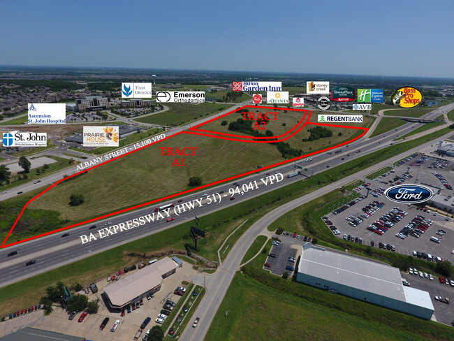
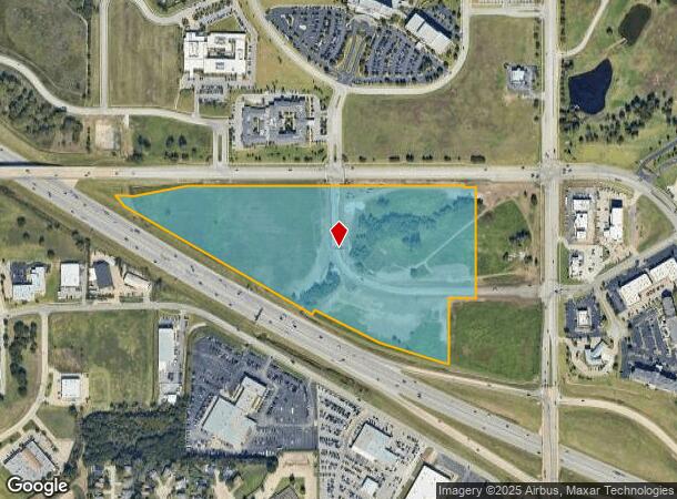
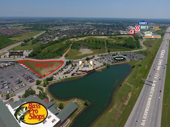
This Property Is For Sale
NEARBY LISTINGS FOR SALE OR LEASE
Property Detail
W Albany St N
Tulsa, OK
Unplatted
98403-84-03-73950
BEG 70W & 70S NEC NE TH S429.84 E10 S211.80 SW67.05 S401.12 W143.93 NW301.04 WLY70.59 NW507.20 CRV RT396.41 SW25 CRV RT931.15 NW237 NW82.67 E126.81 NE305 E200 ELY67.05 E13332.45 S10 E429.84 POB LESS BEG 70W & 70S NEC NE TH S429.84 E10 S211.80 S66.86
Agriculturalland
Tulsa
X
Oklahoma
40143C0385M
29.82 AC
2023
Southeast
2024
Tulsa
007415
DEMOGRAPHICS near W Albany St N
1 Mile
3 Mile
5 Mile
2024 Total Population
6,762
69,151
182,428
2029 Population
6,983
71,977
190,776
Pop Growth 2024-2029
+ 3.27%
+ 4.09%
+ 4.58%
Average Age
36
37
37
2024 Total Households
2,833
26,492
69,684
HH Growth 2024-2029
+ 3.35%
+ 4.20%
+ 4.51%
Median Household Inc
$66,712
$69,881
$64,399
Avg Household Size
2.30
2.50
2.50
2024 Avg HH Vehicles
2.00
2.00
2.00
Median Home Value
$220,427
$196,063
$179,947
Median Year Built
2000
1993
1987
Nearby Places
- Restaurants
- Banks
- Shops
- Fitness
- Groceries
PUBLIC TRANSPORTATION
AIRPORT
Tulsa International
DRIVE
WALK
Distance
Tulsa International
22 min
15.1 mi
Freight Ports
Tulsa Port Of Catoosa
DRIVE
WALK
Distance
Tulsa Port Of Catoosa
24 min
14.2 mi
Nearby Properties
Address
Land Use
TOTAL SIZE
Lot Size
Zoning
Address
Land Use
TOTAL SIZE
Lot Size
Zoning
197,676 SF
13.38 AC
CH
Address
Land Use
TOTAL SIZE
Lot Size
Zoning
435,822 SF
43.42 AC
R1
Address
Land Use
TOTAL SIZE
Lot Size
Zoning
53,094 SF
11.11 AC
CO
Address
Land Use
TOTAL SIZE
Lot Size
Zoning
115,003 SF
59.09 AC
CG
Address
Land Use
TOTAL SIZE
Lot Size
Zoning
125,902 SF
19.15 AC
CH
Address
Land Use
TOTAL SIZE
Lot Size
Zoning
59,108 SF
11.18 AC
R3
Address
Land Use
TOTAL SIZE
Lot Size
Zoning
53,139 SF
108.91 AC
A1
Address
Land Use
TOTAL SIZE
Lot Size
Zoning
82,129 SF
23.92 AC
R1
Address
Land Use
TOTAL SIZE
Lot Size
Zoning
55,283 SF
39.50 AC
SR
Address
Land Use
TOTAL SIZE
Lot Size
Zoning
90,060 SF
13.31 AC
CG
Address
Land Use
TOTAL SIZE
Lot Size
Zoning
58,695 SF
5.34 AC
RM
Address
Land Use
TOTAL SIZE
Lot Size
Zoning
49,113 SF
5.42 AC
R3
Address
Land Use
TOTAL SIZE
Lot Size
Zoning
77,260 SF
0.58 AC
R3
Address
Land Use
TOTAL SIZE
Lot Size
Zoning
84,927 SF
4.81 AC
RM2
Address
Land Use
TOTAL SIZE
Lot Size
Zoning
222,768 SF
20.24 AC
CS
Address
Land Use
TOTAL SIZE
Lot Size
Zoning
248,722 SF
15.01 AC
RM
Address
Land Use
TOTAL SIZE
Lot Size
Zoning
68,478 SF
9.27 AC
R1
Address
Land Use
TOTAL SIZE
Lot Size
Zoning
57,630 SF
35.09 AC
IL
Address
Land Use
TOTAL SIZE
Lot Size
Zoning
33,332 SF
2.92 AC
CO
Address
Land Use
TOTAL SIZE
Lot Size
Zoning
67,149 SF
28.56 AC
R2
Address
Land Use
TOTAL SIZE
Lot Size
Zoning
71,362 SF
14.08 AC
RD
Address
Land Use
TOTAL SIZE
Lot Size
Zoning
363,154 SF
23.09 AC
IL
Address
Land Use
TOTAL SIZE
Lot Size
Zoning
60,790 SF
10.84 AC
R1
Address
Land Use
TOTAL SIZE
Lot Size
Zoning
239,868 SF
14.84 AC
CG
Address
Land Use
TOTAL SIZE
Lot Size
Zoning
268,496 SF
19.31 AC
CN
Address
Land Use
TOTAL SIZE
Lot Size
Zoning
94,348 SF
11.21 AC
CO
Address
Land Use
TOTAL SIZE
Lot Size
Zoning
9,041 SF
38.18 AC
RS1
Address
Land Use
TOTAL SIZE
Lot Size
Zoning
13,691 SF
2.04 AC
CH
Address
Land Use
TOTAL SIZE
Lot Size
Zoning
14,056 SF
60.03 AC
A1
Address
Land Use
TOTAL SIZE
Lot Size
Zoning
24,000 SF
5.85 AC
R1
The World's #1 Commercial Real Estate Marketplace
Connect with us
© 2025 CoStar Group
The information above has been obtained from sources believed reliable. While we do not doubt its accuracy we have not verified it and make no guarantee, warranty or representation about it. It is your responsibility to independently confirm its accuracy and completeness. Any projections, opinions, assumptions, or estimates used are for example only and do not represent the current or future performance of the property. The value of this transaction to you depends on tax and other factors which should be evaluated by your tax, financial, and legal advisors. You and your advisors should conduct a careful, independent investigation of the property to determine to your satisfaction the suitability of the property for your needs.