Property Record
Strawberry Pt, Essex, MD 21221
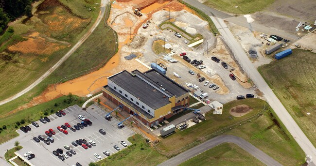

Property Detail
Strawberry Pt
15-1521450100
52.3 AC ON LAND G L MARTI
Taxexempt
BALTIMORE
DR5.5
Maryland
AE The base floodplain where base flood elevations are provided. AE Zones are now used on new format FIRMs instead of A1-A30 Zones.
52.30 AC
0
Baltimore County East
2025
Baltimore
450503
Baltimore-Columbia-Towson, MD
NEARBY LISTINGS FOR SALE OR LEASE
DEMOGRAPHICS near Strawberry Pt
1 mile
3 mile
5 mile
2025 Total Population
3,111
66,693
125,767
2030 Population
3,178
67,171
126,577
Pop Growth 2025-2030
+ 2.15%
+ 0.72%
+ 0.64%
Average Age
45
40
40
2025 Total Households
1,402
26,589
49,115
HH Growth 2025-2030
+ 2.14%
+ 0.83%
+ 0.67%
Median Household Inc
$68,385
$71,130
$79,140
Avg Household Size
2.20
2.50
2.50
2025 Avg HH Vehicles
2.00
2.00
2.00
Median Home Value
$264,353
$296,198
$316,214
Median Year Built
1978
1977
1978
Nearby Places
Map Layers
Map Styles
 Street
 Aerial
Transit
 Traffic
 Biking
Places
Listings with unknown addresses are not visible on the map
- Restaurants
- Banks
- Shops
- Fitness
- Groceries
PUBLIC TRANSPORTATION
COMMUTER RAIL
Martin Airport Marc Nb (PENN - WASHINGTON - Maryland Transit Administration)
Drive
Walk
Distance
Martin Airport Marc Nb (PENN - WASHINGTON - Maryland Transit Administration)
3 min
19 min
1.0 mi
AIRPORT
Baltimore/Washington International Thurgood Marshall
Drive
Walk
Distance
Baltimore/Washington International Thurgood Marshall
38 min
23.6 mi
Freight Ports
Port of Baltimore
Drive
Walk
Distance
Port of Baltimore
25 min
14.0 mi
Nearby Properties
Address
Land Use
TOTAL SIZE
Lot Size
Zoning
Address
Land Use
TOTAL SIZE
Lot Size
Zoning
159,728 SF
0.02 AC
MH
Address
Land Use
TOTAL SIZE
Lot Size
Zoning
504,086 SF
7.48 AC
MH
Address
Land Use
TOTAL SIZE
Lot Size
Zoning
553,984 SF
7.42 AC
Address
Land Use
TOTAL SIZE
Lot Size
Zoning
83.12 AC
ML
Address
Land Use
TOTAL SIZE
Lot Size
Zoning
1,062,672 SF
70.27 AC
MHIM
Address
Land Use
TOTAL SIZE
Lot Size
Zoning
15.40 AC
DR16
Address
Land Use
TOTAL SIZE
Lot Size
Zoning
423,200 SF
22.60 AC
MH-1M
Address
Land Use
TOTAL SIZE
Lot Size
Zoning
14.19 AC
DR16
Address
Land Use
TOTAL SIZE
Lot Size
Zoning
14.28 AC
DR16
Address
Land Use
TOTAL SIZE
Lot Size
Zoning
21.83 AC
DR16
Address
Land Use
TOTAL SIZE
Lot Size
Zoning
253,081 SF
42.21 AC
DR5.5
Address
Land Use
TOTAL SIZE
Lot Size
Zoning
300,400 SF
31.60 AC
ML-IM
Address
Land Use
TOTAL SIZE
Lot Size
Zoning
135,931 SF
21.65 AC
DR5.5
Address
Land Use
TOTAL SIZE
Lot Size
Zoning
440,340 SF
128.19 AC
Address
Land Use
TOTAL SIZE
Lot Size
Zoning
23.40 AC
DR16
Address
Land Use
TOTAL SIZE
Lot Size
Zoning
97,878 SF
12.45 AC
DR5.5
Address
Land Use
TOTAL SIZE
Lot Size
Zoning
20.13 AC
DR16
Address
Land Use
TOTAL SIZE
Lot Size
Zoning
19 AC
DR16
Address
Land Use
TOTAL SIZE
Lot Size
Zoning
24.95 AC
DR16
Address
Land Use
TOTAL SIZE
Lot Size
Zoning
12.47 AC
DR16
Address
Land Use
TOTAL SIZE
Lot Size
Zoning
10.48 AC
DR16
Address
Land Use
TOTAL SIZE
Lot Size
Zoning
11.69 AC
DR16
Address
Land Use
TOTAL SIZE
Lot Size
Zoning
81,466 SF
6.75 AC
BM
Address
Land Use
TOTAL SIZE
Lot Size
Zoning
130,797 SF
18.11 AC
DR105
Address
Land Use
TOTAL SIZE
Lot Size
Zoning
237,925 SF
28.28 AC
Address
Land Use
TOTAL SIZE
Lot Size
Zoning
18 AC
DR16
Address
Land Use
TOTAL SIZE
Lot Size
Zoning
294,750 SF
16.51 AC
ML-IM
Address
Land Use
TOTAL SIZE
Lot Size
Zoning
12.25 AC
DR16
Address
Land Use
TOTAL SIZE
Lot Size
Zoning
89,522 SF
4.03 AC
Address
Land Use
TOTAL SIZE
Lot Size
Zoning
128,400 SF
12.68 AC
The World's #1 Commercial Real Estate Marketplace
Connect with us
© 2026 CoStar Group
The information above has been obtained from sources believed reliable. While we do not doubt its accuracy we have not verified it and make no guarantee, warranty or representation about it. It is your responsibility to independently confirm its accuracy and completeness. Any projections, opinions, assumptions, or estimates used are for example only and do not represent the current or future performance of the property. The value of this transaction to you depends on tax and other factors which should be evaluated by your tax, financial, and legal advisors. You and your advisors should conduct a careful, independent investigation of the property to determine to your satisfaction the suitability of the property for your needs.