Property Record
Stump Rd, Pipersville, PA 18947


Property Detail
Stump Rd
34-003-041
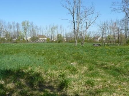
4.24A NW COR LR09077 & T3 98 STUMP ROAD
Residentialacreage
BUCKS
I
Pennsylvania
B and X Area of moderate flood hazard, usually the area between the limits of the 100-year and 500-year floods.
4.24 AC
2025
Upper Bucks County
2026
Philadelphia
104201
Philadelphia-Camden-Wilmington, PA-NJ-DE-MD
NEARBY LISTINGS FOR SALE OR LEASE
DEMOGRAPHICS near Stump Rd
1 mile
3 mile
5 mile
2025 Total Population
2,307
15,985
45,895
2030 Population
2,365
16,068
46,403
Pop Growth 2025-2030
+ 2.51%
+ 0.52%
+ 1.11%
Average Age
41
41
44
2025 Total Households
782
5,674
17,566
HH Growth 2025-2030
+ 2.43%
+ 0.53%
+ 1.47%
Median Household Inc
$143,629
$121,696
$123,383
Avg Household Size
2.90
2.80
2.50
2025 Avg HH Vehicles
2.00
2.00
2.00
Median Home Value
$613,022
$602,727
$622,538
Median Year Built
1993
1990
1987
Nearby Places
Map Layers
Map Styles
 Street
 Aerial
Layers
 Traffic
 Biking
Places
Listings with unknown addresses are not visible on the map
- Restaurants
- Banks
- Shops
- Fitness
- Groceries
PUBLIC TRANSPORTATION
COMMUTER RAIL
Doylestown (R5 - Southeastern Pennsylvania Transportation Authority Regional Rail (SEPTA Regional Rail))
Drive
Walk
Distance
Doylestown (R5 - Southeastern Pennsylvania Transportation Authority Regional Rail (SEPTA Regional Rail))
12 min
6.7 mi
Delaware Valley College (R5 - Southeastern Pennsylvania Transportation Authority Regional Rail (SEPTA Regional Rail))
Drive
Walk
Distance
Delaware Valley College (R5 - Southeastern Pennsylvania Transportation Authority Regional Rail (SEPTA Regional Rail))
12 min
7.5 mi
AIRPORT
Trenton Mercer
Drive
Walk
Distance
Trenton Mercer
44 min
25.2 mi
Lehigh Valley International
Drive
Walk
Distance
Lehigh Valley International
54 min
31.3 mi
Freight Ports
Port of Philadelphia
Drive
Walk
Distance
Port of Philadelphia
57 min
31.9 mi
SALE & LEASE HISTORY
LISTING DATE
SALE/LEASE

Sep 24, 2016
For Sale
Aug 01, 2017
For Sale
Apr 20, 2017
For Sale
Apr 20, 2017
For Sale
Nearby Properties
Address
Land Use
TOTAL SIZE
Lot Size
Zoning
Address
Land Use
TOTAL SIZE
Lot Size
Zoning
109,660 SF
9.81 AC
R3
Address
Land Use
TOTAL SIZE
Lot Size
Zoning
126,278 SF
17.82 AC
I
Address
Land Use
TOTAL SIZE
Lot Size
Zoning
515 SF
128.48 AC
R1
Address
Land Use
TOTAL SIZE
Lot Size
Zoning
66,008 SF
13.28 AC
C3
Address
Land Use
TOTAL SIZE
Lot Size
Zoning
234,274 SF
24.12 AC
C4
Address
Land Use
TOTAL SIZE
Lot Size
Zoning
45,960 SF
0.36 AC
C2
Address
Land Use
TOTAL SIZE
Lot Size
Zoning
55,077 SF
7.22 AC
C2
Address
Land Use
TOTAL SIZE
Lot Size
Zoning
561,638 SF
36.65 AC
RO
Address
Land Use
TOTAL SIZE
Lot Size
Zoning
12,994 SF
3.89 AC
R2
Address
Land Use
TOTAL SIZE
Lot Size
Zoning
61,059 SF
11.43 AC
I
Address
Land Use
TOTAL SIZE
Lot Size
Zoning
25,008 SF
4.05 AC
I
Address
Land Use
TOTAL SIZE
Lot Size
Zoning
41,460 SF
4.90 AC
R1
Address
Land Use
TOTAL SIZE
Lot Size
Zoning
35,177 SF
12.96 AC
I
Address
Land Use
TOTAL SIZE
Lot Size
Zoning
78,057 SF
10.50 AC
I
Address
Land Use
TOTAL SIZE
Lot Size
Zoning
35,200 SF
2.54 AC
C2
Address
Land Use
TOTAL SIZE
Lot Size
Zoning
36,664 SF
5.10 AC
I
Address
Land Use
TOTAL SIZE
Lot Size
Zoning
49,383 SF
4.45 AC
I
Address
Land Use
TOTAL SIZE
Lot Size
Zoning
32,754 SF
8.03 AC
C2
Address
Land Use
TOTAL SIZE
Lot Size
Zoning
21,250 SF
3.36 AC
C1
Address
Land Use
TOTAL SIZE
Lot Size
Zoning
67,590 SF
3.43 AC
L1
Address
Land Use
TOTAL SIZE
Lot Size
Zoning
39,797 SF
10.38 AC
C2
Address
Land Use
TOTAL SIZE
Lot Size
Zoning
30,295 SF
4.11 AC
I
Address
Land Use
TOTAL SIZE
Lot Size
Zoning
4,980 SF
3.36 AC
C2
Address
Land Use
TOTAL SIZE
Lot Size
Zoning
49,460 SF
3.03 AC
C4
Address
Land Use
TOTAL SIZE
Lot Size
Zoning
35,152 SF
10.55 AC
C2
Address
Land Use
TOTAL SIZE
Lot Size
Zoning
16,288 SF
3.13 AC
C2
Address
Land Use
TOTAL SIZE
Lot Size
Zoning
64,000 SF
8 AC
C2
Address
Land Use
TOTAL SIZE
Lot Size
Zoning
17,132 SF
35.10 AC
Address
Land Use
TOTAL SIZE
Lot Size
Zoning
19,120 SF
5.13 AC
C2
Address
Land Use
TOTAL SIZE
Lot Size
Zoning
17,200 SF
2.04 AC
R1
The World's #1 Commercial Real Estate Marketplace
Connect with us
© 2026 CoStar Group
The information above has been obtained from sources believed reliable. While we do not doubt its accuracy we have not verified it and make no guarantee, warranty or representation about it. It is your responsibility to independently confirm its accuracy and completeness. Any projections, opinions, assumptions, or estimates used are for example only and do not represent the current or future performance of the property. The value of this transaction to you depends on tax and other factors which should be evaluated by your tax, financial, and legal advisors. You and your advisors should conduct a careful, independent investigation of the property to determine to your satisfaction the suitability of the property for your needs.