Property Record
Sullivan Rd & Enos Ln, Bakersfield, CA 93314


Property Detail
Sullivan Rd & Enos Ln
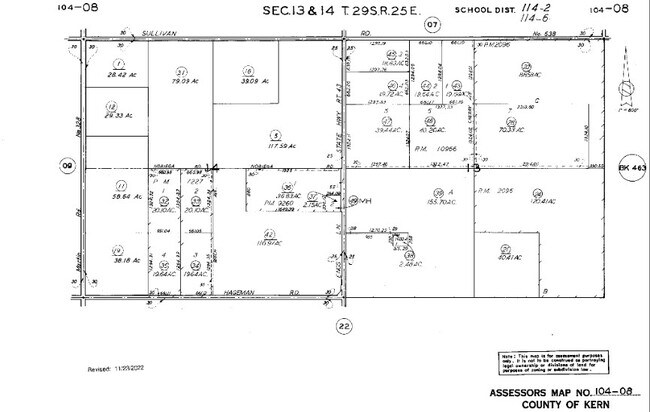
104-080-05-01-5
SECTION 14 , TOWNSHIP 29 , RANGE 25 , QUARTER
Orchard
KERN
A
California
B and X Area of moderate flood hazard, usually the area between the limits of the 100-year and 500-year floods.
117.59 AC
2024
NW Outlying Kern County
2025
Bakersfield
006600
Bakersfield-Delano, CA
NEARBY LISTINGS FOR SALE OR LEASE
DEMOGRAPHICS near Sullivan Rd & Enos Ln
1 mile
3 mile
5 mile
2025 Total Population
44
950
11,236
2030 Population
45
972
11,448
Pop Growth 2025-2030
+ 2.27%
+ 2.32%
+ 1.89%
Average Age
36
36
36
2025 Total Households
12
263
3,051
HH Growth 2025-2030
+ 8.33%
+ 1.90%
+ 2.20%
Median Household Inc
$93,749
$91,785
$126,993
Avg Household Size
3.50
3.50
3.40
2025 Avg HH Vehicles
2.00
3.00
3.00
Median Home Value
$499,999
$443,269
$601,253
Median Year Built
1974
1986
2004
Nearby Places
Map Layers
Map Styles
 Street
 Aerial
Layers
 Traffic
 Biking
Places
Listings with unknown addresses are not visible on the map
- Restaurants
- Banks
- Shops
- Fitness
- Groceries
PUBLIC TRANSPORTATION
AIRPORT
Meadows Field
Drive
Walk
Distance
Meadows Field
25 min
14.8 mi
Freight Ports
The Port of Hueneme
Drive
Walk
Distance
The Port of Hueneme
163 min
130.0 mi
SALE & LEASE HISTORY
LISTING DATE
SALE/LEASE

Dec 18, 2023
For Sale
Nearby Properties
Address
Land Use
TOTAL SIZE
Lot Size
Zoning
Address
Land Use
TOTAL SIZE
Lot Size
Zoning
19.09 AC
Address
Land Use
TOTAL SIZE
Lot Size
Zoning
4,263 SF
49.09 AC
A
Address
Land Use
TOTAL SIZE
Lot Size
Zoning
41.47 AC
M-3
Address
Land Use
TOTAL SIZE
Lot Size
Zoning
263.80 AC
A
Address
Land Use
TOTAL SIZE
Lot Size
Zoning
35,125 SF
20.70 AC
M-2
Address
Land Use
TOTAL SIZE
Lot Size
Zoning
15,000 SF
10.70 AC
M2
Address
Land Use
TOTAL SIZE
Lot Size
Zoning
116.97 AC
A
Address
Land Use
TOTAL SIZE
Lot Size
Zoning
7,200 SF
15.17 AC
M3
Address
Land Use
TOTAL SIZE
Lot Size
Zoning
589.37 AC
A
Address
Land Use
TOTAL SIZE
Lot Size
Zoning
Address
Land Use
TOTAL SIZE
Lot Size
Zoning
6,250 SF
19.12 AC
NR
Address
Land Use
TOTAL SIZE
Lot Size
Zoning
6,000 SF
5.61 AC
M2/PD
Address
Land Use
TOTAL SIZE
Lot Size
Zoning
Address
Land Use
TOTAL SIZE
Lot Size
Zoning
6,000 SF
4.60 AC
M-1
Address
Land Use
TOTAL SIZE
Lot Size
Zoning
14,400 SF
4.98 AC
M-2 PD
Address
Land Use
TOTAL SIZE
Lot Size
Zoning
301.78 AC
A
Address
Land Use
TOTAL SIZE
Lot Size
Zoning
31,200 SF
5 AC
M2
Address
Land Use
TOTAL SIZE
Lot Size
Zoning
4.62 AC
M3
Address
Land Use
TOTAL SIZE
Lot Size
Zoning
17,250 SF
4.30 AC
M-2 PD
Address
Land Use
TOTAL SIZE
Lot Size
Zoning
156.36 AC
A
Address
Land Use
TOTAL SIZE
Lot Size
Zoning
2,400 SF
5.02 AC
NR5
Address
Land Use
TOTAL SIZE
Lot Size
Zoning
6,080 SF
39.83 AC
A
Address
Land Use
TOTAL SIZE
Lot Size
Zoning
306.33 AC
A
Address
Land Use
TOTAL SIZE
Lot Size
Zoning
5,701 SF
39.27 AC
A
Address
Land Use
TOTAL SIZE
Lot Size
Zoning
20.04 AC
A
Address
Land Use
TOTAL SIZE
Lot Size
Zoning
19.58 AC
M2
Address
Land Use
TOTAL SIZE
Lot Size
Zoning
20.04 AC
A
Address
Land Use
TOTAL SIZE
Lot Size
Zoning
7,500 SF
8.11 AC
M2
Address
Land Use
TOTAL SIZE
Lot Size
Zoning
8.51 AC
The World's #1 Commercial Real Estate Marketplace
Connect with us
© 2026 CoStar Group
The information above has been obtained from sources believed reliable. While we do not doubt its accuracy we have not verified it and make no guarantee, warranty or representation about it. It is your responsibility to independently confirm its accuracy and completeness. Any projections, opinions, assumptions, or estimates used are for example only and do not represent the current or future performance of the property. The value of this transaction to you depends on tax and other factors which should be evaluated by your tax, financial, and legal advisors. You and your advisors should conduct a careful, independent investigation of the property to determine to your satisfaction the suitability of the property for your needs.