Property Record
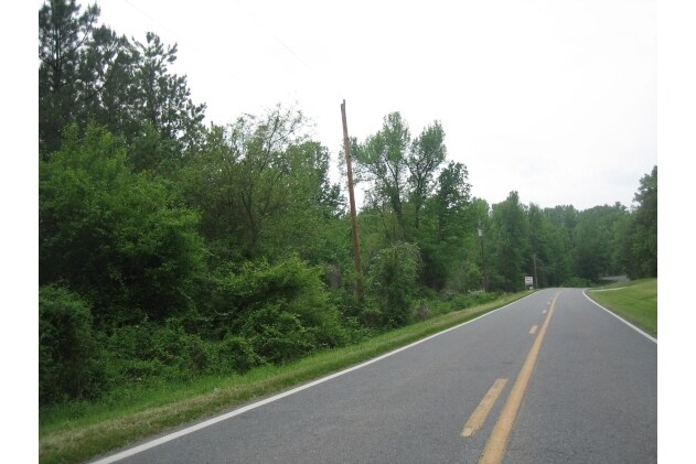
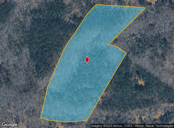
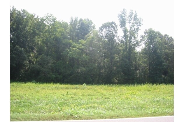
Sulphur Springs Rd, Lawndale, NC 28090
NEARBY LISTINGS FOR SALE OR LEASE
Property Detail
Sulphur Springs Rd
Shelby, NC
South Shelby
5408
17.88 AC RD 1100
Residentialacreage
Cleveland
X
North Carolina
45021C0075D
11
2025
17.88 AC
2025
Cleveland County
951200
Charlotte
DEMOGRAPHICS near Sulphur Springs Rd
1 Mile
3 Mile
5 Mile
2024 Total Population
1,554
12,232
34,784
2029 Population
1,625
12,764
36,371
Pop Growth 2024-2029
+ 4.57%
+ 4.35%
+ 4.56%
Average Age
41
40
41
2024 Total Households
634
4,964
14,282
HH Growth 2024-2029
+ 4.57%
+ 4.31%
+ 4.57%
Median Household Inc
$30,625
$40,644
$43,570
Avg Household Size
2.30
2.40
2.30
2024 Avg HH Vehicles
2.00
2.00
2.00
Median Home Value
$75,274
$97,344
$130,486
Median Year Built
1981
1978
1976
Nearby Places
Map Layers
Map Styles
 Street
 Aerial
- Restaurants
- Banks
- Shops
- Fitness
- Groceries
SALE & LEASE HISTORY
LISTING DATE
SALE/LEASE

Sep 24, 2016
For Sale
Nearby Properties
Address
Land Use
TOTAL SIZE
Lot Size
Zoning
Address
Land Use
TOTAL SIZE
Lot Size
Zoning
5,036 SF
29.46 AC
CPD
Address
Land Use
TOTAL SIZE
Lot Size
Zoning
139,067 SF
25 AC
R20
Address
Land Use
TOTAL SIZE
Lot Size
Zoning
224,162 SF
15 AC
GBCU
Address
Land Use
TOTAL SIZE
Lot Size
Zoning
8,880 SF
8.28 AC
CPD
Address
Land Use
TOTAL SIZE
Lot Size
Zoning
66,184 SF
56.38 AC
ROCU
Address
Land Use
TOTAL SIZE
Lot Size
Zoning
4,040 SF
22.83 AC
GB
Address
Land Use
TOTAL SIZE
Lot Size
Zoning
71,644 SF
7.67 AC
GB
Address
Land Use
TOTAL SIZE
Lot Size
Zoning
91,986 SF
29.44 AC
R15
Address
Land Use
TOTAL SIZE
Lot Size
Zoning
52.33 AC
R8
Address
Land Use
TOTAL SIZE
Lot Size
Zoning
46,948 SF
2.06 AC
GB
Address
Land Use
TOTAL SIZE
Lot Size
Zoning
78,165 SF
8.02 AC
GB
Address
Land Use
TOTAL SIZE
Lot Size
Zoning
37,580 SF
2 AC
GB
Address
Land Use
TOTAL SIZE
Lot Size
Zoning
35,829 SF
4 AC
GB
Address
Land Use
TOTAL SIZE
Lot Size
Zoning
8,000 SF
7.90 AC
R10
Address
Land Use
TOTAL SIZE
Lot Size
Zoning
1,416 SF
10.74 AC
R6
Address
Land Use
TOTAL SIZE
Lot Size
Zoning
130,560 SF
7.27 AC
Address
Land Use
TOTAL SIZE
Lot Size
Zoning
53,684 SF
20.06 AC
GB
Address
Land Use
TOTAL SIZE
Lot Size
Zoning
27,014 SF
9.93 AC
GB
Address
Land Use
TOTAL SIZE
Lot Size
Zoning
10,406 SF
1.68 AC
GB
Address
Land Use
TOTAL SIZE
Lot Size
Zoning
21,208 SF
5.65 AC
GB
Address
Land Use
TOTAL SIZE
Lot Size
Zoning
21,266 SF
2.49 AC
GB
Address
Land Use
TOTAL SIZE
Lot Size
Zoning
2,562 SF
7.92 AC
R6
Address
Land Use
TOTAL SIZE
Lot Size
Zoning
103,000 SF
13.65 AC
GB
Address
Land Use
TOTAL SIZE
Lot Size
Zoning
3,115 SF
7.13 AC
R6
Address
Land Use
TOTAL SIZE
Lot Size
Zoning
8,920 SF
6.97 AC
CPD
Address
Land Use
TOTAL SIZE
Lot Size
Zoning
6,500 SF
11.21 AC
R20
Address
Land Use
TOTAL SIZE
Lot Size
Zoning
2,007 SF
423.55 AC
HI
Address
Land Use
TOTAL SIZE
Lot Size
Zoning
21,888 SF
6.03 AC
Address
Land Use
TOTAL SIZE
Lot Size
Zoning
7,080 SF
7.70 AC
R20
Address
Land Use
TOTAL SIZE
Lot Size
Zoning
36,205 SF
8.74 AC
GB
The World's #1 Commercial Real Estate Marketplace
Connect with us
© 2025 CoStar Group
The information above has been obtained from sources believed reliable. While we do not doubt its accuracy we have not verified it and make no guarantee, warranty or representation about it. It is your responsibility to independently confirm its accuracy and completeness. Any projections, opinions, assumptions, or estimates used are for example only and do not represent the current or future performance of the property. The value of this transaction to you depends on tax and other factors which should be evaluated by your tax, financial, and legal advisors. You and your advisors should conduct a careful, independent investigation of the property to determine to your satisfaction the suitability of the property for your needs.