Property Record
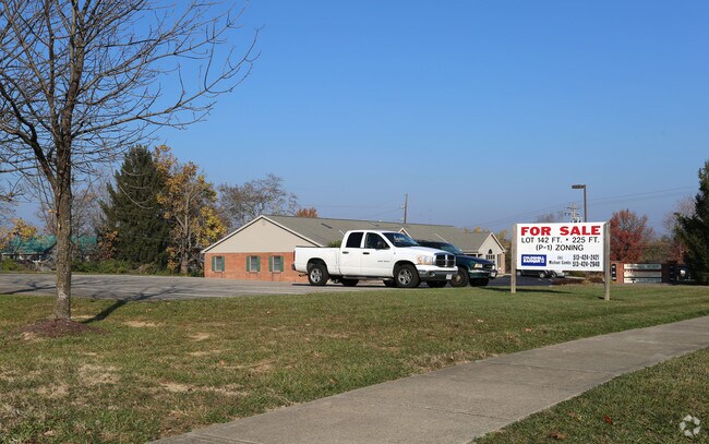
Summit Dr, Middletown, OH 45042


Property Detail
Summit Dr
Cincinnati, OH-KY-IN
17288 ENT
Q6531-073-000-043
BUTLER
Commercialnec
Ohio
B and X Area of moderate flood hazard, usually the area between the limits of the 100-year and 500-year floods.
0.73 AC
2024
Butler County
2025
Cincinnati/Dayton
012200
NEARBY LISTINGS FOR SALE OR LEASE
DEMOGRAPHICS near Summit Dr
1 mile
3 mile
5 mile
2025 Total Population
7,044
52,078
90,283
2030 Population
7,215
53,888
93,709
Pop Growth 2025-2030
+ 2.43%
+ 3.48%
+ 3.79%
Average Age
45
40
41
2025 Total Households
2,951
21,744
36,838
HH Growth 2025-2030
+ 2.47%
+ 3.51%
+ 3.82%
Median Household Inc
$79,925
$56,363
$59,340
Avg Household Size
2.30
2.30
2.40
2025 Avg HH Vehicles
2.00
2.00
2.00
Median Home Value
$244,579
$182,472
$192,784
Median Year Built
1965
1964
1966
Nearby Places
Map Layers
Map Styles
 Street
 Aerial
Layers
 Traffic
 Biking
Places
Listings with unknown addresses are not visible on the map
- Restaurants
- Banks
- Shops
- Fitness
- Groceries
PUBLIC TRANSPORTATION
AIRPORT
James M Cox Dayton International
Drive
Walk
Distance
James M Cox Dayton International
52 min
35.3 mi
SALE & LEASE HISTORY
LISTING DATE
SALE/LEASE

Nov 18, 2016
For Sale
May 04, 2017
For Sale
Nearby Properties
Address
Land Use
TOTAL SIZE
Lot Size
Zoning
Address
Land Use
TOTAL SIZE
Lot Size
Zoning
160,701 SF
10.83 AC
Address
Land Use
TOTAL SIZE
Lot Size
Zoning
39.51 AC
Address
Land Use
TOTAL SIZE
Lot Size
Zoning
5,000 SF
60.29 AC
Address
Land Use
TOTAL SIZE
Lot Size
Zoning
7.19 AC
Address
Land Use
TOTAL SIZE
Lot Size
Zoning
27,780 SF
61.49 AC
Address
Land Use
TOTAL SIZE
Lot Size
Zoning
16.57 AC
Address
Land Use
TOTAL SIZE
Lot Size
Zoning
Address
Land Use
TOTAL SIZE
Lot Size
Zoning
15,228 SF
37.19 AC
R1
Address
Land Use
TOTAL SIZE
Lot Size
Zoning
120,685 SF
21.52 AC
Address
Land Use
TOTAL SIZE
Lot Size
Zoning
37,842 SF
13.68 AC
Address
Land Use
TOTAL SIZE
Lot Size
Zoning
17.24 AC
ADV
Address
Land Use
TOTAL SIZE
Lot Size
Zoning
17.47 AC
Address
Land Use
TOTAL SIZE
Lot Size
Zoning
84,352 SF
0.30 AC
Address
Land Use
TOTAL SIZE
Lot Size
Zoning
86.47 AC
ADV
Address
Land Use
TOTAL SIZE
Lot Size
Zoning
54,005 SF
0.33 AC
Address
Land Use
TOTAL SIZE
Lot Size
Zoning
113,241 SF
7.84 AC
Address
Land Use
TOTAL SIZE
Lot Size
Zoning
33,362 SF
0.73 AC
Address
Land Use
TOTAL SIZE
Lot Size
Zoning
868 SF
36.06 AC
Address
Land Use
TOTAL SIZE
Lot Size
Zoning
111,304 SF
9.77 AC
Address
Land Use
TOTAL SIZE
Lot Size
Zoning
371,743 SF
24.58 AC
ADV
Address
Land Use
TOTAL SIZE
Lot Size
Zoning
14.36 AC
Address
Land Use
TOTAL SIZE
Lot Size
Zoning
58,564 SF
7.36 AC
Address
Land Use
TOTAL SIZE
Lot Size
Zoning
205,346 SF
24 AC
Address
Land Use
TOTAL SIZE
Lot Size
Zoning
118,671 SF
5.46 AC
ADV
Address
Land Use
TOTAL SIZE
Lot Size
Zoning
59,038 SF
10 AC
Address
Land Use
TOTAL SIZE
Lot Size
Zoning
166 AC
ADV
Address
Land Use
TOTAL SIZE
Lot Size
Zoning
15,530 SF
4.50 AC
Address
Land Use
TOTAL SIZE
Lot Size
Zoning
5,370 SF
3.68 AC
Address
Land Use
TOTAL SIZE
Lot Size
Zoning
14.86 AC
Address
Land Use
TOTAL SIZE
Lot Size
Zoning
The World's #1 Commercial Real Estate Marketplace
Connect with us
© 2026 CoStar Group
The information above has been obtained from sources believed reliable. While we do not doubt its accuracy we have not verified it and make no guarantee, warranty or representation about it. It is your responsibility to independently confirm its accuracy and completeness. Any projections, opinions, assumptions, or estimates used are for example only and do not represent the current or future performance of the property. The value of this transaction to you depends on tax and other factors which should be evaluated by your tax, financial, and legal advisors. You and your advisors should conduct a careful, independent investigation of the property to determine to your satisfaction the suitability of the property for your needs.