Property Record
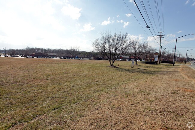
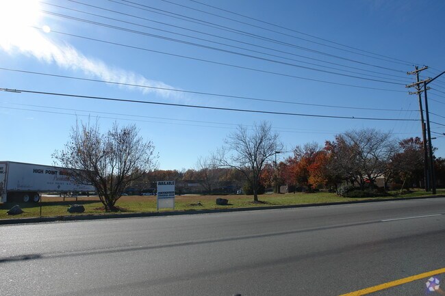
6321 Statesville Rd, Charlotte, NC 28269
Property Detail
6321 Statesville Rd
Charlotte-Concord-Gastonia, NC-SC
M75-265
041-242-10
MECKLENBURG
Commercialnec
North Carolina
CC
10
B and X Area of moderate flood hazard, usually the area between the limits of the 100-year and 500-year floods.
1.70 AC
2024
Northeast/I-77
2025
Charlotte
005403
NEARBY LISTINGS FOR SALE OR LEASE
DEMOGRAPHICS near 6321 Statesville Rd
1 mile
3 mile
5 mile
2025 Total Population
5,864
69,526
191,978
2030 Population
6,378
75,533
209,542
Pop Growth 2025-2030
+ 8.77%
+ 8.64%
+ 9.15%
Average Age
36
37
36
2025 Total Households
2,007
26,079
74,266
HH Growth 2025-2030
+ 8.92%
+ 8.70%
+ 9.34%
Median Household Inc
$57,426
$64,365
$66,020
Avg Household Size
2.80
2.60
2.50
2025 Avg HH Vehicles
2.00
2.00
2.00
Median Home Value
$284,929
$294,522
$324,649
Median Year Built
1996
1998
1997
Nearby Places
Map Layers
Map Styles
 Street
 Aerial
Transit
 Traffic
 Biking
Places
Listings with unknown addresses are not visible on the map
- Restaurants
- Banks
- Shops
- Fitness
- Groceries
PUBLIC TRANSPORTATION
COMMUTER RAIL
Charlotte Amtrak Station (Carolinian - Amtrak, Crescent - Amtrak, Piedmont - Amtrak)
Drive
Walk
Distance
Charlotte Amtrak Station (Carolinian - Amtrak, Crescent - Amtrak, Piedmont - Amtrak)
11 min
5.8 mi
AIRPORT
Concord-Padgett Regional
Drive
Walk
Distance
Concord-Padgett Regional
19 min
12.6 mi
Charlotte/Douglas International
Drive
Walk
Distance
Charlotte/Douglas International
22 min
13.1 mi
Freight Ports
North Charleston Terminal
Drive
Walk
Distance
North Charleston Terminal
234 min
205.3 mi
SALE & LEASE HISTORY
LISTING DATE
SALE/LEASE

Sep 24, 2016
For Sale
Jun 14, 2017
For Sale
Nearby Properties
Address
Land Use
TOTAL SIZE
Lot Size
Zoning
Address
Land Use
TOTAL SIZE
Lot Size
Zoning
497,730 SF
32.66 AC
B2CD
Address
Land Use
TOTAL SIZE
Lot Size
Zoning
641,285 SF
43.18 AC
I-1
Address
Land Use
TOTAL SIZE
Lot Size
Zoning
481,045 SF
36.15 AC
R12MFCD
Address
Land Use
TOTAL SIZE
Lot Size
Zoning
318,829 SF
26.68 AC
MX1INNOV
Address
Land Use
TOTAL SIZE
Lot Size
Zoning
256,254 SF
20.66 AC
R9MFCD
Address
Land Use
TOTAL SIZE
Lot Size
Zoning
322,507 SF
25.95 AC
I1
Address
Land Use
TOTAL SIZE
Lot Size
Zoning
295,520 SF
23.13 AC
R12MFCD
Address
Land Use
TOTAL SIZE
Lot Size
Zoning
263,035 SF
10.42 AC
CC
Address
Land Use
TOTAL SIZE
Lot Size
Zoning
294,175 SF
20.23 AC
R12MFCD
Address
Land Use
TOTAL SIZE
Lot Size
Zoning
244,003 SF
26.78 AC
R12MFCD
Address
Land Use
TOTAL SIZE
Lot Size
Zoning
490,844 SF
40.50 AC
I-2(CD)
Address
Land Use
TOTAL SIZE
Lot Size
Zoning
304,185 SF
14.32 AC
UR-3(CD)
Address
Land Use
TOTAL SIZE
Lot Size
Zoning
187,636 SF
16.56 AC
R17MFCD
Address
Land Use
TOTAL SIZE
Lot Size
Zoning
209,748 SF
12.38 AC
MX1INNOV
Address
Land Use
TOTAL SIZE
Lot Size
Zoning
634,939 SF
42.26 AC
I1CD
Address
Land Use
TOTAL SIZE
Lot Size
Zoning
322,342 SF
19.64 AC
R12MFCD
Address
Land Use
TOTAL SIZE
Lot Size
Zoning
221,187 SF
16.34 AC
R17MF
Address
Land Use
TOTAL SIZE
Lot Size
Zoning
129,017 SF
7.27 AC
CC
Address
Land Use
TOTAL SIZE
Lot Size
Zoning
221,404 SF
17.13 AC
R15MFCD
Address
Land Use
TOTAL SIZE
Lot Size
Zoning
134,925 SF
13.68 AC
CC
Address
Land Use
TOTAL SIZE
Lot Size
Zoning
195,448 SF
23.10 AC
R12MFCD
Address
Land Use
TOTAL SIZE
Lot Size
Zoning
180,625 SF
12.60 AC
Address
Land Use
TOTAL SIZE
Lot Size
Zoning
348,081 SF
17.20 AC
I-2(CD)
Address
Land Use
TOTAL SIZE
Lot Size
Zoning
174,118 SF
10.92 AC
R17MFCD
Address
Land Use
TOTAL SIZE
Lot Size
Zoning
627,355 SF
45.41 AC
I2
Address
Land Use
TOTAL SIZE
Lot Size
Zoning
381,151 SF
21.40 AC
I-1
Address
Land Use
TOTAL SIZE
Lot Size
Zoning
136,783 SF
7.85 AC
I-1
Address
Land Use
TOTAL SIZE
Lot Size
Zoning
174,768 SF
9.28 AC
INST(CD)
Address
Land Use
TOTAL SIZE
Lot Size
Zoning
382,375 SF
25.11 AC
I1
Address
Land Use
TOTAL SIZE
Lot Size
Zoning
429,864 SF
35.57 AC
I1
The World's #1 Commercial Real Estate Marketplace
Connect with us
© 2026 CoStar Group
The information above has been obtained from sources believed reliable. While we do not doubt its accuracy we have not verified it and make no guarantee, warranty or representation about it. It is your responsibility to independently confirm its accuracy and completeness. Any projections, opinions, assumptions, or estimates used are for example only and do not represent the current or future performance of the property. The value of this transaction to you depends on tax and other factors which should be evaluated by your tax, financial, and legal advisors. You and your advisors should conduct a careful, independent investigation of the property to determine to your satisfaction the suitability of the property for your needs.