Property Record
Superior Dr, Spring Lake, NC 28390


Property Detail
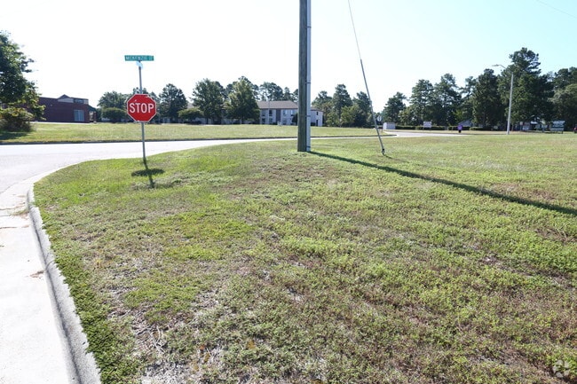
Superior Dr
Fayetteville, NC
LAKETREE INC LO:1 SE:01 PL:0090-0147
0501-49-8776
CUMBERLAND
Commercialacreage
North Carolina
CP
1
B and X Area of moderate flood hazard, usually the area between the limits of the 100-year and 500-year floods.
0.80 AC
2025
Spring Lake
2025
Fayetteville
071203
NEARBY LISTINGS FOR SALE OR LEASE
DEMOGRAPHICS near Superior Dr
1 mile
3 mile
5 mile
2025 Total Population
6,615
24,427
45,854
2030 Population
6,878
25,275
47,316
Pop Growth 2025-2030
+ 3.98%
+ 3.47%
+ 3.19%
Average Age
32
29
29
2025 Total Households
2,667
8,116
12,768
HH Growth 2025-2030
+ 3.22%
+ 3.34%
+ 3.70%
Median Household Inc
$49,972
$52,238
$53,760
Avg Household Size
2.30
2.50
2.60
2025 Avg HH Vehicles
2.00
2.00
2.00
Median Home Value
$112,770
$107,495
$171,979
Median Year Built
1991
1990
1988
Nearby Places
Map Layers
Map Styles
 Street
 Aerial
Layers
 Traffic
 Biking
Places
Listings with unknown addresses are not visible on the map
- Restaurants
- Banks
- Shops
- Fitness
- Groceries
PUBLIC TRANSPORTATION
AIRPORT
Fayetteville Regional/Grannis Field
Drive
Walk
Distance
Fayetteville Regional/Grannis Field
26 min
16.1 mi
Freight Ports
Port of Wilmington
Drive
Walk
Distance
Port of Wilmington
143 min
101.9 mi
Nearby Properties
Address
Land Use
TOTAL SIZE
Lot Size
Zoning
Address
Land Use
TOTAL SIZE
Lot Size
Zoning
1,697 SF
20.29 AC
R5A
Address
Land Use
TOTAL SIZE
Lot Size
Zoning
2,580 SF
27.55 AC
R5A
Address
Land Use
TOTAL SIZE
Lot Size
Zoning
2,600 SF
21.95 AC
R10
Address
Land Use
TOTAL SIZE
Lot Size
Zoning
2,485 SF
11.17 AC
R5A
Address
Land Use
TOTAL SIZE
Lot Size
Zoning
2,916 SF
17.13 AC
R5A-RESIDE
Address
Land Use
TOTAL SIZE
Lot Size
Zoning
2,400 SF
21.45 AC
R5A-RESIDE
Address
Land Use
TOTAL SIZE
Lot Size
Zoning
3,656 SF
15.73 AC
PND
Address
Land Use
TOTAL SIZE
Lot Size
Zoning
185,162 SF
22.13 AC
CP
Address
Land Use
TOTAL SIZE
Lot Size
Zoning
35,339 SF
6.67 AC
CP
Address
Land Use
TOTAL SIZE
Lot Size
Zoning
41,616 SF
UK-UNKNOWN
Address
Land Use
TOTAL SIZE
Lot Size
Zoning
51,660 SF
14.24 AC
CP
Address
Land Use
TOTAL SIZE
Lot Size
Zoning
12,487 SF
2.86 AC
CP
Address
Land Use
TOTAL SIZE
Lot Size
Zoning
4,192 SF
12.81 AC
R5A
Address
Land Use
TOTAL SIZE
Lot Size
Zoning
31,876 SF
7.38 AC
CP
Address
Land Use
TOTAL SIZE
Lot Size
Zoning
11,903 SF
7.22 AC
CP
Address
Land Use
TOTAL SIZE
Lot Size
Zoning
2,056 SF
4.12 AC
R5A
Address
Land Use
TOTAL SIZE
Lot Size
Zoning
2.40 AC
CB-CENTRAL
Address
Land Use
TOTAL SIZE
Lot Size
Zoning
17,057 SF
2.05 AC
CP
Address
Land Use
TOTAL SIZE
Lot Size
Zoning
72,284 SF
7.75 AC
CP
Address
Land Use
TOTAL SIZE
Lot Size
Zoning
8,523 SF
10 AC
M1P
Address
Land Use
TOTAL SIZE
Lot Size
Zoning
71,482 SF
12 AC
R10
Address
Land Use
TOTAL SIZE
Lot Size
Zoning
21,800 SF
3.01 AC
M1PCU
Address
Land Use
TOTAL SIZE
Lot Size
Zoning
2,312 SF
8.50 AC
R5
Address
Land Use
TOTAL SIZE
Lot Size
Zoning
13,732 SF
2.36 AC
CP
Address
Land Use
TOTAL SIZE
Lot Size
Zoning
15,096 SF
6.22 AC
CP-PLANNED
Address
Land Use
TOTAL SIZE
Lot Size
Zoning
2,608 SF
2.26 AC
CP-PLANNED
Address
Land Use
TOTAL SIZE
Lot Size
Zoning
29,760 SF
4.12 AC
CP
Address
Land Use
TOTAL SIZE
Lot Size
Zoning
7,668 SF
2.18 AC
CP
Address
Land Use
TOTAL SIZE
Lot Size
Zoning
6,885 SF
2.01 AC
C3
Address
Land Use
TOTAL SIZE
Lot Size
Zoning
4,200 SF
3.15 AC
R5A
The World's #1 Commercial Real Estate Marketplace
Connect with us
© 2026 CoStar Group
The information above has been obtained from sources believed reliable. While we do not doubt its accuracy we have not verified it and make no guarantee, warranty or representation about it. It is your responsibility to independently confirm its accuracy and completeness. Any projections, opinions, assumptions, or estimates used are for example only and do not represent the current or future performance of the property. The value of this transaction to you depends on tax and other factors which should be evaluated by your tax, financial, and legal advisors. You and your advisors should conduct a careful, independent investigation of the property to determine to your satisfaction the suitability of the property for your needs.