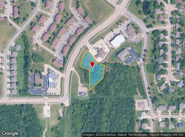
Property Record
Sw 37Th St, Topeka, KS 66614


NEARBY LISTINGS FOR SALE OR LEASE
Property Detail
Sw 37Th St
Topeka, KS
Summerfield Sub No 6
145-16-0-40-05-001-020
SUMMERFIELD SUB NO 6 , BLOCK A , LOT 4 , BLK A LOT 4 SUMMERFIELD SUB #6 SECTION 16 TOWNSHIP 12 RANGE 15
Commercialnec
Shawnee
X
Kansas
20177C0213E
4
2024
1.05 AC
2025
Topeka
002602
Kansas City
DEMOGRAPHICS near Sw 37Th St
1 Mile
3 Mile
5 Mile
2024 Total Population
6,575
52,131
107,043
2029 Population
6,431
51,331
105,979
Pop Growth 2024-2029
(2.19%)
(1.53%)
(0.99%)
Average Age
44
42
40
2024 Total Households
3,133
22,983
46,018
HH Growth 2024-2029
(2.33%)
(1.61%)
(1.06%)
Median Household Inc
$62,839
$61,368
$54,262
Avg Household Size
2.10
2.20
2.20
2024 Avg HH Vehicles
2.00
2.00
2.00
Median Home Value
$165,613
$160,894
$142,358
Median Year Built
1982
1975
1970
Nearby Places
Map Layers
Map Styles
 Street
 Aerial
- Restaurants
- Banks
- Shops
- Fitness
- Groceries
PUBLIC TRANSPORTATION
COMMUTER RAIL
DRIVE
WALK
Distance
14 min
7.6 mi
SALE & LEASE HISTORY
LISTING DATE
SALE/LEASE

Sep 24, 2016
For Sale
Nearby Properties
Address
Land Use
TOTAL SIZE
Lot Size
Zoning
Address
Land Use
TOTAL SIZE
Lot Size
Zoning
117,839 SF
121.95 AC
R1
Address
Land Use
TOTAL SIZE
Lot Size
Zoning
77,776 SF
10.64 AC
PUD,M2,R1,
Address
Land Use
TOTAL SIZE
Lot Size
Zoning
80,630 SF
107.16 AC
R1
Address
Land Use
TOTAL SIZE
Lot Size
Zoning
19,120 SF
2.08 AC
R1
Address
Land Use
TOTAL SIZE
Lot Size
Zoning
43,282 SF
19.33 AC
PUD,M2
Address
Land Use
TOTAL SIZE
Lot Size
Zoning
152,049 SF
25.61 AC
R1
Address
Land Use
TOTAL SIZE
Lot Size
Zoning
208,685 SF
38.23 AC
R1
Address
Land Use
TOTAL SIZE
Lot Size
Zoning
88,935 SF
20.24 AC
C4
Address
Land Use
TOTAL SIZE
Lot Size
Zoning
6.95 AC
PUD,OI1
Address
Land Use
TOTAL SIZE
Lot Size
Zoning
81,364 SF
19.52 AC
R1
Address
Land Use
TOTAL SIZE
Lot Size
Zoning
84,510 SF
5.95 AC
M2
Address
Land Use
TOTAL SIZE
Lot Size
Zoning
71,575 SF
10.93 AC
C2,C4
Address
Land Use
TOTAL SIZE
Lot Size
Zoning
40,321 SF
5.69 AC
I1
Address
Land Use
TOTAL SIZE
Lot Size
Zoning
19,892 SF
3.51 AC
M4
Address
Land Use
TOTAL SIZE
Lot Size
Zoning
31,132 SF
111.36 AC
R1
Address
Land Use
TOTAL SIZE
Lot Size
Zoning
19.37 AC
Address
Land Use
TOTAL SIZE
Lot Size
Zoning
38,858 SF
1.01 AC
R1
Address
Land Use
TOTAL SIZE
Lot Size
Zoning
33,487 SF
2.65 AC
R1
Address
Land Use
TOTAL SIZE
Lot Size
Zoning
59,337 SF
6.84 AC
R1
Address
Land Use
TOTAL SIZE
Lot Size
Zoning
15,893 SF
0.64 AC
R1
Address
Land Use
TOTAL SIZE
Lot Size
Zoning
72,482 SF
19.53 AC
R1
Address
Land Use
TOTAL SIZE
Lot Size
Zoning
51,636 SF
3.89 AC
C4
Address
Land Use
TOTAL SIZE
Lot Size
Zoning
57,380 SF
15.03 AC
RR1
Address
Land Use
TOTAL SIZE
Lot Size
Zoning
74,659 SF
15.24 AC
RR1
Address
Land Use
TOTAL SIZE
Lot Size
Zoning
46,253 SF
6.23 AC
R1
Address
Land Use
TOTAL SIZE
Lot Size
Zoning
50,795 SF
7.70 AC
R1
Address
Land Use
TOTAL SIZE
Lot Size
Zoning
36,511 SF
7.05 AC
R1
Address
Land Use
TOTAL SIZE
Lot Size
Zoning
61,383 SF
8.09 AC
R1
Address
Land Use
TOTAL SIZE
Lot Size
Zoning
37,132 SF
13.48 AC
R1
Address
Land Use
TOTAL SIZE
Lot Size
Zoning
23,158 SF
1.64 AC
R1
The World's #1 Commercial Real Estate Marketplace
Connect with us
© 2025 CoStar Group
The information above has been obtained from sources believed reliable. While we do not doubt its accuracy we have not verified it and make no guarantee, warranty or representation about it. It is your responsibility to independently confirm its accuracy and completeness. Any projections, opinions, assumptions, or estimates used are for example only and do not represent the current or future performance of the property. The value of this transaction to you depends on tax and other factors which should be evaluated by your tax, financial, and legal advisors. You and your advisors should conduct a careful, independent investigation of the property to determine to your satisfaction the suitability of the property for your needs.