Property Record
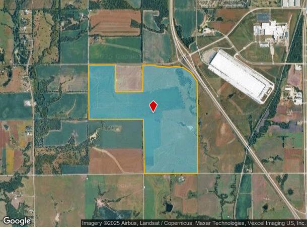
Sw 85Th St, Wakarusa, KS 66546

NEARBY LISTINGS FOR SALE OR LEASE
Property Detail
Sw 85Th St
196-14-0-00-01-001-000
S14, T13, R15, ACRES 425.12, NW 1/4 OF NW 1/4 & S 1/2 OF NW 1/4 & N E 1/4 & SE 1/4 ALL LESS ROW
Agriculturalland
Shawnee
A
Kansas
20177C0315E
425.12 AC
2024
Topeka
2025
Kansas City
003902
Topeka, KS
DEMOGRAPHICS near Sw 85Th St
1 Mile
3 Mile
5 Mile
2024 Total Population
8
3,855
9,579
2029 Population
8
3,813
9,469
Pop Growth 2024-2029
0.00%
(1.09%)
(1.15%)
Average Age
55
34
39
2024 Total Households
4
1,306
3,522
HH Growth 2024-2029
(25.00%)
(1.23%)
(1.19%)
Median Household Inc
$137,500
$56,325
$70,942
Avg Household Size
2.00
2.90
2.70
2024 Avg HH Vehicles
2.00
2.00
2.00
Median Home Value
$199,999
$141,927
$209,333
Median Year Built
1979
1967
1986
Nearby Places
Map Layers
Map Styles
 Street
 Aerial
- Restaurants
- Banks
- Shops
- Fitness
- Groceries
SALE & LEASE HISTORY
LISTING DATE
SALE/LEASE

Sep 24, 2016
For Sale
Nearby Properties
Address
Land Use
TOTAL SIZE
Lot Size
Zoning
Address
Land Use
TOTAL SIZE
Lot Size
Zoning
194.03 AC
I2
Address
Land Use
TOTAL SIZE
Lot Size
Zoning
42.18 AC
I2
Address
Land Use
TOTAL SIZE
Lot Size
Zoning
797,582 SF
384.32 AC
I1,I2
Address
Land Use
TOTAL SIZE
Lot Size
Zoning
577,341 SF
152.58 AC
I2
Address
Land Use
TOTAL SIZE
Lot Size
Zoning
602,448 SF
43.68 AC
I1
Address
Land Use
TOTAL SIZE
Lot Size
Zoning
53,815 SF
15.40 AC
RR1
Address
Land Use
TOTAL SIZE
Lot Size
Zoning
188,358 SF
183.64 AC
I1,RR1
Address
Land Use
TOTAL SIZE
Lot Size
Zoning
64,248 SF
13.78 AC
RR1
Address
Land Use
TOTAL SIZE
Lot Size
Zoning
1,253,081 SF
73.17 AC
I1
Address
Land Use
TOTAL SIZE
Lot Size
Zoning
521,739 SF
25.22 AC
I1
Address
Land Use
TOTAL SIZE
Lot Size
Zoning
63,500 SF
1.93 AC
I1
Address
Land Use
TOTAL SIZE
Lot Size
Zoning
9.02 AC
Address
Land Use
TOTAL SIZE
Lot Size
Zoning
10,305 SF
63.93 AC
I1,RR1
Address
Land Use
TOTAL SIZE
Lot Size
Zoning
158.02 AC
RR1
Address
Land Use
TOTAL SIZE
Lot Size
Zoning
39,893 SF
1.77 AC
I1
Address
Land Use
TOTAL SIZE
Lot Size
Zoning
98.45 AC
RR1
Address
Land Use
TOTAL SIZE
Lot Size
Zoning
14,000 SF
75.65 AC
RR1
Address
Land Use
TOTAL SIZE
Lot Size
Zoning
49,068 SF
174.83 AC
I1,I2
Address
Land Use
TOTAL SIZE
Lot Size
Zoning
8.91 AC
Address
Land Use
TOTAL SIZE
Lot Size
Zoning
210,744 SF
19.55 AC
I1
Address
Land Use
TOTAL SIZE
Lot Size
Zoning
173,398 SF
6.95 AC
I1
Address
Land Use
TOTAL SIZE
Lot Size
Zoning
9,000 SF
60.52 AC
I1,RR1
Address
Land Use
TOTAL SIZE
Lot Size
Zoning
52.58 AC
RR1
Address
Land Use
TOTAL SIZE
Lot Size
Zoning
3,692 SF
0.26 AC
RR1
Address
Land Use
TOTAL SIZE
Lot Size
Zoning
74.66 AC
R1
Address
Land Use
TOTAL SIZE
Lot Size
Zoning
30 AC
I1,RR1
Address
Land Use
TOTAL SIZE
Lot Size
Zoning
10,935 SF
9.03 AC
Address
Land Use
TOTAL SIZE
Lot Size
Zoning
194,295 SF
8.41 AC
I1
Address
Land Use
TOTAL SIZE
Lot Size
Zoning
7,344 SF
24.56 AC
I1
Address
Land Use
TOTAL SIZE
Lot Size
Zoning
34.05 AC
I1
The World's #1 Commercial Real Estate Marketplace
Connect with us
© 2025 CoStar Group
The information above has been obtained from sources believed reliable. While we do not doubt its accuracy we have not verified it and make no guarantee, warranty or representation about it. It is your responsibility to independently confirm its accuracy and completeness. Any projections, opinions, assumptions, or estimates used are for example only and do not represent the current or future performance of the property. The value of this transaction to you depends on tax and other factors which should be evaluated by your tax, financial, and legal advisors. You and your advisors should conduct a careful, independent investigation of the property to determine to your satisfaction the suitability of the property for your needs.