Property Record
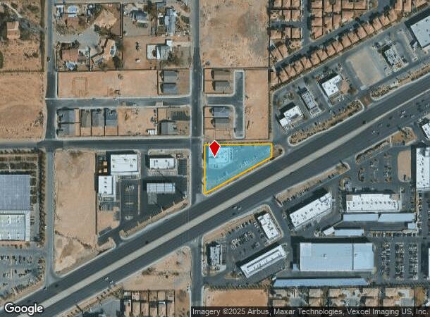
5180 Blue Diamond Rd, Las Vegas, NV 89139


NEARBY LISTINGS FOR SALE OR LEASE
Property Detail
5180 Blue Diamond Rd
Las Vegas-Henderson-Paradise, NV
Parcel Map File 107 Page 53
176-13-801-046
PARCEL MAP FILE 107 PAGE 53 LOT 3
Restaurantbuilding
Clark
X
Nevada
32003C2562F
3
2025
0.95 AC
2025
Southwest Las Vegas
002983
Las Vegas
6,160 SF
DEMOGRAPHICS near 5180 Blue Diamond Rd
1 Mile
3 Mile
5 Mile
2024 Total Population
11,432
117,100
332,117
2029 Population
12,362
127,369
360,061
Pop Growth 2024-2029
+ 8.14%
+ 8.77%
+ 8.41%
Average Age
37
38
38
2024 Total Households
3,641
42,433
122,899
HH Growth 2024-2029
+ 8.13%
+ 8.66%
+ 8.29%
Median Household Inc
$101,352
$87,002
$80,394
Avg Household Size
3.10
2.70
2.70
2024 Avg HH Vehicles
2.00
2.00
2.00
Median Home Value
$451,971
$438,650
$400,224
Median Year Built
2007
2006
2004
Nearby Places
- Restaurants
- Banks
- Shops
- Fitness
- Groceries
PUBLIC TRANSPORTATION
AIRPORT
Harry Reid International
DRIVE
WALK
Distance
Harry Reid International
12 min
7.6 mi
Boulder City Municipal
DRIVE
WALK
Distance
Boulder City Municipal
36 min
25.2 mi
Freight Ports
Port of Long Beach
DRIVE
WALK
Distance
Port of Long Beach
308 min
276.7 mi
SALE & LEASE HISTORY
LISTING DATE
SALE/LEASE

Sep 25, 2016
For Lease
Nearby Properties
Address
Land Use
TOTAL SIZE
Lot Size
Zoning
Address
Land Use
TOTAL SIZE
Lot Size
Zoning
2,340,130 SF
56.10 AC
H1
Address
Land Use
TOTAL SIZE
Lot Size
Zoning
391,021 SF
40.14 AC
Address
Land Use
TOTAL SIZE
Lot Size
Zoning
35.25 AC
MD
Address
Land Use
TOTAL SIZE
Lot Size
Zoning
257,910 SF
31.47 AC
Address
Land Use
TOTAL SIZE
Lot Size
Zoning
66.26 AC
RE
Address
Land Use
TOTAL SIZE
Lot Size
Zoning
317,500 SF
19.26 AC
Address
Land Use
TOTAL SIZE
Lot Size
Zoning
353,690 SF
17.23 AC
Address
Land Use
TOTAL SIZE
Lot Size
Zoning
262,750 SF
17.95 AC
Address
Land Use
TOTAL SIZE
Lot Size
Zoning
930,204 SF
53.28 AC
MD
Address
Land Use
TOTAL SIZE
Lot Size
Zoning
222,625 SF
16.99 AC
Address
Land Use
TOTAL SIZE
Lot Size
Zoning
7,370 SF
18.03 AC
Address
Land Use
TOTAL SIZE
Lot Size
Zoning
4,924 SF
16.14 AC
C:R-3
Address
Land Use
TOTAL SIZE
Lot Size
Zoning
374,101 SF
31.11 AC
Address
Land Use
TOTAL SIZE
Lot Size
Zoning
239,500 SF
13.18 AC
Address
Land Use
TOTAL SIZE
Lot Size
Zoning
10,869 SF
14.77 AC
Address
Land Use
TOTAL SIZE
Lot Size
Zoning
3,398 SF
13.56 AC
Address
Land Use
TOTAL SIZE
Lot Size
Zoning
117.50 AC
Address
Land Use
TOTAL SIZE
Lot Size
Zoning
9.34 AC
Address
Land Use
TOTAL SIZE
Lot Size
Zoning
4,830 SF
15.84 AC
Address
Land Use
TOTAL SIZE
Lot Size
Zoning
4,199 SF
12.11 AC
RE
Address
Land Use
TOTAL SIZE
Lot Size
Zoning
6,782 SF
17.45 AC
R3
Address
Land Use
TOTAL SIZE
Lot Size
Zoning
370,870 SF
28.56 AC
MD
Address
Land Use
TOTAL SIZE
Lot Size
Zoning
5,921 SF
17.62 AC
RE
Address
Land Use
TOTAL SIZE
Lot Size
Zoning
22,180 SF
5.89 AC
Address
Land Use
TOTAL SIZE
Lot Size
Zoning
342,768 SF
28.30 AC
H1
Address
Land Use
TOTAL SIZE
Lot Size
Zoning
329,135 SF
18.94 AC
Address
Land Use
TOTAL SIZE
Lot Size
Zoning
3,148 SF
18.80 AC
R3
Address
Land Use
TOTAL SIZE
Lot Size
Zoning
4,393 SF
14.25 AC
Address
Land Use
TOTAL SIZE
Lot Size
Zoning
526,284 SF
30.18 AC
The World's #1 Commercial Real Estate Marketplace
Connect with us
© 2025 CoStar Group
The information above has been obtained from sources believed reliable. While we do not doubt its accuracy we have not verified it and make no guarantee, warranty or representation about it. It is your responsibility to independently confirm its accuracy and completeness. Any projections, opinions, assumptions, or estimates used are for example only and do not represent the current or future performance of the property. The value of this transaction to you depends on tax and other factors which should be evaluated by your tax, financial, and legal advisors. You and your advisors should conduct a careful, independent investigation of the property to determine to your satisfaction the suitability of the property for your needs.