Property Record
Sw Collins St, Arcadia, FL 34269

Property Detail
Sw Collins St
Arcadia, FL
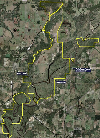
GOVT LOTS 1,2,3 & 4 LYG E OF PEACE RIVER INST:201114018788 INST:201214003499 INST:201414005077 & 5079
11-39-23-0000-0020-0000
DESOTO
Vacantlandnec
Florida
A-10
1
AE The base floodplain where base flood elevations are provided. AE Zones are now used on new format FIRMs instead of A1-A30 Zones.
143 AC
2024
Florida Central South Area
2024
Other Market Areas
010405
NEARBY LISTINGS FOR SALE OR LEASE
DEMOGRAPHICS near Sw Collins St
1 mile
3 mile
5 mile
2025 Total Population
128
2,986
5,727
2030 Population
136
3,358
6,476
Pop Growth 2025-2030
+ 6.25%
+ 12.46%
+ 13.08%
Average Age
41
49
51
2025 Total Households
45
1,254
2,495
HH Growth 2025-2030
+ 8.89%
+ 13.48%
+ 13.99%
Median Household Inc
$34,999
$57,274
$57,733
Avg Household Size
2.50
2.30
2.20
2025 Avg HH Vehicles
2.00
2.00
2.00
Median Home Value
$194,444
$209,375
$193,232
Median Year Built
1988
1997
1997
Nearby Places
Map Layers
Map Styles
 Street
 Aerial
Transit
 Traffic
 Biking
Places
Listings with unknown addresses are not visible on the map
- Restaurants
- Banks
- Shops
- Fitness
- Groceries
PUBLIC TRANSPORTATION
AIRPORT
Punta Gorda
Drive
Walk
Distance
Punta Gorda
26 min
15.6 mi
Freight Ports
Port Manatee
Drive
Walk
Distance
Port Manatee
100 min
75.9 mi
Nearby Properties
Address
Land Use
TOTAL SIZE
Lot Size
Zoning
Address
Land Use
TOTAL SIZE
Lot Size
Zoning
173.33 AC
P/I
Address
Land Use
TOTAL SIZE
Lot Size
Zoning
153.66 AC
P/I
Address
Land Use
TOTAL SIZE
Lot Size
Zoning
1,836 SF
17.80 AC
P/I
Address
Land Use
TOTAL SIZE
Lot Size
Zoning
8,044 SF
29.55 AC
TTRVC
Address
Land Use
TOTAL SIZE
Lot Size
Zoning
2,025 SF
28.05 AC
RVC
Address
Land Use
TOTAL SIZE
Lot Size
Zoning
9,908 SF
40 AC
RVC
Address
Land Use
TOTAL SIZE
Lot Size
Zoning
3,248 SF
21.20 AC
MHP
Address
Land Use
TOTAL SIZE
Lot Size
Zoning
27,214 SF
7.92 AC
A-5
Address
Land Use
TOTAL SIZE
Lot Size
Zoning
4,800 SF
40.53 AC
PUD
Address
Land Use
TOTAL SIZE
Lot Size
Zoning
31.61 AC
RVC
Address
Land Use
TOTAL SIZE
Lot Size
Zoning
65.31 AC
P/I
Address
Land Use
TOTAL SIZE
Lot Size
Zoning
2,768 SF
285 AC
A-10
Address
Land Use
TOTAL SIZE
Lot Size
Zoning
2,689 SF
398.23 AC
A-10
Address
Land Use
TOTAL SIZE
Lot Size
Zoning
227.49 AC
A-10
Address
Land Use
TOTAL SIZE
Lot Size
Zoning
351 AC
A-10
Address
Land Use
TOTAL SIZE
Lot Size
Zoning
18.83 AC
RVC
Address
Land Use
TOTAL SIZE
Lot Size
Zoning
1,537 SF
10.97 AC
RVC
Address
Land Use
TOTAL SIZE
Lot Size
Zoning
181 AC
A-5
Address
Land Use
TOTAL SIZE
Lot Size
Zoning
98.17 AC
A-10
Address
Land Use
TOTAL SIZE
Lot Size
Zoning
4,828 SF
12.51 AC
A-10
Address
Land Use
TOTAL SIZE
Lot Size
Zoning
4,405 SF
5.10 AC
A-5
Address
Land Use
TOTAL SIZE
Lot Size
Zoning
10.97 AC
RVC
Address
Land Use
TOTAL SIZE
Lot Size
Zoning
10,151 SF
3.33 AC
A-5
Address
Land Use
TOTAL SIZE
Lot Size
Zoning
110.23 AC
A-10
Address
Land Use
TOTAL SIZE
Lot Size
Zoning
137 AC
A-10
Address
Land Use
TOTAL SIZE
Lot Size
Zoning
341 AC
A-10
Address
Land Use
TOTAL SIZE
Lot Size
Zoning
14,149 SF
12.20 AC
A-10
Address
Land Use
TOTAL SIZE
Lot Size
Zoning
169 AC
A-10
Address
Land Use
TOTAL SIZE
Lot Size
Zoning
1,866 SF
7.72 AC
A-5
Address
Land Use
TOTAL SIZE
Lot Size
Zoning
10.97 AC
RVC
The World's #1 Commercial Real Estate Marketplace
Connect with us
© 2026 CoStar Group
The information above has been obtained from sources believed reliable. While we do not doubt its accuracy we have not verified it and make no guarantee, warranty or representation about it. It is your responsibility to independently confirm its accuracy and completeness. Any projections, opinions, assumptions, or estimates used are for example only and do not represent the current or future performance of the property. The value of this transaction to you depends on tax and other factors which should be evaluated by your tax, financial, and legal advisors. You and your advisors should conduct a careful, independent investigation of the property to determine to your satisfaction the suitability of the property for your needs.