Property Record
Sw County Road 769, Arcadia, FL 34269

Property Detail
Sw County Road 769
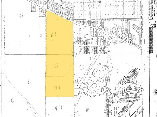
30-39-23-0000-0015-0000
THAT PART OF S1/2 LYG W OF KINGS HWY LESS N 520 FT & LESS THE FOLLOWING: COMM SW COR OF SEC 30 TH S 89D06M37S E 2659.62 FT TO SW COR OF SE1/4 OF SEC 30 TH N 89D55M34S E 2105.36 FT TO POB TH N 00D07M54S W 216.38 FT TH N 10D48M55S W 52.83 FT TH S 86D06
Miscellaneous
DESOTO
A-10
Florida
AE The base floodplain where base flood elevations are provided. AE Zones are now used on new format FIRMs instead of A1-A30 Zones.
80 AC
2024
Florida Central South Area
2024
Other Market Areas
010405
Arcadia, FL
NEARBY LISTINGS FOR SALE OR LEASE
DEMOGRAPHICS near Sw County Road 769
1 mile
3 mile
5 mile
2025 Total Population
1,778
18,038
54,029
2030 Population
1,987
19,729
59,026
Pop Growth 2025-2030
+ 11.75%
+ 9.37%
+ 9.25%
Average Age
57
52
50
2025 Total Households
860
8,254
23,540
HH Growth 2025-2030
+ 11.86%
+ 9.44%
+ 9.40%
Median Household Inc
$62,240
$73,325
$68,949
Avg Household Size
2.00
2.20
2.20
2025 Avg HH Vehicles
2.00
2.00
2.00
Median Home Value
$276,052
$350,899
$311,341
Median Year Built
1994
1998
1994
Nearby Places
Map Layers
Map Styles
 Street
 Aerial
Layers
 Traffic
 Biking
Places
Listings with unknown addresses are not visible on the map
- Restaurants
- Banks
- Shops
- Fitness
- Groceries
PUBLIC TRANSPORTATION
AIRPORT
Punta Gorda
Drive
Walk
Distance
Punta Gorda
21 min
12.1 mi
Freight Ports
Port Manatee
Drive
Walk
Distance
Port Manatee
81 min
66.5 mi
SALE & LEASE HISTORY
LISTING DATE
SALE/LEASE

Oct 11, 2017
For Sale
Oct 10, 2016
For Sale
Oct 10, 2016
For Sale
Nov 22, 2016
For Sale
Nearby Properties
Address
Land Use
TOTAL SIZE
Lot Size
Zoning
Address
Land Use
TOTAL SIZE
Lot Size
Zoning
202,009 SF
20.89 AC
PD
Address
Land Use
TOTAL SIZE
Lot Size
Zoning
204,731 SF
16.11 AC
PD
Address
Land Use
TOTAL SIZE
Lot Size
Zoning
229,973 SF
21.33 AC
PD
Address
Land Use
TOTAL SIZE
Lot Size
Zoning
217,784 SF
38.63 AC
PD
Address
Land Use
TOTAL SIZE
Lot Size
Zoning
73,222 SF
5.14 AC
PD
Address
Land Use
TOTAL SIZE
Lot Size
Zoning
50,970 SF
9.74 AC
RSF3.5
Address
Land Use
TOTAL SIZE
Lot Size
Zoning
41,148 SF
155.85 AC
RSF-3
Address
Land Use
TOTAL SIZE
Lot Size
Zoning
83,180 SF
9.31 AC
PD
Address
Land Use
TOTAL SIZE
Lot Size
Zoning
95,547 SF
14.06 AC
PD
Address
Land Use
TOTAL SIZE
Lot Size
Zoning
35,951 SF
24.23 AC
PD
Address
Land Use
TOTAL SIZE
Lot Size
Zoning
27,082 SF
2.05 AC
PD
Address
Land Use
TOTAL SIZE
Lot Size
Zoning
86,773 SF
5.07 AC
IG
Address
Land Use
TOTAL SIZE
Lot Size
Zoning
23,798 SF
1.71 AC
PD
Address
Land Use
TOTAL SIZE
Lot Size
Zoning
98,552 SF
11.42 AC
CG
Address
Land Use
TOTAL SIZE
Lot Size
Zoning
594.36 AC
A-10
Address
Land Use
TOTAL SIZE
Lot Size
Zoning
82.27 AC
PD
Address
Land Use
TOTAL SIZE
Lot Size
Zoning
21.61 AC
PD
Address
Land Use
TOTAL SIZE
Lot Size
Zoning
12,977 SF
2.29 AC
PD
Address
Land Use
TOTAL SIZE
Lot Size
Zoning
13,642 SF
2.55 AC
PD
Address
Land Use
TOTAL SIZE
Lot Size
Zoning
11,773 SF
1.55 AC
PD
Address
Land Use
TOTAL SIZE
Lot Size
Zoning
7.81 AC
PD
Address
Land Use
TOTAL SIZE
Lot Size
Zoning
30,928 SF
41.30 AC
PKR
Address
Land Use
TOTAL SIZE
Lot Size
Zoning
73,260 SF
7.68 AC
PD
Address
Land Use
TOTAL SIZE
Lot Size
Zoning
74,434 SF
4.42 AC
CG
Address
Land Use
TOTAL SIZE
Lot Size
Zoning
23,566 SF
20.33 AC
RMF10
Address
Land Use
TOTAL SIZE
Lot Size
Zoning
662.52 AC
EC
Address
Land Use
TOTAL SIZE
Lot Size
Zoning
36,049 SF
4.12 AC
PD
Address
Land Use
TOTAL SIZE
Lot Size
Zoning
31.27 AC
PD
Address
Land Use
TOTAL SIZE
Lot Size
Zoning
14,945 SF
2.47 AC
RMF15
Address
Land Use
TOTAL SIZE
Lot Size
Zoning
22,306 SF
1.97 AC
CG
The World's #1 Commercial Real Estate Marketplace
Connect with us
© 2026 CoStar Group
The information above has been obtained from sources believed reliable. While we do not doubt its accuracy we have not verified it and make no guarantee, warranty or representation about it. It is your responsibility to independently confirm its accuracy and completeness. Any projections, opinions, assumptions, or estimates used are for example only and do not represent the current or future performance of the property. The value of this transaction to you depends on tax and other factors which should be evaluated by your tax, financial, and legal advisors. You and your advisors should conduct a careful, independent investigation of the property to determine to your satisfaction the suitability of the property for your needs.