Property Record
Sw Highway 54, Augusta, KS 67010
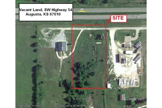

Property Detail
Sw Highway 54
Wichita, KS
TOWAKONI HILLS ESTATES, S26, T27, R03E, LOT E/2 4, ACRES 4.1
307-26-0-00-00-024-01-0
BUTLER
Commercialacreage
Kansas
B and X Area of moderate flood hazard, usually the area between the limits of the 100-year and 500-year floods.
4
2024
4.10 AC
2025
Augusta/El Dorado
020800
Wichita
NEARBY LISTINGS FOR SALE OR LEASE
-
-
View all Augusta listings for sale on LoopNet.com
DEMOGRAPHICS near Sw Highway 54
1 mile
3 mile
5 mile
2025 Total Population
523
2,820
20,633
2030 Population
530
2,886
21,070
Pop Growth 2025-2030
+ 1.34%
+ 2.34%
+ 2.12%
Average Age
42
41
39
2025 Total Households
184
1,019
7,333
HH Growth 2025-2030
+ 1.63%
+ 2.36%
+ 2.21%
Median Household Inc
$112,820
$93,243
$92,652
Avg Household Size
2.70
2.70
2.70
2025 Avg HH Vehicles
3.00
3.00
2.00
Median Home Value
$247,058
$280,079
$283,322
Median Year Built
1985
1991
1993
Nearby Places
Map Layers
Map Styles
 Street
 Aerial
Layers
 Traffic
 Biking
Places
Listings with unknown addresses are not visible on the map
- Restaurants
- Banks
- Shops
- Fitness
- Groceries
PUBLIC TRANSPORTATION
AIRPORT
Wichita Dwight D Eisenhower Ntl
Drive
Walk
Distance
Wichita Dwight D Eisenhower Ntl
30 min
21.5 mi
Freight Ports
Tulsa Port Of Catoosa
Drive
Walk
Distance
Tulsa Port Of Catoosa
217 min
204.0 mi
Nearby Properties
Address
Land Use
TOTAL SIZE
Lot Size
Zoning
Address
Land Use
TOTAL SIZE
Lot Size
Zoning
117,375 SF
20.60 AC
Address
Land Use
TOTAL SIZE
Lot Size
Zoning
97,612 SF
28.40 AC
Address
Land Use
TOTAL SIZE
Lot Size
Zoning
15,597 SF
67.40 AC
Address
Land Use
TOTAL SIZE
Lot Size
Zoning
15,184 SF
136.70 AC
Address
Land Use
TOTAL SIZE
Lot Size
Zoning
1,147 SF
32.40 AC
Address
Land Use
TOTAL SIZE
Lot Size
Zoning
11,040 SF
11.40 AC
Address
Land Use
TOTAL SIZE
Lot Size
Zoning
28,144 SF
17.60 AC
Address
Land Use
TOTAL SIZE
Lot Size
Zoning
75.70 AC
Address
Land Use
TOTAL SIZE
Lot Size
Zoning
19,120 SF
3.20 AC
Address
Land Use
TOTAL SIZE
Lot Size
Zoning
7,200 SF
10.30 AC
Address
Land Use
TOTAL SIZE
Lot Size
Zoning
27,251 SF
9.40 AC
Address
Land Use
TOTAL SIZE
Lot Size
Zoning
Address
Land Use
TOTAL SIZE
Lot Size
Zoning
11,040 SF
17.90 AC
Address
Land Use
TOTAL SIZE
Lot Size
Zoning
6,000 SF
3.50 AC
Address
Land Use
TOTAL SIZE
Lot Size
Zoning
5,000 SF
Address
Land Use
TOTAL SIZE
Lot Size
Zoning
4,000 SF
3.80 AC
Address
Land Use
TOTAL SIZE
Lot Size
Zoning
18,145 SF
4.20 AC
Address
Land Use
TOTAL SIZE
Lot Size
Zoning
11.90 AC
Address
Land Use
TOTAL SIZE
Lot Size
Zoning
2,520 SF
10.70 AC
Address
Land Use
TOTAL SIZE
Lot Size
Zoning
14.80 AC
Address
Land Use
TOTAL SIZE
Lot Size
Zoning
2,400 SF
2.60 AC
Address
Land Use
TOTAL SIZE
Lot Size
Zoning
2,352 SF
7.50 AC
Address
Land Use
TOTAL SIZE
Lot Size
Zoning
3.30 AC
Address
Land Use
TOTAL SIZE
Lot Size
Zoning
20,580 SF
4.10 AC
Address
Land Use
TOTAL SIZE
Lot Size
Zoning
7,848 SF
4.10 AC
Address
Land Use
TOTAL SIZE
Lot Size
Zoning
3,200 SF
2.70 AC
Address
Land Use
TOTAL SIZE
Lot Size
Zoning
3,840 SF
12.10 AC
Address
Land Use
TOTAL SIZE
Lot Size
Zoning
1,500 SF
24.80 AC
Address
Land Use
TOTAL SIZE
Lot Size
Zoning
4,800 SF
0.50 AC
Address
Land Use
TOTAL SIZE
Lot Size
Zoning
3,737 SF
10.80 AC
The World's #1 Commercial Real Estate Marketplace
Connect with us
© 2026 CoStar Group
The information above has been obtained from sources believed reliable. While we do not doubt its accuracy we have not verified it and make no guarantee, warranty or representation about it. It is your responsibility to independently confirm its accuracy and completeness. Any projections, opinions, assumptions, or estimates used are for example only and do not represent the current or future performance of the property. The value of this transaction to you depends on tax and other factors which should be evaluated by your tax, financial, and legal advisors. You and your advisors should conduct a careful, independent investigation of the property to determine to your satisfaction the suitability of the property for your needs.