Property Record
3000 Sw County Road 760, Arcadia, FL 34266
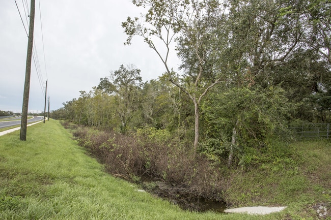
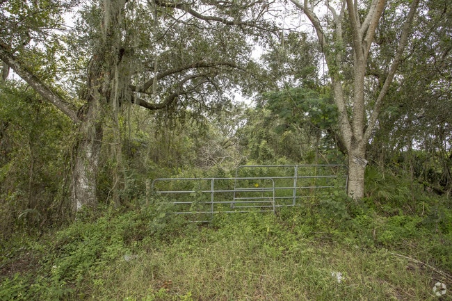

This Property Is For Sale
NEARBY LISTINGS FOR SALE OR LEASE
Property Detail
3000 Sw County Road 760
14-38-24-0000-0800-0000
Peace River Est East Unit One
Pasture
THAT PART OF SEC LYG W OF E R/W OF ABANDONED RR & E OF PEACE RIVER LESS PARCELS 0841 THRU 0849 & LESS THAT PART S OF JOSHUA CREEK (PARCEL 0802) TOGETHER WITH MINERAL RIGHTS REVERTED FROM OR 62/734 OR 567/1817
AE
DeSoto
12027C0167C
Florida
2024
73.90 AC
2024
Florida Central South Area
010302
Other Market Areas
820 SF
Arcadia, FL
DEMOGRAPHICS near 3000 Sw County Road 760
1 Mile
3 Mile
5 Mile
2024 Total Population
645
8,012
22,988
2029 Population
717
8,866
25,384
Pop Growth 2024-2029
+ 11.16%
+ 10.66%
+ 10.42%
Average Age
37
37
39
2024 Total Households
212
2,743
7,890
HH Growth 2024-2029
+ 12.26%
+ 11.52%
+ 11.39%
Median Household Inc
$39,721
$37,389
$34,387
Avg Household Size
3.00
2.90
2.80
2024 Avg HH Vehicles
2.00
2.00
2.00
Median Home Value
$107,353
$95,510
$116,870
Median Year Built
1984
1986
1983
Nearby Places
- Restaurants
- Banks
- Shops
- Fitness
- Groceries
PUBLIC TRANSPORTATION
AIRPORT
Punta Gorda
DRIVE
WALK
Distance
Punta Gorda
34 min
22.0 mi
Freight Ports
Port Manatee
DRIVE
WALK
Distance
Port Manatee
90 min
63.0 mi
Nearby Properties
Address
Land Use
TOTAL SIZE
Lot Size
Zoning
Address
Land Use
TOTAL SIZE
Lot Size
Zoning
67,387 SF
46.10 AC
PUD
Address
Land Use
TOTAL SIZE
Lot Size
Zoning
57,048 SF
20.25 AC
PUD
Address
Land Use
TOTAL SIZE
Lot Size
Zoning
83,273 SF
13.94 AC
ROI
Address
Land Use
TOTAL SIZE
Lot Size
Zoning
21,108 SF
3.36 AC
A-5
Address
Land Use
TOTAL SIZE
Lot Size
Zoning
20,008 SF
4.69 AC
A-5
Address
Land Use
TOTAL SIZE
Lot Size
Zoning
1,368 SF
16.90 AC
MHP
Address
Land Use
TOTAL SIZE
Lot Size
Zoning
7,514 SF
121.57 AC
A-5
Address
Land Use
TOTAL SIZE
Lot Size
Zoning
10,972 SF
6.77 AC
RSF-3
Address
Land Use
TOTAL SIZE
Lot Size
Zoning
22,414 SF
5.02 AC
R-1C
Address
Land Use
TOTAL SIZE
Lot Size
Zoning
50,951 SF
47.23 AC
IH
Address
Land Use
TOTAL SIZE
Lot Size
Zoning
47,950 SF
5.66 AC
IL
Address
Land Use
TOTAL SIZE
Lot Size
Zoning
96 SF
95.92 AC
A-10
Address
Land Use
TOTAL SIZE
Lot Size
Zoning
8,763 SF
5.31 AC
A-10
Address
Land Use
TOTAL SIZE
Lot Size
Zoning
7,307 SF
305.60 AC
A-5
Address
Land Use
TOTAL SIZE
Lot Size
Zoning
44,436 SF
3.94 AC
B-3
Address
Land Use
TOTAL SIZE
Lot Size
Zoning
1,800 SF
13.92 AC
MHP
Address
Land Use
TOTAL SIZE
Lot Size
Zoning
7,895 SF
2.47 AC
CG
Address
Land Use
TOTAL SIZE
Lot Size
Zoning
7,953 SF
1.22 AC
B-3
Address
Land Use
TOTAL SIZE
Lot Size
Zoning
13,642 SF
124.26 AC
A-5
Address
Land Use
TOTAL SIZE
Lot Size
Zoning
4,380 SF
4.28 AC
RMF-6
Address
Land Use
TOTAL SIZE
Lot Size
Zoning
10,673 SF
0.64 AC
R-1C
Address
Land Use
TOTAL SIZE
Lot Size
Zoning
5,696 SF
27.29 AC
A-5
Address
Land Use
TOTAL SIZE
Lot Size
Zoning
4,404 SF
37.41 AC
A-5
Address
Land Use
TOTAL SIZE
Lot Size
Zoning
12,037 SF
2.79 AC
CG
Address
Land Use
TOTAL SIZE
Lot Size
Zoning
7,096 SF
0.96 AC
B-1
Address
Land Use
TOTAL SIZE
Lot Size
Zoning
4,968 SF
10.19 AC
IL
Address
Land Use
TOTAL SIZE
Lot Size
Zoning
4,354 SF
54.99 AC
A-10
Address
Land Use
TOTAL SIZE
Lot Size
Zoning
3,414 SF
10 AC
A-10
Address
Land Use
TOTAL SIZE
Lot Size
Zoning
9,230 SF
1.29 AC
CG
Address
Land Use
TOTAL SIZE
Lot Size
Zoning
11,232 SF
2.65 AC
RMF-M
The World's #1 Commercial Real Estate Marketplace
Connect with us
© 2025 CoStar Group
The information above has been obtained from sources believed reliable. While we do not doubt its accuracy we have not verified it and make no guarantee, warranty or representation about it. It is your responsibility to independently confirm its accuracy and completeness. Any projections, opinions, assumptions, or estimates used are for example only and do not represent the current or future performance of the property. The value of this transaction to you depends on tax and other factors which should be evaluated by your tax, financial, and legal advisors. You and your advisors should conduct a careful, independent investigation of the property to determine to your satisfaction the suitability of the property for your needs.