Property Record
Sw Kissimmee Rd, Arcadia, FL 34269

NEARBY LISTINGS FOR SALE OR LEASE
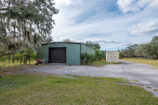
Property Detail
Sw Kissimmee Rd
Arcadia, FL
Cypress Bend Subdivision
23-39-23-0000-0300-0000
CYPRESS BEND SUB LOT 12 & PART OF LOT 11 MPDAF: BEG NW COR LOT 11 FOR POB TH S 89D46M37S E ALG N LI 628.38 FT TH S 72D07M43S W 161.15 FT TH S 74D18M20S W 80.74 FT TH S 77D18M37S W 119.92 FT TO W LI LOT 11 TH ALG ARC OF CURVE TO LEFT (R=1000 CA=17D30M
Pasture
DeSoto
AE
Florida
12027C0278D
12
2024
59.75 AC
2024
Florida Central South Area
010405
Other Market Areas
DEMOGRAPHICS near Sw Kissimmee Rd
1 Mile
3 Mile
5 Mile
2024 Total Population
555
2,833
16,192
2029 Population
592
3,062
18,893
Pop Growth 2024-2029
+ 6.67%
+ 8.08%
+ 16.68%
Average Age
51
51
52
2024 Total Households
238
1,220
7,279
HH Growth 2024-2029
+ 7.14%
+ 8.77%
+ 17.05%
Median Household Inc
$47,500
$48,333
$55,044
Avg Household Size
2.10
2.20
2.20
2024 Avg HH Vehicles
2.00
2.00
2.00
Median Home Value
$121,875
$138,080
$246,522
Median Year Built
1990
1990
1993
Nearby Places
Map Layers
Map Styles
 Street
 Aerial
- Restaurants
- Banks
- Shops
- Fitness
- Groceries
PUBLIC TRANSPORTATION
AIRPORT
Punta Gorda
DRIVE
WALK
Distance
Punta Gorda
26 min
15.1 mi
Freight Ports
Port Manatee
DRIVE
WALK
Distance
Port Manatee
92 min
72.3 mi
SALE & LEASE HISTORY
LISTING DATE
SALE/LEASE

Jan 10, 2024
For Sale
Feb 08, 2021
For Sale
Nearby Properties
Address
Land Use
TOTAL SIZE
Lot Size
Zoning
Address
Land Use
TOTAL SIZE
Lot Size
Zoning
1,225,024 SF
170.84 AC
IL
Address
Land Use
TOTAL SIZE
Lot Size
Zoning
173.33 AC
P/I
Address
Land Use
TOTAL SIZE
Lot Size
Zoning
594.36 AC
A-10
Address
Land Use
TOTAL SIZE
Lot Size
Zoning
153.66 AC
P/I
Address
Land Use
TOTAL SIZE
Lot Size
Zoning
15,866 SF
63.03 AC
TTRVC
Address
Land Use
TOTAL SIZE
Lot Size
Zoning
1,836 SF
17.80 AC
P/I
Address
Land Use
TOTAL SIZE
Lot Size
Zoning
8,044 SF
29.55 AC
TTRVC
Address
Land Use
TOTAL SIZE
Lot Size
Zoning
2,025 SF
28.05 AC
RVC
Address
Land Use
TOTAL SIZE
Lot Size
Zoning
9,908 SF
40 AC
RVC
Address
Land Use
TOTAL SIZE
Lot Size
Zoning
509 AC
A-5
Address
Land Use
TOTAL SIZE
Lot Size
Zoning
3,248 SF
21.20 AC
MHP
Address
Land Use
TOTAL SIZE
Lot Size
Zoning
27,214 SF
7.92 AC
A-5
Address
Land Use
TOTAL SIZE
Lot Size
Zoning
432 SF
20 AC
A-5
Address
Land Use
TOTAL SIZE
Lot Size
Zoning
4,800 SF
40.53 AC
PUD
Address
Land Use
TOTAL SIZE
Lot Size
Zoning
31.61 AC
RVC
Address
Land Use
TOTAL SIZE
Lot Size
Zoning
499.70 AC
A-5
Address
Land Use
TOTAL SIZE
Lot Size
Zoning
65.31 AC
P/I
Address
Land Use
TOTAL SIZE
Lot Size
Zoning
501.85 AC
A-5
Address
Land Use
TOTAL SIZE
Lot Size
Zoning
23,142 SF
5 AC
A-5
Address
Land Use
TOTAL SIZE
Lot Size
Zoning
480 AC
A-5
Address
Land Use
TOTAL SIZE
Lot Size
Zoning
33.42 AC
PUD
Address
Land Use
TOTAL SIZE
Lot Size
Zoning
2,689 SF
398.23 AC
A-10
Address
Land Use
TOTAL SIZE
Lot Size
Zoning
8,838 SF
2.43 AC
RMF-6
Address
Land Use
TOTAL SIZE
Lot Size
Zoning
227.49 AC
A-10
Address
Land Use
TOTAL SIZE
Lot Size
Zoning
18.83 AC
RVC
Address
Land Use
TOTAL SIZE
Lot Size
Zoning
1,537 SF
10.97 AC
RVC
Address
Land Use
TOTAL SIZE
Lot Size
Zoning
9,714 SF
10 AC
RMF-M
Address
Land Use
TOTAL SIZE
Lot Size
Zoning
10,935 SF
5 AC
CG
Address
Land Use
TOTAL SIZE
Lot Size
Zoning
21.25 AC
A-5
Address
Land Use
TOTAL SIZE
Lot Size
Zoning
4,828 SF
12.51 AC
A-10
The World's #1 Commercial Real Estate Marketplace
Connect with us
© 2025 CoStar Group
The information above has been obtained from sources believed reliable. While we do not doubt its accuracy we have not verified it and make no guarantee, warranty or representation about it. It is your responsibility to independently confirm its accuracy and completeness. Any projections, opinions, assumptions, or estimates used are for example only and do not represent the current or future performance of the property. The value of this transaction to you depends on tax and other factors which should be evaluated by your tax, financial, and legal advisors. You and your advisors should conduct a careful, independent investigation of the property to determine to your satisfaction the suitability of the property for your needs.