Property Record
211 W Loop 410 E, San Antonio, TX 78242

NEARBY LISTINGS FOR SALE OR LEASE
Property Detail
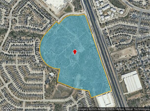
211 W Loop 410 E
San Antonio-New Braunfels, TX
(Solana Ridge Subd Ut-5)
15248-000-0714
NCB 15248 P-71 (0.403 AC) & P-1E (62.1721 AC) 2022- RMS PER PLAT 20002/1336, FILED 12-13-2021///2021-RMS PER PLAT 20001/1809-1811, FILED 02-7-20202018 REMAINS PER PLAT 9710/72-6 FILED 01/13/2017. REMS PER PLAT 9665/168-4 FILED 03/14/2014, 2013 NEW RE
Vacantlandnec
Bexar
AE
Texas
48029C0535F
71
2024
62.58 AC
2025
South
161504
San Antonio
DEMOGRAPHICS near 211 W Loop 410 E
1 Mile
3 Mile
5 Mile
2024 Total Population
16,416
61,934
135,883
2029 Population
17,658
65,927
144,813
Pop Growth 2024-2029
+ 7.57%
+ 6.45%
+ 6.57%
Average Age
31
31
33
2024 Total Households
4,762
16,217
39,665
HH Growth 2024-2029
+ 7.73%
+ 7.21%
+ 7.01%
Median Household Inc
$45,983
$45,210
$46,974
Avg Household Size
3.40
3.30
3.10
2024 Avg HH Vehicles
2.00
2.00
2.00
Median Home Value
$161,917
$140,338
$139,337
Median Year Built
2006
1982
1982
Nearby Places
Map Layers
Map Styles
 Street
 Aerial
- Restaurants
- Banks
- Shops
- Fitness
- Groceries
PUBLIC TRANSPORTATION
AIRPORT
San Antonio International
DRIVE
WALK
Distance
San Antonio International
26 min
21.2 mi
Freight Ports
Port of Corpus Christi
DRIVE
WALK
Distance
Port of Corpus Christi
154 min
149.4 mi
SALE & LEASE HISTORY
LISTING DATE
SALE/LEASE

Sep 24, 2016
For Sale
Nearby Properties
Address
Land Use
TOTAL SIZE
Lot Size
Zoning
Address
Land Use
TOTAL SIZE
Lot Size
Zoning
677,476 SF
52.48 AC
Address
Land Use
TOTAL SIZE
Lot Size
Zoning
505,914 SF
41.01 AC
Address
Land Use
TOTAL SIZE
Lot Size
Zoning
331,055 SF
15.98 AC
Address
Land Use
TOTAL SIZE
Lot Size
Zoning
288,476 SF
9.87 AC
Address
Land Use
TOTAL SIZE
Lot Size
Zoning
283,920 SF
20.13 AC
Address
Land Use
TOTAL SIZE
Lot Size
Zoning
248,405 SF
14.04 AC
Address
Land Use
TOTAL SIZE
Lot Size
Zoning
137,602 SF
23.62 AC
Address
Land Use
TOTAL SIZE
Lot Size
Zoning
168,273 SF
23.13 AC
Address
Land Use
TOTAL SIZE
Lot Size
Zoning
94,561 SF
34.91 AC
Address
Land Use
TOTAL SIZE
Lot Size
Zoning
55,882 SF
23.66 AC
Address
Land Use
TOTAL SIZE
Lot Size
Zoning
25.09 AC
Address
Land Use
TOTAL SIZE
Lot Size
Zoning
152,050 SF
11.54 AC
Address
Land Use
TOTAL SIZE
Lot Size
Zoning
240,313 SF
160.50 AC
Address
Land Use
TOTAL SIZE
Lot Size
Zoning
186,797 SF
23.22 AC
Address
Land Use
TOTAL SIZE
Lot Size
Zoning
198,000 SF
9.93 AC
Address
Land Use
TOTAL SIZE
Lot Size
Zoning
73,567 SF
18 AC
Address
Land Use
TOTAL SIZE
Lot Size
Zoning
150,000 SF
10.11 AC
Address
Land Use
TOTAL SIZE
Lot Size
Zoning
223,403 SF
15.98 AC
Address
Land Use
TOTAL SIZE
Lot Size
Zoning
241,162 SF
15.60 AC
Address
Land Use
TOTAL SIZE
Lot Size
Zoning
235,873 SF
12.50 AC
Address
Land Use
TOTAL SIZE
Lot Size
Zoning
180,644 SF
15.85 AC
Address
Land Use
TOTAL SIZE
Lot Size
Zoning
128,200 SF
10.66 AC
Address
Land Use
TOTAL SIZE
Lot Size
Zoning
107,135 SF
6.62 AC
Address
Land Use
TOTAL SIZE
Lot Size
Zoning
109,420 SF
215.95 AC
Address
Land Use
TOTAL SIZE
Lot Size
Zoning
1,394 SF
72.83 AC
Address
Land Use
TOTAL SIZE
Lot Size
Zoning
1,930,397 SF
16.57 AC
Address
Land Use
TOTAL SIZE
Lot Size
Zoning
216,680 SF
21.92 AC
Address
Land Use
TOTAL SIZE
Lot Size
Zoning
38,002 SF
565.81 AC
Address
Land Use
TOTAL SIZE
Lot Size
Zoning
342.37 AC
Address
Land Use
TOTAL SIZE
Lot Size
Zoning
91.89 AC
The World's #1 Commercial Real Estate Marketplace
Connect with us
© 2025 CoStar Group
The information above has been obtained from sources believed reliable. While we do not doubt its accuracy we have not verified it and make no guarantee, warranty or representation about it. It is your responsibility to independently confirm its accuracy and completeness. Any projections, opinions, assumptions, or estimates used are for example only and do not represent the current or future performance of the property. The value of this transaction to you depends on tax and other factors which should be evaluated by your tax, financial, and legal advisors. You and your advisors should conduct a careful, independent investigation of the property to determine to your satisfaction the suitability of the property for your needs.