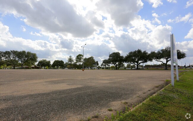
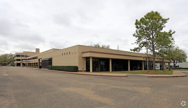
Property Record
8016 Highway 90A, Sugar Land, TX 77478

NEARBY LISTINGS FOR SALE OR LEASE
Property Detail
8016 Highway 90A
Houston-Pasadena-The Woodlands, TX
S M Williams
0097-00-000-4100-907
0097 S M WILLIAMS, ACRES 6.07, RESERVE A, BLOCK 1, HASS IMPERIAL CENTER
Commercialnec
Fort Bend
X
Texas
48157C0260L
27
2024
6.07 AC
2025
E Fort Bend Co/Sugar Land
672100
Houston
12,119 SF
DEMOGRAPHICS near 8016 Highway 90A
1 Mile
3 Mile
5 Mile
2024 Total Population
6,451
85,107
272,816
2029 Population
7,763
101,523
317,558
Pop Growth 2024-2029
+ 20.34%
+ 19.29%
+ 16.40%
Average Age
48
41
39
2024 Total Households
2,834
29,985
89,420
HH Growth 2024-2029
+ 21.03%
+ 19.95%
+ 17.11%
Median Household Inc
$95,438
$97,935
$83,883
Avg Household Size
2.20
2.80
3.00
2024 Avg HH Vehicles
2.00
2.00
2.00
Median Home Value
$450,311
$340,602
$301,824
Median Year Built
1995
1994
1993
Nearby Places
Map Layers
Map Styles
 Street
 Aerial
- Restaurants
- Banks
- Shops
- Fitness
- Groceries
PUBLIC TRANSPORTATION
AIRPORT
William P Hobby
DRIVE
WALK
Distance
William P Hobby
40 min
25.6 mi
George Bush Intcntl/Houston
DRIVE
WALK
Distance
George Bush Intcntl/Houston
52 min
41.7 mi
Freight Ports
Port of Houston
DRIVE
WALK
Distance
Port of Houston
41 min
27.7 mi
SALE & LEASE HISTORY
LISTING DATE
SALE/LEASE

Sep 25, 2016
For Lease
Nearby Properties
Address
Land Use
TOTAL SIZE
Lot Size
Zoning
Address
Land Use
TOTAL SIZE
Lot Size
Zoning
448,502 SF
35.66 AC
Address
Land Use
TOTAL SIZE
Lot Size
Zoning
171,425 SF
29.96 AC
Address
Land Use
TOTAL SIZE
Lot Size
Zoning
221,618 SF
6.50 AC
Address
Land Use
TOTAL SIZE
Lot Size
Zoning
198,085 SF
9.79 AC
Address
Land Use
TOTAL SIZE
Lot Size
Zoning
378,797 SF
10.97 AC
Address
Land Use
TOTAL SIZE
Lot Size
Zoning
Address
Land Use
TOTAL SIZE
Lot Size
Zoning
287,350 SF
59.38 AC
Address
Land Use
TOTAL SIZE
Lot Size
Zoning
77,850 SF
8.53 AC
YQZ
Address
Land Use
TOTAL SIZE
Lot Size
Zoning
104,287 SF
13.56 AC
M
Address
Land Use
TOTAL SIZE
Lot Size
Zoning
88,705 SF
17.04 AC
SY
Address
Land Use
TOTAL SIZE
Lot Size
Zoning
260,269 SF
8.53 AC
Address
Land Use
TOTAL SIZE
Lot Size
Zoning
Address
Land Use
TOTAL SIZE
Lot Size
Zoning
171,800 SF
11.92 AC
Address
Land Use
TOTAL SIZE
Lot Size
Zoning
76,306 SF
15.84 AC
Address
Land Use
TOTAL SIZE
Lot Size
Zoning
129,813 SF
8.53 AC
Address
Land Use
TOTAL SIZE
Lot Size
Zoning
343,438 SF
54.92 AC
S
Address
Land Use
TOTAL SIZE
Lot Size
Zoning
61,006 SF
13.16 AC
X
Address
Land Use
TOTAL SIZE
Lot Size
Zoning
89,033 SF
12.46 AC
Address
Land Use
TOTAL SIZE
Lot Size
Zoning
254,210 SF
10.59 AC
JT
Address
Land Use
TOTAL SIZE
Lot Size
Zoning
49,976 SF
0.79 AC
X
Address
Land Use
TOTAL SIZE
Lot Size
Zoning
310,144 SF
7.19 AC
Address
Land Use
TOTAL SIZE
Lot Size
Zoning
194,593 SF
2.29 AC
X
Address
Land Use
TOTAL SIZE
Lot Size
Zoning
291,196 SF
30.06 AC
SXY
Address
Land Use
TOTAL SIZE
Lot Size
Zoning
259,117 SF
6.28 AC
YS
Address
Land Use
TOTAL SIZE
Lot Size
Zoning
218,755 SF
19.69 AC
MQY
Address
Land Use
TOTAL SIZE
Lot Size
Zoning
190,152 SF
13.17 AC
I
Address
Land Use
TOTAL SIZE
Lot Size
Zoning
84,509 SF
13.06 AC
Y
Address
Land Use
TOTAL SIZE
Lot Size
Zoning
194,211 SF
26.22 AC
Y
Address
Land Use
TOTAL SIZE
Lot Size
Zoning
156,259 SF
9.28 AC
IT
Address
Land Use
TOTAL SIZE
Lot Size
Zoning
75,978 SF
10.13 AC
The World's #1 Commercial Real Estate Marketplace
Connect with us
© 2026 CoStar Group
The information above has been obtained from sources believed reliable. While we do not doubt its accuracy we have not verified it and make no guarantee, warranty or representation about it. It is your responsibility to independently confirm its accuracy and completeness. Any projections, opinions, assumptions, or estimates used are for example only and do not represent the current or future performance of the property. The value of this transaction to you depends on tax and other factors which should be evaluated by your tax, financial, and legal advisors. You and your advisors should conduct a careful, independent investigation of the property to determine to your satisfaction the suitability of the property for your needs.