Property Record
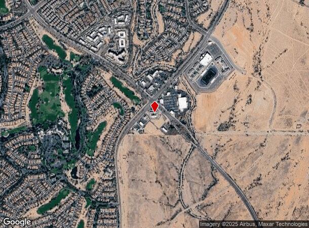
28460 N Vistancia Blvd, Peoria, AZ 85383
NEARBY LISTINGS FOR SALE OR LEASE
Property Detail
28460 N Vistancia Blvd
Phoenix
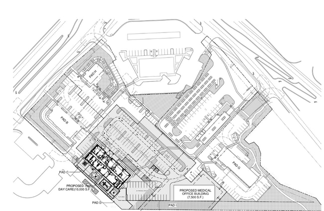
Vistancia Retail Center Phase I
Phoenix-Mesa-Scottsdale, AZ
VISTANCIA RETAIL CENTER PHASE I MCR 1817-50
503-99-993
Maricopa
Storebuilding
Arizona
2025
1
2025
2.19 AC
040534
Surprise/North Peoria
DEMOGRAPHICS near 28460 N Vistancia Blvd
1 Mile
3 Mile
5 Mile
2024 Total Population
5,869
34,436
77,486
2029 Population
6,502
38,275
84,597
Pop Growth 2024-2029
+ 10.79%
+ 11.15%
+ 9.18%
Average Age
49
43
46
2024 Total Households
2,350
12,448
29,246
HH Growth 2024-2029
+ 10.89%
+ 11.44%
+ 9.35%
Median Household Inc
$107,402
$114,236
$106,096
Avg Household Size
2.50
2.70
2.60
2024 Avg HH Vehicles
2.00
2.00
2.00
Median Home Value
$572,533
$491,698
$458,076
Median Year Built
2008
2010
2007
Nearby Places
- Restaurants
- Banks
- Shops
- Fitness
- Groceries
PUBLIC TRANSPORTATION
AIRPORT
Phoenix Sky Harbor International
DRIVE
WALK
Distance
Phoenix Sky Harbor International
56 min
43.0 mi
Freight Ports
Port of San Diego
DRIVE
WALK
Distance
Port of San Diego
399 min
358.0 mi
SALE & LEASE HISTORY
LISTING DATE
SALE/LEASE

Dec 03, 2024
For Lease
Nearby Properties
Address
Land Use
TOTAL SIZE
Lot Size
Zoning
Address
Land Use
TOTAL SIZE
Lot Size
Zoning
110,752 SF
16.07 AC
PAD
Address
Land Use
TOTAL SIZE
Lot Size
Zoning
120,691 SF
16.33 AC
PAD
Address
Land Use
TOTAL SIZE
Lot Size
Zoning
252,143 SF
13.24 AC
Address
Land Use
TOTAL SIZE
Lot Size
Zoning
192,849 SF
19.09 AC
R3
Address
Land Use
TOTAL SIZE
Lot Size
Zoning
394,394 SF
15.24 AC
PAD
Address
Land Use
TOTAL SIZE
Lot Size
Zoning
118,893 SF
5.07 AC
C3
Address
Land Use
TOTAL SIZE
Lot Size
Zoning
28,034 SF
18.35 AC
PCD
Address
Land Use
TOTAL SIZE
Lot Size
Zoning
1,522 SF
20.43 AC
C2
Address
Land Use
TOTAL SIZE
Lot Size
Zoning
57,888 SF
4.65 AC
PAD
Address
Land Use
TOTAL SIZE
Lot Size
Zoning
Address
Land Use
TOTAL SIZE
Lot Size
Zoning
22,755 SF
2.63 AC
PCD
Address
Land Use
TOTAL SIZE
Lot Size
Zoning
16,454 SF
6.55 AC
C-C
Address
Land Use
TOTAL SIZE
Lot Size
Zoning
11,578 SF
19.90 AC
Address
Land Use
TOTAL SIZE
Lot Size
Zoning
12,864 SF
7.28 AC
Address
Land Use
TOTAL SIZE
Lot Size
Zoning
18.96 AC
R-43
Address
Land Use
TOTAL SIZE
Lot Size
Zoning
10,001 SF
2.15 AC
PCD
Address
Land Use
TOTAL SIZE
Lot Size
Zoning
12,207 SF
47.06 AC
PAD
Address
Land Use
TOTAL SIZE
Lot Size
Zoning
14,722 SF
1.51 AC
PAD
Address
Land Use
TOTAL SIZE
Lot Size
Zoning
213.80 AC
Address
Land Use
TOTAL SIZE
Lot Size
Zoning
1.28 AC
Address
Land Use
TOTAL SIZE
Lot Size
Zoning
4,989 SF
0.97 AC
PAD
Address
Land Use
TOTAL SIZE
Lot Size
Zoning
6,840 SF
1.33 AC
PCD
Address
Land Use
TOTAL SIZE
Lot Size
Zoning
Address
Land Use
TOTAL SIZE
Lot Size
Zoning
Address
Land Use
TOTAL SIZE
Lot Size
Zoning
The World's #1 Commercial Real Estate Marketplace
Connect with us
© 2025 CoStar Group
The information above has been obtained from sources believed reliable. While we do not doubt its accuracy we have not verified it and make no guarantee, warranty or representation about it. It is your responsibility to independently confirm its accuracy and completeness. Any projections, opinions, assumptions, or estimates used are for example only and do not represent the current or future performance of the property. The value of this transaction to you depends on tax and other factors which should be evaluated by your tax, financial, and legal advisors. You and your advisors should conduct a careful, independent investigation of the property to determine to your satisfaction the suitability of the property for your needs.