Property Record
2209 N 99Th Ave, Phoenix, AZ 85037

Property Detail
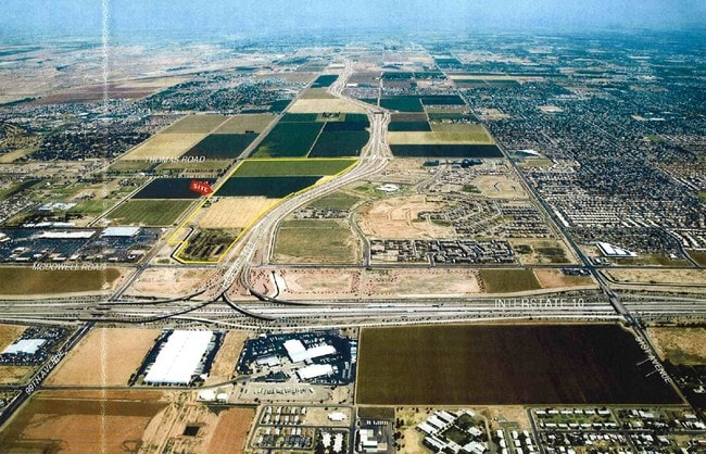
2209 N 99Th Ave
102-34-002E
NW4 SEC 33 EX S 33F & EX 35F TRI IN NW COR & EX RD P/F 84-003645 & EX N 63F TH/OF & EX W 70F TH/OF & EX R/W P/F 98-0663064 & EX TH PT LY WI-IN SHEELY FARMS INFRASTRUCTURE MCR 561-42 & EX TH PART NW4 SD SEC DAF COM NW COR TH ELY 1368.02F DES AS LI A T
Farms
MARICOPA
C-2
Arizona
C and X Area of minimal flood hazard, usually depicted on FIRMs as above the 500-year flood level.
111.38 AC
2025
Glendale
2025
Phoenix
082017
Phoenix-Mesa-Chandler, AZ
NEARBY LISTINGS FOR SALE OR LEASE
DEMOGRAPHICS near 2209 N 99Th Ave
1 mile
3 mile
5 mile
2024 Total Population
10,581
124,446
346,408
2029 Population
11,085
129,518
360,403
Pop Growth 2024-2029
+ 4.76%
+ 4.08%
+ 4.04%
Average Age
33
34
34
2024 Total Households
3,119
37,025
100,083
HH Growth 2024-2029
+ 4.75%
+ 4.15%
+ 4.18%
Median Household Inc
$93,199
$79,513
$82,049
Avg Household Size
3.30
3.30
3.30
2024 Avg HH Vehicles
2.00
2.00
2.00
Median Home Value
$433,867
$370,859
$379,993
Median Year Built
2004
1997
1999
Nearby Places
Map Layers
Map Styles
 Street
 Aerial
Transit
 Traffic
 Biking
Places
Listings with unknown addresses are not visible on the map
- Restaurants
- Banks
- Shops
- Fitness
- Groceries
PUBLIC TRANSPORTATION
AIRPORT
Phoenix Sky Harbor International
Drive
Walk
Distance
Phoenix Sky Harbor International
26 min
18.5 mi
Freight Ports
Port of San Diego
Drive
Walk
Distance
Port of San Diego
382 min
343.9 mi
Nearby Properties
Address
Land Use
TOTAL SIZE
Lot Size
Zoning
Address
Land Use
TOTAL SIZE
Lot Size
Zoning
12.04 AC
Address
Land Use
TOTAL SIZE
Lot Size
Zoning
896,916 SF
25.91 AC
C-C
Address
Land Use
TOTAL SIZE
Lot Size
Zoning
Address
Land Use
TOTAL SIZE
Lot Size
Zoning
Address
Land Use
TOTAL SIZE
Lot Size
Zoning
889,089 SF
83.11 AC
I-1
Address
Land Use
TOTAL SIZE
Lot Size
Zoning
1,267,497 SF
70.43 AC
A1
Address
Land Use
TOTAL SIZE
Lot Size
Zoning
1,100,500 SF
57.61 AC
PUD
Address
Land Use
TOTAL SIZE
Lot Size
Zoning
177,052 SF
2.69 AC
THEBLVDD
Address
Land Use
TOTAL SIZE
Lot Size
Zoning
728,550 SF
41.98 AC
Address
Land Use
TOTAL SIZE
Lot Size
Zoning
287,294 SF
67.46 AC
PAD
Address
Land Use
TOTAL SIZE
Lot Size
Zoning
763,410 SF
45.50 AC
Address
Land Use
TOTAL SIZE
Lot Size
Zoning
587,843 SF
20.49 AC
PAD
Address
Land Use
TOTAL SIZE
Lot Size
Zoning
296,791 SF
35 AC
PAD
Address
Land Use
TOTAL SIZE
Lot Size
Zoning
258,097 SF
32.53 AC
AG
Address
Land Use
TOTAL SIZE
Lot Size
Zoning
369,413 SF
16.39 AC
THEBLVDD
Address
Land Use
TOTAL SIZE
Lot Size
Zoning
351,903 SF
29.13 AC
A1
Address
Land Use
TOTAL SIZE
Lot Size
Zoning
660,838 SF
29.28 AC
C2
Address
Land Use
TOTAL SIZE
Lot Size
Zoning
466,868 SF
45.99 AC
I-1
Address
Land Use
TOTAL SIZE
Lot Size
Zoning
432,022 SF
19.33 AC
PAD
Address
Land Use
TOTAL SIZE
Lot Size
Zoning
797,310 SF
36.82 AC
I-1
Address
Land Use
TOTAL SIZE
Lot Size
Zoning
628,480 SF
34.45 AC
PAD
Address
Land Use
TOTAL SIZE
Lot Size
Zoning
660,980 SF
40.15 AC
Address
Land Use
TOTAL SIZE
Lot Size
Zoning
660,807 SF
31.44 AC
PAD-14
Address
Land Use
TOTAL SIZE
Lot Size
Zoning
397,132 SF
27.52 AC
I1
Address
Land Use
TOTAL SIZE
Lot Size
Zoning
487,424 SF
30.05 AC
CPGCP
Address
Land Use
TOTAL SIZE
Lot Size
Zoning
498,064 SF
12.92 AC
C-N
Address
Land Use
TOTAL SIZE
Lot Size
Zoning
370,522 SF
9.45 AC
Address
Land Use
TOTAL SIZE
Lot Size
Zoning
409,088 SF
21.34 AC
PAD
Address
Land Use
TOTAL SIZE
Lot Size
Zoning
630,285 SF
36.02 AC
R-43AG
The World's #1 Commercial Real Estate Marketplace
Connect with us
© 2026 CoStar Group
The information above has been obtained from sources believed reliable. While we do not doubt its accuracy we have not verified it and make no guarantee, warranty or representation about it. It is your responsibility to independently confirm its accuracy and completeness. Any projections, opinions, assumptions, or estimates used are for example only and do not represent the current or future performance of the property. The value of this transaction to you depends on tax and other factors which should be evaluated by your tax, financial, and legal advisors. You and your advisors should conduct a careful, independent investigation of the property to determine to your satisfaction the suitability of the property for your needs.