Property Record
8130 W Hausman Rd, San Antonio, TX 78249
NEARBY LISTINGS FOR SALE OR LEASE
Property Detail
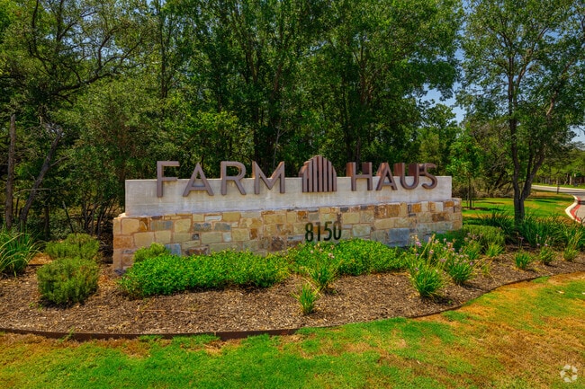
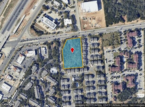
8130 W Hausman Rd
San Antonio-New Braunfels, TX
Ncb 14616 (Hausman Grove)
14616-006-0220
NCB 14616 (HAUSMAN GROVE), BLOCK 6 LOT 22 2019-NEW ACCT CREATED PER PLAT 9726/1-4 FILED 1-26-18. LR/GIS/5-1-18.
Commercialnec
Bexar
X
Texas
48029C0210G
22
2024
2.46 AC
2025
Northwest Side
181824
San Antonio
DEMOGRAPHICS near 8130 W Hausman Rd
1 Mile
3 Mile
5 Mile
2024 Total Population
13,477
89,241
219,756
2029 Population
14,409
94,826
233,610
Pop Growth 2024-2029
+ 6.92%
+ 6.26%
+ 6.30%
Average Age
35
36
36
2024 Total Households
4,815
32,362
86,409
HH Growth 2024-2029
+ 7.27%
+ 6.54%
+ 6.62%
Median Household Inc
$86,481
$83,666
$78,601
Avg Household Size
2.80
2.60
2.50
2024 Avg HH Vehicles
2.00
2.00
2.00
Median Home Value
$249,878
$260,204
$254,590
Median Year Built
2001
1999
1998
Nearby Places
Map Layers
Map Styles
 Street
 Aerial
- Restaurants
- Banks
- Shops
- Fitness
- Groceries
PUBLIC TRANSPORTATION
AIRPORT
San Antonio International
DRIVE
WALK
Distance
San Antonio International
21 min
14.2 mi
Freight Ports
Calhoun Port
DRIVE
WALK
Distance
Calhoun Port
199 min
167.4 mi
Nearby Properties
Address
Land Use
TOTAL SIZE
Lot Size
Zoning
Address
Land Use
TOTAL SIZE
Lot Size
Zoning
437,060 SF
91.31 AC
Address
Land Use
TOTAL SIZE
Lot Size
Zoning
538,895 SF
54.58 AC
Address
Land Use
TOTAL SIZE
Lot Size
Zoning
335,841 SF
33.70 AC
Address
Land Use
TOTAL SIZE
Lot Size
Zoning
538,895 SF
60.25 AC
Address
Land Use
TOTAL SIZE
Lot Size
Zoning
940,089 SF
63.74 AC
Address
Land Use
TOTAL SIZE
Lot Size
Zoning
13,128 SF
5.23 AC
Address
Land Use
TOTAL SIZE
Lot Size
Zoning
21,852 SF
5.25 AC
Address
Land Use
TOTAL SIZE
Lot Size
Zoning
329,050 SF
17.10 AC
Address
Land Use
TOTAL SIZE
Lot Size
Zoning
320,406 SF
12.11 AC
Address
Land Use
TOTAL SIZE
Lot Size
Zoning
244,260 SF
5.82 AC
Address
Land Use
TOTAL SIZE
Lot Size
Zoning
520,686 SF
53.63 AC
Address
Land Use
TOTAL SIZE
Lot Size
Zoning
413,362 SF
33.77 AC
Address
Land Use
TOTAL SIZE
Lot Size
Zoning
305,600 SF
30.64 AC
Address
Land Use
TOTAL SIZE
Lot Size
Zoning
284,890 SF
18.83 AC
Address
Land Use
TOTAL SIZE
Lot Size
Zoning
249,241 SF
28.10 AC
Address
Land Use
TOTAL SIZE
Lot Size
Zoning
307,272 SF
24.14 AC
Address
Land Use
TOTAL SIZE
Lot Size
Zoning
331,020 SF
20.13 AC
Address
Land Use
TOTAL SIZE
Lot Size
Zoning
239,341 SF
9.21 AC
Address
Land Use
TOTAL SIZE
Lot Size
Zoning
299,491 SF
15.43 AC
Address
Land Use
TOTAL SIZE
Lot Size
Zoning
258,373 SF
14.16 AC
Address
Land Use
TOTAL SIZE
Lot Size
Zoning
237,499 SF
37.26 AC
Address
Land Use
TOTAL SIZE
Lot Size
Zoning
220,719 SF
25.86 AC
Address
Land Use
TOTAL SIZE
Lot Size
Zoning
292,752 SF
15.77 AC
Address
Land Use
TOTAL SIZE
Lot Size
Zoning
263,082 SF
15.70 AC
Address
Land Use
TOTAL SIZE
Lot Size
Zoning
289,158 SF
31.78 AC
Address
Land Use
TOTAL SIZE
Lot Size
Zoning
217,267 SF
17.63 AC
Address
Land Use
TOTAL SIZE
Lot Size
Zoning
217,176 SF
13.63 AC
Address
Land Use
TOTAL SIZE
Lot Size
Zoning
223,377 SF
7.56 AC
Address
Land Use
TOTAL SIZE
Lot Size
Zoning
255,890 SF
14.23 AC
Address
Land Use
TOTAL SIZE
Lot Size
Zoning
236,779 SF
14.31 AC
The World's #1 Commercial Real Estate Marketplace
Connect with us
© 2026 CoStar Group
The information above has been obtained from sources believed reliable. While we do not doubt its accuracy we have not verified it and make no guarantee, warranty or representation about it. It is your responsibility to independently confirm its accuracy and completeness. Any projections, opinions, assumptions, or estimates used are for example only and do not represent the current or future performance of the property. The value of this transaction to you depends on tax and other factors which should be evaluated by your tax, financial, and legal advisors. You and your advisors should conduct a careful, independent investigation of the property to determine to your satisfaction the suitability of the property for your needs.