Property Record
T T Lanier St, Lillington, NC 27546

NEARBY LISTINGS FOR SALE OR LEASE
-
-
View all Lillington listings for sale on LoopNet.com
Property Detail
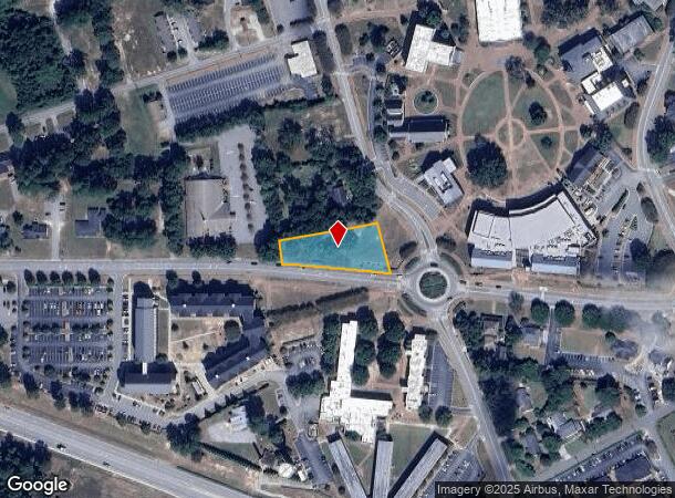
T T Lanier St
Dunn, NC
A
110670 0263
LT 160X311(I) CAMPBELL UNIV M#2011-103
Commercialacreage
Harnett
X
North Carolina
3720066000J
160x
2025
0.72 AC
2025
North Carolina Southeast Area
071102
Other Market Areas
DEMOGRAPHICS near T T Lanier St
1 Mile
3 Mile
5 Mile
2024 Total Population
1,755
6,742
18,277
2029 Population
1,872
7,316
19,901
Pop Growth 2024-2029
+ 6.67%
+ 8.51%
+ 8.89%
Average Age
28
36
39
2024 Total Households
509
2,216
6,480
HH Growth 2024-2029
+ 7.86%
+ 9.52%
+ 9.57%
Median Household Inc
$36,363
$50,679
$55,296
Avg Household Size
2.00
2.30
2.40
2024 Avg HH Vehicles
2.00
2.00
2.00
Median Home Value
$191,249
$219,247
$193,603
Median Year Built
1997
1994
1991
Nearby Places
Map Layers
Map Styles
 Street
 Aerial
- Restaurants
- Banks
- Shops
- Fitness
- Groceries
PUBLIC TRANSPORTATION
AIRPORT
Fayetteville Regional/Grannis Field
DRIVE
WALK
Distance
Fayetteville Regional/Grannis Field
55 min
39.4 mi
Freight Ports
Port of Wilmington
DRIVE
WALK
Distance
Port of Wilmington
139 min
115.7 mi
Nearby Properties
Address
Land Use
TOTAL SIZE
Lot Size
Zoning
Address
Land Use
TOTAL SIZE
Lot Size
Zoning
9.12 AC
R20
Address
Land Use
TOTAL SIZE
Lot Size
Zoning
42,958 SF
14.51 AC
RA20M
Address
Land Use
TOTAL SIZE
Lot Size
Zoning
34,086 SF
1.04 AC
OI
Address
Land Use
TOTAL SIZE
Lot Size
Zoning
33,205 SF
2.70 AC
OI
Address
Land Use
TOTAL SIZE
Lot Size
Zoning
18,045 SF
1.30 AC
RA20M
Address
Land Use
TOTAL SIZE
Lot Size
Zoning
43.10 AC
RA30
Address
Land Use
TOTAL SIZE
Lot Size
Zoning
154.23 AC
RS20
Address
Land Use
TOTAL SIZE
Lot Size
Zoning
35,768 SF
5.91 AC
RA20M
Address
Land Use
TOTAL SIZE
Lot Size
Zoning
18,569 SF
2.52 AC
RA30
Address
Land Use
TOTAL SIZE
Lot Size
Zoning
52.96 AC
Address
Land Use
TOTAL SIZE
Lot Size
Zoning
1,604 SF
238.90 AC
R20
Address
Land Use
TOTAL SIZE
Lot Size
Zoning
81.12 AC
RS20
Address
Land Use
TOTAL SIZE
Lot Size
Zoning
1,764 SF
48.50 AC
RA30
Address
Land Use
TOTAL SIZE
Lot Size
Zoning
19,768 SF
3.26 AC
R20
Address
Land Use
TOTAL SIZE
Lot Size
Zoning
15,839 SF
2.13 AC
R20
Address
Land Use
TOTAL SIZE
Lot Size
Zoning
14,400 SF
4.97 AC
COMM
Address
Land Use
TOTAL SIZE
Lot Size
Zoning
10,472 SF
1.97 AC
COMM
Address
Land Use
TOTAL SIZE
Lot Size
Zoning
146 AC
RA20M
Address
Land Use
TOTAL SIZE
Lot Size
Zoning
29.77 AC
GB
Address
Land Use
TOTAL SIZE
Lot Size
Zoning
12,180 SF
0.30 AC
OI
Address
Land Use
TOTAL SIZE
Lot Size
Zoning
13,450 SF
1.86 AC
RA20M
Address
Land Use
TOTAL SIZE
Lot Size
Zoning
6,480 SF
3.52 AC
RA30
Address
Land Use
TOTAL SIZE
Lot Size
Zoning
529.48 AC
LI
Address
Land Use
TOTAL SIZE
Lot Size
Zoning
9,888 SF
9.95 AC
IND
Address
Land Use
TOTAL SIZE
Lot Size
Zoning
Address
Land Use
TOTAL SIZE
Lot Size
Zoning
2,460 SF
37.51 AC
RA30
Address
Land Use
TOTAL SIZE
Lot Size
Zoning
57.59 AC
RA30
Address
Land Use
TOTAL SIZE
Lot Size
Zoning
4,596 SF
0.47 AC
OI
Address
Land Use
TOTAL SIZE
Lot Size
Zoning
7,500 SF
3.82 AC
RA30
Address
Land Use
TOTAL SIZE
Lot Size
Zoning
10.01 AC
RA30
The World's #1 Commercial Real Estate Marketplace
Connect with us
© 2025 CoStar Group
The information above has been obtained from sources believed reliable. While we do not doubt its accuracy we have not verified it and make no guarantee, warranty or representation about it. It is your responsibility to independently confirm its accuracy and completeness. Any projections, opinions, assumptions, or estimates used are for example only and do not represent the current or future performance of the property. The value of this transaction to you depends on tax and other factors which should be evaluated by your tax, financial, and legal advisors. You and your advisors should conduct a careful, independent investigation of the property to determine to your satisfaction the suitability of the property for your needs.