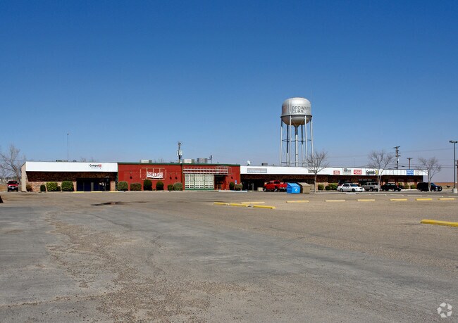
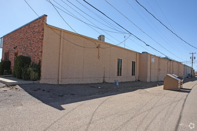
Property Record
Tahoka Rd, Brownfield, TX 79316

Property Detail
Tahoka Rd
R11736
BLK T SEC 103 183'X43' COMPUT ER-CUBS DEN-GOODPASTURE CBD-TANKD BLK/TRACT T 0.18 ACRES
Commercialnec
TERRY
2024
Texas
2024
0.18 AC
950300
Panhandle Area
7,351 SF
Other Market Areas
NEARBY LISTINGS FOR SALE OR LEASE
-
-
View all Brownfield listings for sale on LoopNet.com
DEMOGRAPHICS near Tahoka Rd
1 mile
3 mile
5 mile
2024 Total Population
5,959
9,221
9,754
2029 Population
5,905
9,243
9,769
Pop Growth 2024-2029
(0.91%)
+ 0.24%
+ 0.15%
Average Age
38
38
38
2024 Total Households
2,106
3,215
3,386
HH Growth 2024-2029
(1.09%)
+ 0.25%
+ 0.21%
Median Household Inc
$50,253
$43,054
$43,399
Avg Household Size
2.70
2.70
2.70
2024 Avg HH Vehicles
2.00
2.00
2.00
Median Home Value
$139,737
$120,932
$121,571
Median Year Built
1964
1966
1966
Nearby Places
Map Layers
Map Styles
 Street
 Aerial
Transit
 Traffic
 Biking
Places
Listings with unknown addresses are not visible on the map
- Restaurants
- Banks
- Shops
- Fitness
- Groceries
SALE & LEASE HISTORY
LISTING DATE
SALE/LEASE

Sep 23, 2016
For Sale
Nearby Properties
Address
Land Use
TOTAL SIZE
Lot Size
Zoning
Address
Land Use
TOTAL SIZE
Lot Size
Zoning
53,168 SF
1.93 AC
Address
Land Use
TOTAL SIZE
Lot Size
Zoning
1,152 SF
1.92 AC
Address
Land Use
TOTAL SIZE
Lot Size
Zoning
55,000 SF
3.43 AC
Address
Land Use
TOTAL SIZE
Lot Size
Zoning
45,817 SF
1.68 AC
Address
Land Use
TOTAL SIZE
Lot Size
Zoning
15,497 SF
0.83 AC
Address
Land Use
TOTAL SIZE
Lot Size
Zoning
21,350 SF
2.30 AC
Address
Land Use
TOTAL SIZE
Lot Size
Zoning
34,440 SF
2.87 AC
Address
Land Use
TOTAL SIZE
Lot Size
Zoning
150,000 SF
10.96 AC
Address
Land Use
TOTAL SIZE
Lot Size
Zoning
77,675 SF
7.12 AC
Address
Land Use
TOTAL SIZE
Lot Size
Zoning
98,960 SF
21.96 AC
Address
Land Use
TOTAL SIZE
Lot Size
Zoning
20,484 SF
21.89 AC
Address
Land Use
TOTAL SIZE
Lot Size
Zoning
128,942 SF
9.53 AC
Address
Land Use
TOTAL SIZE
Lot Size
Zoning
19,333 SF
3.20 AC
Address
Land Use
TOTAL SIZE
Lot Size
Zoning
25,756 SF
2.74 AC
Address
Land Use
TOTAL SIZE
Lot Size
Zoning
17,214 SF
4.13 AC
Address
Land Use
TOTAL SIZE
Lot Size
Zoning
12,640 SF
0.60 AC
Address
Land Use
TOTAL SIZE
Lot Size
Zoning
21,250 SF
17.49 AC
Address
Land Use
TOTAL SIZE
Lot Size
Zoning
12,306 SF
0.96 AC
Address
Land Use
TOTAL SIZE
Lot Size
Zoning
9,000 SF
2.78 AC
Address
Land Use
TOTAL SIZE
Lot Size
Zoning
5,256 SF
0.71 AC
Address
Land Use
TOTAL SIZE
Lot Size
Zoning
10,360 SF
0.86 AC
Address
Land Use
TOTAL SIZE
Lot Size
Zoning
17,894 SF
4.85 AC
Address
Land Use
TOTAL SIZE
Lot Size
Zoning
9,000 SF
0.70 AC
Address
Land Use
TOTAL SIZE
Lot Size
Zoning
25,940 SF
10.03 AC
Address
Land Use
TOTAL SIZE
Lot Size
Zoning
15,834 SF
3.31 AC
Address
Land Use
TOTAL SIZE
Lot Size
Zoning
12,095 SF
0.74 AC
Address
Land Use
TOTAL SIZE
Lot Size
Zoning
9,000 SF
1.13 AC
Address
Land Use
TOTAL SIZE
Lot Size
Zoning
9,773 SF
4.60 AC
Address
Land Use
TOTAL SIZE
Lot Size
Zoning
13,800 SF
1.55 AC
Address
Land Use
TOTAL SIZE
Lot Size
Zoning
20,059 SF
0.96 AC
The World's #1 Commercial Real Estate Marketplace
Connect with us
© 2026 CoStar Group
The information above has been obtained from sources believed reliable. While we do not doubt its accuracy we have not verified it and make no guarantee, warranty or representation about it. It is your responsibility to independently confirm its accuracy and completeness. Any projections, opinions, assumptions, or estimates used are for example only and do not represent the current or future performance of the property. The value of this transaction to you depends on tax and other factors which should be evaluated by your tax, financial, and legal advisors. You and your advisors should conduct a careful, independent investigation of the property to determine to your satisfaction the suitability of the property for your needs.