Property Record
Tavern Rd, Alpine, CA 91901


Property Detail
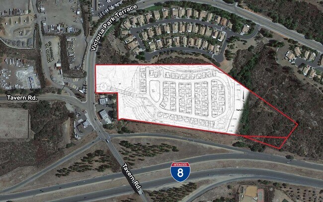
Tavern Rd
403-391-03
SEC 28-15-2E NEQ 17.76 AC M/L IN N H OF
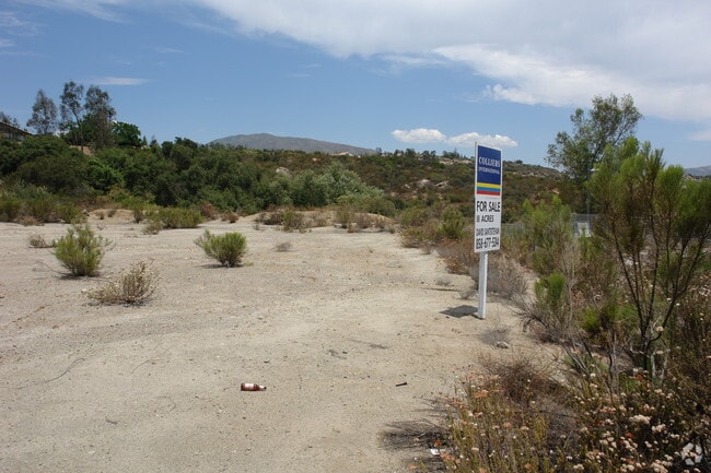
Vacantlandnec
SAN DIEGO
RU
California
B and X Area of moderate flood hazard, usually the area between the limits of the 100-year and 500-year floods.
17.76 AC
2024
Outlying SD County S
2025
San Diego
021204
San Diego-Chula Vista-Carlsbad, CA
NEARBY LISTINGS FOR SALE OR LEASE
DEMOGRAPHICS near Tavern Rd
1 mile
3 mile
5 mile
2025 Total Population
5,329
15,869
23,000
2030 Population
5,339
15,884
22,988
Pop Growth 2025-2030
+ 0.19%
+ 0.09%
(0.05%)
Average Age
41
43
43
2025 Total Households
1,973
5,677
8,262
HH Growth 2025-2030
+ 0.05%
(0.04%)
(0.25%)
Median Household Inc
$112,993
$119,258
$119,127
Avg Household Size
2.70
2.70
2.70
2025 Avg HH Vehicles
2.00
2.00
2.00
Median Home Value
$761,301
$824,608
$821,546
Median Year Built
1986
1987
1987
Nearby Places
Map Layers
Map Styles
 Street
 Aerial
Layers
 Traffic
 Biking
Places
Listings with unknown addresses are not visible on the map
- Restaurants
- Banks
- Shops
- Fitness
- Groceries
PUBLIC TRANSPORTATION
AIRPORT
San Diego International
Drive
Walk
Distance
San Diego International
38 min
29.7 mi
Freight Ports
Port of San Diego
Drive
Walk
Distance
Port of San Diego
36 min
28.6 mi
SALE & LEASE HISTORY
LISTING DATE
SALE/LEASE

Sep 24, 2016
For Sale
May 04, 2022
For Sale
Mar 04, 2019
For Sale
Apr 05, 2017
For Sale
Nearby Properties
Address
Land Use
TOTAL SIZE
Lot Size
Zoning
Address
Land Use
TOTAL SIZE
Lot Size
Zoning
30.54 AC
RV
Address
Land Use
TOTAL SIZE
Lot Size
Zoning
72,864 SF
4.50 AC
RM
Address
Land Use
TOTAL SIZE
Lot Size
Zoning
14.05 AC
RU
Address
Land Use
TOTAL SIZE
Lot Size
Zoning
52,525 SF
6.90 AC
C36
Address
Land Use
TOTAL SIZE
Lot Size
Zoning
4.83 AC
RV
Address
Land Use
TOTAL SIZE
Lot Size
Zoning
8.70 AC
RS
Address
Land Use
TOTAL SIZE
Lot Size
Zoning
47,195 SF
3.42 AC
C37
Address
Land Use
TOTAL SIZE
Lot Size
Zoning
57,457 SF
6.91 AC
C36
Address
Land Use
TOTAL SIZE
Lot Size
Zoning
57,350 SF
3.21 AC
RU
Address
Land Use
TOTAL SIZE
Lot Size
Zoning
17,597 SF
21.22 AC
A70
Address
Land Use
TOTAL SIZE
Lot Size
Zoning
31,412 SF
4.09 AC
C34
Address
Land Use
TOTAL SIZE
Lot Size
Zoning
27,288 SF
1.71 AC
ALV1
Address
Land Use
TOTAL SIZE
Lot Size
Zoning
6.04 AC
ALV1
Address
Land Use
TOTAL SIZE
Lot Size
Zoning
12,176 SF
5.12 AC
A70
Address
Land Use
TOTAL SIZE
Lot Size
Zoning
5,748 SF
0.50 AC
C36
Address
Land Use
TOTAL SIZE
Lot Size
Zoning
3.60 AC
RU
Address
Land Use
TOTAL SIZE
Lot Size
Zoning
8,400 SF
5 AC
A70
Address
Land Use
TOTAL SIZE
Lot Size
Zoning
34,303 SF
2.65 AC
C36
Address
Land Use
TOTAL SIZE
Lot Size
Zoning
16,708 SF
2.49 AC
C36
Address
Land Use
TOTAL SIZE
Lot Size
Zoning
49,961 SF
1.25 AC
M52
Address
Land Use
TOTAL SIZE
Lot Size
Zoning
22,104 SF
0.83 AC
ALV1
Address
Land Use
TOTAL SIZE
Lot Size
Zoning
45,678 SF
2.92 AC
RU
Address
Land Use
TOTAL SIZE
Lot Size
Zoning
32,000 SF
2.40 AC
C36
Address
Land Use
TOTAL SIZE
Lot Size
Zoning
2.22 AC
RU
Address
Land Use
TOTAL SIZE
Lot Size
Zoning
2.23 AC
RU
Address
Land Use
TOTAL SIZE
Lot Size
Zoning
26,616 SF
1.98 AC
M52
Address
Land Use
TOTAL SIZE
Lot Size
Zoning
5.44 AC
A70
Address
Land Use
TOTAL SIZE
Lot Size
Zoning
23,720 SF
2.57 AC
C36
Address
Land Use
TOTAL SIZE
Lot Size
Zoning
2,500 SF
8.60 AC
RMH8
Address
Land Use
TOTAL SIZE
Lot Size
Zoning
41,364 SF
1.31 AC
RV
The World's #1 Commercial Real Estate Marketplace
Connect with us
© 2026 CoStar Group
The information above has been obtained from sources believed reliable. While we do not doubt its accuracy we have not verified it and make no guarantee, warranty or representation about it. It is your responsibility to independently confirm its accuracy and completeness. Any projections, opinions, assumptions, or estimates used are for example only and do not represent the current or future performance of the property. The value of this transaction to you depends on tax and other factors which should be evaluated by your tax, financial, and legal advisors. You and your advisors should conduct a careful, independent investigation of the property to determine to your satisfaction the suitability of the property for your needs.