Property Record
Taylor St, Tybee Island, GA 31328

NEARBY LISTINGS FOR SALE OR LEASE
-
-
View all Tybee Island listings for sale on LoopNet.com
Property Detail
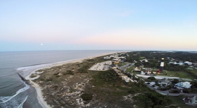
Taylor St
Savannah, GA
T-Lighthouse La
4000102014
LOT C FORT SCREVEN WARD TYBEE P RB 17P 92 .31 AC EASEMENT PRB
Residentialacreage
Chatham
AE
Georgia
13051C0213G
c
2023
0.32 AC
2025
Outer Islands
011111
Savannah
DEMOGRAPHICS near Taylor St
1 Mile
3 Mile
5 Mile
2024 Total Population
1,469
3,122
3,156
2029 Population
1,485
3,173
3,214
Pop Growth 2024-2029
+ 1.09%
+ 1.63%
+ 1.84%
Average Age
56
56
56
2024 Total Households
662
1,501
1,516
HH Growth 2024-2029
+ 1.06%
+ 1.73%
+ 1.98%
Median Household Inc
$100,532
$104,046
$104,650
Avg Household Size
2.10
2.00
2.00
2024 Avg HH Vehicles
2.00
2.00
2.00
Median Home Value
$540,892
$559,629
$557,456
Median Year Built
1990
1983
1984
Nearby Places
Map Layers
Map Styles
 Street
 Aerial
- Restaurants
- Banks
- Shops
- Fitness
- Groceries
PUBLIC TRANSPORTATION
AIRPORT
Savannah/Hilton Head International
DRIVE
WALK
Distance
Savannah/Hilton Head International
43 min
26.0 mi
Freight Ports
Georgia Ports - Savannah
DRIVE
WALK
Distance
Georgia Ports - Savannah
35 min
21.9 mi
SALE & LEASE HISTORY
LISTING DATE
SALE/LEASE

Sep 24, 2016
For Sale
Nearby Properties
Address
Land Use
TOTAL SIZE
Lot Size
Zoning
Address
Land Use
TOTAL SIZE
Lot Size
Zoning
54,760 SF
2.64 AC
C1
Address
Land Use
TOTAL SIZE
Lot Size
Zoning
10,962 SF
5 AC
RT
Address
Land Use
TOTAL SIZE
Lot Size
Zoning
10,984 SF
2.30 AC
RT
Address
Land Use
TOTAL SIZE
Lot Size
Zoning
2,660 SF
4.54 AC
R2B
Address
Land Use
TOTAL SIZE
Lot Size
Zoning
14,505 SF
3.38 AC
R1
Address
Land Use
TOTAL SIZE
Lot Size
Zoning
9,126 SF
0.50 AC
C1
Address
Land Use
TOTAL SIZE
Lot Size
Zoning
21,372 SF
0.87 AC
C1
Address
Land Use
TOTAL SIZE
Lot Size
Zoning
19,790 SF
0.78 AC
C1
Address
Land Use
TOTAL SIZE
Lot Size
Zoning
30,084 SF
0.52 AC
C1
Address
Land Use
TOTAL SIZE
Lot Size
Zoning
6,268 SF
0.83 AC
R1
Address
Land Use
TOTAL SIZE
Lot Size
Zoning
23,736 SF
0.50 AC
C1
Address
Land Use
TOTAL SIZE
Lot Size
Zoning
1.10 AC
C1
Address
Land Use
TOTAL SIZE
Lot Size
Zoning
980 SF
1.63 AC
R2B
Address
Land Use
TOTAL SIZE
Lot Size
Zoning
6,318 SF
0.87 AC
C1
Address
Land Use
TOTAL SIZE
Lot Size
Zoning
5,000 SF
0.76 AC
R2B
Address
Land Use
TOTAL SIZE
Lot Size
Zoning
6,120 SF
0.87 AC
R2B
Address
Land Use
TOTAL SIZE
Lot Size
Zoning
3,336 SF
0.68 AC
R2B
Address
Land Use
TOTAL SIZE
Lot Size
Zoning
8,514 SF
1.15 AC
C2
Address
Land Use
TOTAL SIZE
Lot Size
Zoning
5,796 SF
0.39 AC
R2B
Address
Land Use
TOTAL SIZE
Lot Size
Zoning
4,384 SF
0.15 AC
R2
Address
Land Use
TOTAL SIZE
Lot Size
Zoning
5,270 SF
1.90 AC
C2A
Address
Land Use
TOTAL SIZE
Lot Size
Zoning
27,139 SF
0.44 AC
C1
Address
Land Use
TOTAL SIZE
Lot Size
Zoning
9,024 SF
0.51 AC
R1
Address
Land Use
TOTAL SIZE
Lot Size
Zoning
14,468 SF
0.54 AC
R2B
Address
Land Use
TOTAL SIZE
Lot Size
Zoning
24,592 SF
1.98 AC
R1
Address
Land Use
TOTAL SIZE
Lot Size
Zoning
3,448 SF
0.20 AC
R2
Address
Land Use
TOTAL SIZE
Lot Size
Zoning
3,520 SF
0.16 AC
R1
Address
Land Use
TOTAL SIZE
Lot Size
Zoning
10,533 SF
0.66 AC
R2B
Address
Land Use
TOTAL SIZE
Lot Size
Zoning
4,802 SF
0.18 AC
R1
Address
Land Use
TOTAL SIZE
Lot Size
Zoning
0.62 AC
R2
The World's #1 Commercial Real Estate Marketplace
Connect with us
© 2025 CoStar Group
The information above has been obtained from sources believed reliable. While we do not doubt its accuracy we have not verified it and make no guarantee, warranty or representation about it. It is your responsibility to independently confirm its accuracy and completeness. Any projections, opinions, assumptions, or estimates used are for example only and do not represent the current or future performance of the property. The value of this transaction to you depends on tax and other factors which should be evaluated by your tax, financial, and legal advisors. You and your advisors should conduct a careful, independent investigation of the property to determine to your satisfaction the suitability of the property for your needs.