Property Record
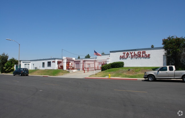
Taylor St, Vista, CA 92084

Property Detail
Taylor St
171-250-50
SEC 8-11-3W SWQ (EX DOC77-455080&STS OP)PAR B PER PM 1315 IN
Warehouse
SAN DIEGO
R-M
California
B and X Area of moderate flood hazard, usually the area between the limits of the 100-year and 500-year floods.
1.19 AC
2024
Vista
2025
San Diego
019210
San Diego-Chula Vista-Carlsbad, CA
NEARBY LISTINGS FOR SALE OR LEASE
DEMOGRAPHICS near Taylor St
1 mile
3 mile
5 mile
2024 Total Population
14,526
82,046
197,230
2029 Population
14,534
82,556
197,922
Pop Growth 2024-2029
+ 0.06%
+ 0.62%
+ 0.35%
Average Age
39
39
40
2024 Total Households
4,606
25,211
64,023
HH Growth 2024-2029
(0.07%)
+ 0.46%
+ 0.19%
Median Household Inc
$84,662
$98,651
$105,283
Avg Household Size
3.10
3.10
2.90
2024 Avg HH Vehicles
2.00
2.00
2.00
Median Home Value
$650,312
$753,535
$770,093
Median Year Built
1978
1980
1983
Nearby Places
Map Layers
Map Styles
 Street
 Aerial
Transit
 Traffic
 Biking
Places
Listings with unknown addresses are not visible on the map
- Restaurants
- Banks
- Shops
- Fitness
- Groceries
PUBLIC TRANSPORTATION
AIRPORT
San Diego International
Drive
Walk
Distance
San Diego International
55 min
42.8 mi
Freight Ports
Port of San Diego
Drive
Walk
Distance
Port of San Diego
61 min
45.9 mi
Nearby Properties
Address
Land Use
TOTAL SIZE
Lot Size
Zoning
Address
Land Use
TOTAL SIZE
Lot Size
Zoning
20.10 AC
M-U
Address
Land Use
TOTAL SIZE
Lot Size
Zoning
10.39 AC
M-U (40)
Address
Land Use
TOTAL SIZE
Lot Size
Zoning
11.17 AC
M-U
Address
Land Use
TOTAL SIZE
Lot Size
Zoning
21.44 AC
C-1
Address
Land Use
TOTAL SIZE
Lot Size
Zoning
1.23 AC
SPI
Address
Land Use
TOTAL SIZE
Lot Size
Zoning
7.97 AC
SPI-DV
Address
Land Use
TOTAL SIZE
Lot Size
Zoning
14.08 AC
RH
Address
Land Use
TOTAL SIZE
Lot Size
Zoning
8.67 AC
R-M
Address
Land Use
TOTAL SIZE
Lot Size
Zoning
6.55 AC
R-M
Address
Land Use
TOTAL SIZE
Lot Size
Zoning
3.32 AC
SPI
Address
Land Use
TOTAL SIZE
Lot Size
Zoning
10.59 AC
RH
Address
Land Use
TOTAL SIZE
Lot Size
Zoning
4.34 AC
SP-08
Address
Land Use
TOTAL SIZE
Lot Size
Zoning
7.18 AC
R-M
Address
Land Use
TOTAL SIZE
Lot Size
Zoning
99,906 SF
5.06 AC
R-M
Address
Land Use
TOTAL SIZE
Lot Size
Zoning
59,481 SF
2.63 AC
C-1
Address
Land Use
TOTAL SIZE
Lot Size
Zoning
77,084 SF
2.12 AC
SPI
Address
Land Use
TOTAL SIZE
Lot Size
Zoning
6.53 AC
R-M
Address
Land Use
TOTAL SIZE
Lot Size
Zoning
89,926 SF
4.25 AC
C-1
Address
Land Use
TOTAL SIZE
Lot Size
Zoning
43,610 SF
10.57 AC
SPI
Address
Land Use
TOTAL SIZE
Lot Size
Zoning
56,500 SF
5.02 AC
R-1
Address
Land Use
TOTAL SIZE
Lot Size
Zoning
10.25 AC
C-1
Address
Land Use
TOTAL SIZE
Lot Size
Zoning
4.03 AC
70
Address
Land Use
TOTAL SIZE
Lot Size
Zoning
7.82 AC
IL-MP-3-82
Address
Land Use
TOTAL SIZE
Lot Size
Zoning
88,361 SF
4.94 AC
IL
Address
Land Use
TOTAL SIZE
Lot Size
Zoning
4.28 AC
SP-DV
Address
Land Use
TOTAL SIZE
Lot Size
Zoning
44,963 SF
43.97 AC
A70
Address
Land Use
TOTAL SIZE
Lot Size
Zoning
7.97 AC
C-2
Address
Land Use
TOTAL SIZE
Lot Size
Zoning
6.26 AC
R-M
Address
Land Use
TOTAL SIZE
Lot Size
Zoning
44,724 SF
1.55 AC
O-P
Address
Land Use
TOTAL SIZE
Lot Size
Zoning
40,439 SF
3.04 AC
R-M
The World's #1 Commercial Real Estate Marketplace
Connect with us
© 2026 CoStar Group
The information above has been obtained from sources believed reliable. While we do not doubt its accuracy we have not verified it and make no guarantee, warranty or representation about it. It is your responsibility to independently confirm its accuracy and completeness. Any projections, opinions, assumptions, or estimates used are for example only and do not represent the current or future performance of the property. The value of this transaction to you depends on tax and other factors which should be evaluated by your tax, financial, and legal advisors. You and your advisors should conduct a careful, independent investigation of the property to determine to your satisfaction the suitability of the property for your needs.