Property Record
Fb Schwertner Rd, Jarrell, TX 76537


Property Detail
Fb Schwertner Rd
Austin-Round Rock-San Marcos, TX
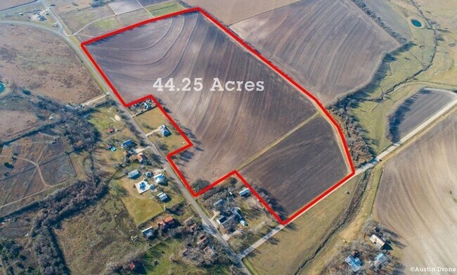
AW0354 JONES, B.D. SUR., ACRES 2.75
R011446
WILLIAMSON
Vacantlandnec
Texas
B and X Area of moderate flood hazard, usually the area between the limits of the 100-year and 500-year floods.
2.75 AC
2024
Georgetown
2025
Austin
021603
NEARBY LISTINGS FOR SALE OR LEASE
DEMOGRAPHICS near Fb Schwertner Rd
1 mile
3 mile
5 mile
2025 Total Population
189
8,332
23,506
2030 Population
220
9,864
27,984
Pop Growth 2025-2030
+ 16.40%
+ 18.39%
+ 19.05%
Average Age
38
36
36
2025 Total Households
64
2,794
8,082
HH Growth 2025-2030
+ 17.19%
+ 19.01%
+ 19.57%
Median Household Inc
$57,499
$84,549
$92,209
Avg Household Size
2.90
2.90
2.90
2025 Avg HH Vehicles
3.00
2.00
2.00
Median Home Value
$435,294
$354,844
$348,260
Median Year Built
2002
2010
2011
Nearby Places
Map Layers
Map Styles
 Street
 Aerial
Layers
 Traffic
 Biking
Places
Listings with unknown addresses are not visible on the map
- Restaurants
- Banks
- Shops
- Fitness
- Groceries
PUBLIC TRANSPORTATION
AIRPORT
Killeen Municipal
Drive
Walk
Distance
Killeen Municipal
48 min
34.8 mi
Robert Gray AAF
Drive
Walk
Distance
Robert Gray AAF
58 min
43.7 mi
Freight Ports
Port of Houston
Drive
Walk
Distance
Port of Houston
223 min
191.7 mi
SALE & LEASE HISTORY
LISTING DATE
SALE/LEASE

Jan 04, 2023
For Sale
Nearby Properties
Address
Land Use
TOTAL SIZE
Lot Size
Zoning
Address
Land Use
TOTAL SIZE
Lot Size
Zoning
110,565 SF
14.29 AC
Address
Land Use
TOTAL SIZE
Lot Size
Zoning
65,904 SF
14.96 AC
Address
Land Use
TOTAL SIZE
Lot Size
Zoning
101,484 SF
17.37 AC
Address
Land Use
TOTAL SIZE
Lot Size
Zoning
39,020 SF
11.65 AC
Address
Land Use
TOTAL SIZE
Lot Size
Zoning
34,278 SF
4.98 AC
Address
Land Use
TOTAL SIZE
Lot Size
Zoning
68,261 SF
4.12 AC
Address
Land Use
TOTAL SIZE
Lot Size
Zoning
28,704 SF
13.05 AC
Address
Land Use
TOTAL SIZE
Lot Size
Zoning
18,001 SF
8.87 AC
Address
Land Use
TOTAL SIZE
Lot Size
Zoning
11,100 SF
10 AC
Address
Land Use
TOTAL SIZE
Lot Size
Zoning
31,850 SF
20 AC
Address
Land Use
TOTAL SIZE
Lot Size
Zoning
201.67 AC
Address
Land Use
TOTAL SIZE
Lot Size
Zoning
2,096 SF
5 AC
Address
Land Use
TOTAL SIZE
Lot Size
Zoning
8,216 SF
1.25 AC
Address
Land Use
TOTAL SIZE
Lot Size
Zoning
89 SF
21.40 AC
Address
Land Use
TOTAL SIZE
Lot Size
Zoning
12,218 SF
9.92 AC
Address
Land Use
TOTAL SIZE
Lot Size
Zoning
32,000 SF
4.67 AC
Address
Land Use
TOTAL SIZE
Lot Size
Zoning
10,612 SF
3.59 AC
Address
Land Use
TOTAL SIZE
Lot Size
Zoning
14,615 SF
2.62 AC
Address
Land Use
TOTAL SIZE
Lot Size
Zoning
3,760 SF
4.96 AC
Address
Land Use
TOTAL SIZE
Lot Size
Zoning
10,150 SF
5 AC
Address
Land Use
TOTAL SIZE
Lot Size
Zoning
11,676 SF
1.63 AC
Address
Land Use
TOTAL SIZE
Lot Size
Zoning
2,079 SF
81.19 AC
Address
Land Use
TOTAL SIZE
Lot Size
Zoning
16,540 SF
35.01 AC
Address
Land Use
TOTAL SIZE
Lot Size
Zoning
6,000 SF
4.34 AC
Address
Land Use
TOTAL SIZE
Lot Size
Zoning
12,836 SF
1.40 AC
Address
Land Use
TOTAL SIZE
Lot Size
Zoning
10,001 SF
6.79 AC
Address
Land Use
TOTAL SIZE
Lot Size
Zoning
3,600 SF
7.16 AC
Address
Land Use
TOTAL SIZE
Lot Size
Zoning
14,920 SF
3.83 AC
Address
Land Use
TOTAL SIZE
Lot Size
Zoning
11,621 SF
3 AC
Address
Land Use
TOTAL SIZE
Lot Size
Zoning
The World's #1 Commercial Real Estate Marketplace
Connect with us
© 2026 CoStar Group
The information above has been obtained from sources believed reliable. While we do not doubt its accuracy we have not verified it and make no guarantee, warranty or representation about it. It is your responsibility to independently confirm its accuracy and completeness. Any projections, opinions, assumptions, or estimates used are for example only and do not represent the current or future performance of the property. The value of this transaction to you depends on tax and other factors which should be evaluated by your tax, financial, and legal advisors. You and your advisors should conduct a careful, independent investigation of the property to determine to your satisfaction the suitability of the property for your needs.