Property Record
N Post Rd, Shelby, NC 28150


NEARBY LISTINGS FOR SALE OR LEASE
Property Detail
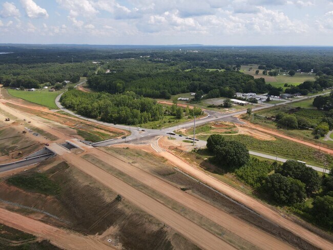
N Post Rd
Shelby, NC
1.00AC HWY 180N #3 PB48-23
24323
Cleveland
Commercialacreage
North Carolina
X
7
3710255700J
0.79 AC
2025
Cleveland County
2025
Charlotte
950900
DEMOGRAPHICS near N Post Rd
1 Mile
3 Mile
5 Mile
2024 Total Population
1,094
14,141
33,923
2029 Population
1,137
14,787
35,444
Pop Growth 2024-2029
+ 3.93%
+ 4.57%
+ 4.48%
Average Age
44
43
42
2024 Total Households
509
6,012
14,133
HH Growth 2024-2029
+ 3.93%
+ 4.61%
+ 4.51%
Median Household Inc
$37,828
$46,203
$44,247
Avg Household Size
2.10
2.30
2.30
2024 Avg HH Vehicles
2.00
2.00
2.00
Median Home Value
$149,583
$155,843
$152,846
Median Year Built
1977
1975
1976
Nearby Places
Map Layers
Map Styles
 Street
 Aerial
- Restaurants
- Banks
- Shops
- Fitness
- Groceries
SALE & LEASE HISTORY
LISTING DATE
SALE/LEASE

Nov 22, 2022
For Sale
Nearby Properties
Address
Land Use
TOTAL SIZE
Lot Size
Zoning
Address
Land Use
TOTAL SIZE
Lot Size
Zoning
15.70 AC
RO
Address
Land Use
TOTAL SIZE
Lot Size
Zoning
92,278 SF
41.63 AC
R10
Address
Land Use
TOTAL SIZE
Lot Size
Zoning
12.80 AC
R10
Address
Land Use
TOTAL SIZE
Lot Size
Zoning
6,250 SF
18.80 AC
HI
Address
Land Use
TOTAL SIZE
Lot Size
Zoning
29,747 SF
21.06 AC
RO
Address
Land Use
TOTAL SIZE
Lot Size
Zoning
9.55 AC
RO
Address
Land Use
TOTAL SIZE
Lot Size
Zoning
8,712 SF
13.95 AC
R6
Address
Land Use
TOTAL SIZE
Lot Size
Zoning
18,864 SF
10.65 AC
ROCU
Address
Land Use
TOTAL SIZE
Lot Size
Zoning
1,436 SF
8.02 AC
RO
Address
Land Use
TOTAL SIZE
Lot Size
Zoning
4,040 SF
22.83 AC
GB
Address
Land Use
TOTAL SIZE
Lot Size
Zoning
71,644 SF
7.67 AC
GB
Address
Land Use
TOTAL SIZE
Lot Size
Zoning
50,771 SF
2.40 AC
GB
Address
Land Use
TOTAL SIZE
Lot Size
Zoning
63,543 SF
24.07 AC
R20
Address
Land Use
TOTAL SIZE
Lot Size
Zoning
46,948 SF
2.06 AC
GB
Address
Land Use
TOTAL SIZE
Lot Size
Zoning
36,511 SF
11.57 AC
GB2
Address
Land Use
TOTAL SIZE
Lot Size
Zoning
159,172 SF
30.75 AC
GB
Address
Land Use
TOTAL SIZE
Lot Size
Zoning
40,074 SF
16 AC
R20
Address
Land Use
TOTAL SIZE
Lot Size
Zoning
24,255 SF
8.28 AC
GB2
Address
Land Use
TOTAL SIZE
Lot Size
Zoning
130 SF
6.14 AC
CB
Address
Land Use
TOTAL SIZE
Lot Size
Zoning
50,776 SF
15.10 AC
R20
Address
Land Use
TOTAL SIZE
Lot Size
Zoning
33,067 SF
3.10 AC
R6CU
Address
Land Use
TOTAL SIZE
Lot Size
Zoning
19,069 SF
12.69 AC
ROCU
Address
Land Use
TOTAL SIZE
Lot Size
Zoning
29,969 SF
9.28 AC
CPD
Address
Land Use
TOTAL SIZE
Lot Size
Zoning
49,947 SF
1 AC
GB
Address
Land Use
TOTAL SIZE
Lot Size
Zoning
34,936 SF
5.60 AC
GB
Address
Land Use
TOTAL SIZE
Lot Size
Zoning
23,500 SF
0.81 AC
RO
Address
Land Use
TOTAL SIZE
Lot Size
Zoning
10,406 SF
1.68 AC
GB
Address
Land Use
TOTAL SIZE
Lot Size
Zoning
26,682 SF
1.84 AC
GB
Address
Land Use
TOTAL SIZE
Lot Size
Zoning
27,800 SF
2.16 AC
RO
Address
Land Use
TOTAL SIZE
Lot Size
Zoning
43,128 SF
7.61 AC
CPD
The World's #1 Commercial Real Estate Marketplace
Connect with us
© 2025 CoStar Group
The information above has been obtained from sources believed reliable. While we do not doubt its accuracy we have not verified it and make no guarantee, warranty or representation about it. It is your responsibility to independently confirm its accuracy and completeness. Any projections, opinions, assumptions, or estimates used are for example only and do not represent the current or future performance of the property. The value of this transaction to you depends on tax and other factors which should be evaluated by your tax, financial, and legal advisors. You and your advisors should conduct a careful, independent investigation of the property to determine to your satisfaction the suitability of the property for your needs.