Property Record
10303 Quaal Rd, Black Hawk, SD 57718
NEARBY LISTINGS FOR SALE OR LEASE
Property Detail
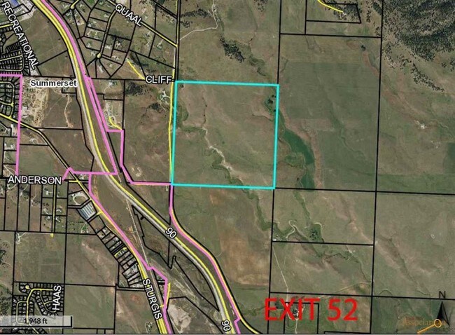
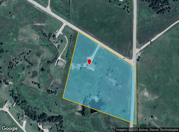
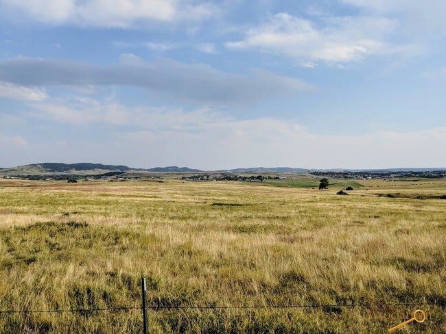
10303 Quaal Rd
Rapid City, SD
Rendezvous Ranch
15.92.03
RENDEZVOUS RANCH LOT 3
Sfr
Meade
X
South Dakota
46103C0340H
3
2024
9 AC
2025
South Dakota Area
020302
Other Market Areas
DEMOGRAPHICS near 10303 Quaal Rd
1 mile
3 mile
5 mile
2024 Total Population
806
8,370
12,332
2029 Population
857
8,890
13,162
Pop Growth 2024-2029
+ 6.33%
+ 6.21%
+ 6.73%
Average Age
36
39
40
2024 Total Households
302
3,232
4,848
HH Growth 2024-2029
+ 6.62%
+ 6.44%
+ 7.05%
Median Household Inc
$84,615
$78,942
$78,754
Avg Household Size
2.60
2.60
2.50
2024 Avg HH Vehicles
2.00
3.00
2.00
Median Home Value
$238,392
$243,863
$252,323
Median Year Built
2002
1994
1995
Nearby Places
Map Layers
Map Styles
 Street
 Aerial
Transit
 Traffic
 Biking
Places
Listings with unknown addresses are not visible on the map
- Restaurants
- Banks
- Shops
- Fitness
- Groceries
PUBLIC TRANSPORTATION
AIRPORT
Rapid City Regional
Drive
Walk
Distance
Rapid City Regional
33 min
20.8 mi
Freight Ports
Tulsa Port Of Catoosa
Drive
Walk
Distance
Tulsa Port Of Catoosa
977 min
896.8 mi
SALE & LEASE HISTORY
LISTING DATE
SALE/LEASE

Aug 29, 2019
For Sale
Nearby Properties
Address
Land Use
TOTAL SIZE
Lot Size
Zoning
Address
Land Use
TOTAL SIZE
Lot Size
Zoning
6.45 AC
Address
Land Use
TOTAL SIZE
Lot Size
Zoning
4.72 AC
Address
Land Use
TOTAL SIZE
Lot Size
Zoning
Address
Land Use
TOTAL SIZE
Lot Size
Zoning
3.50 AC
Address
Land Use
TOTAL SIZE
Lot Size
Zoning
1.65 AC
Address
Land Use
TOTAL SIZE
Lot Size
Zoning
Address
Land Use
TOTAL SIZE
Lot Size
Zoning
15.03 AC
Address
Land Use
TOTAL SIZE
Lot Size
Zoning
9.49 AC
Address
Land Use
TOTAL SIZE
Lot Size
Zoning
Address
Land Use
TOTAL SIZE
Lot Size
Zoning
38.86 AC
Address
Land Use
TOTAL SIZE
Lot Size
Zoning
2.24 AC
Address
Land Use
TOTAL SIZE
Lot Size
Zoning
5.60 AC
Address
Land Use
TOTAL SIZE
Lot Size
Zoning
Address
Land Use
TOTAL SIZE
Lot Size
Zoning
Address
Land Use
TOTAL SIZE
Lot Size
Zoning
2.01 AC
Address
Land Use
TOTAL SIZE
Lot Size
Zoning
3.12 AC
Address
Land Use
TOTAL SIZE
Lot Size
Zoning
Address
Land Use
TOTAL SIZE
Lot Size
Zoning
1,200 SF
21.49 AC
Address
Land Use
TOTAL SIZE
Lot Size
Zoning
Address
Land Use
TOTAL SIZE
Lot Size
Zoning
Address
Land Use
TOTAL SIZE
Lot Size
Zoning
Address
Land Use
TOTAL SIZE
Lot Size
Zoning
3.12 AC
Address
Land Use
TOTAL SIZE
Lot Size
Zoning
23.54 AC
Address
Land Use
TOTAL SIZE
Lot Size
Zoning
Address
Land Use
TOTAL SIZE
Lot Size
Zoning
11.63 AC
Address
Land Use
TOTAL SIZE
Lot Size
Zoning
21.55 AC
Address
Land Use
TOTAL SIZE
Lot Size
Zoning
Address
Land Use
TOTAL SIZE
Lot Size
Zoning
11.58 AC
Address
Land Use
TOTAL SIZE
Lot Size
Zoning
The World's #1 Commercial Real Estate Marketplace
Connect with us
© 2026 CoStar Group
The information above has been obtained from sources believed reliable. While we do not doubt its accuracy we have not verified it and make no guarantee, warranty or representation about it. It is your responsibility to independently confirm its accuracy and completeness. Any projections, opinions, assumptions, or estimates used are for example only and do not represent the current or future performance of the property. The value of this transaction to you depends on tax and other factors which should be evaluated by your tax, financial, and legal advisors. You and your advisors should conduct a careful, independent investigation of the property to determine to your satisfaction the suitability of the property for your needs.