Property Record
Los Angeles Rd, Carbondale, IL 62902
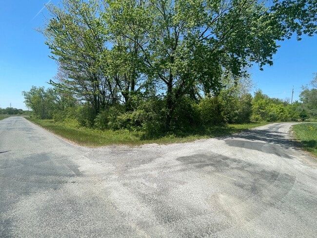
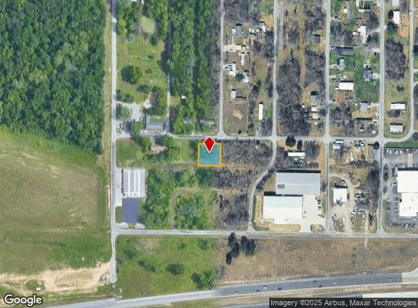
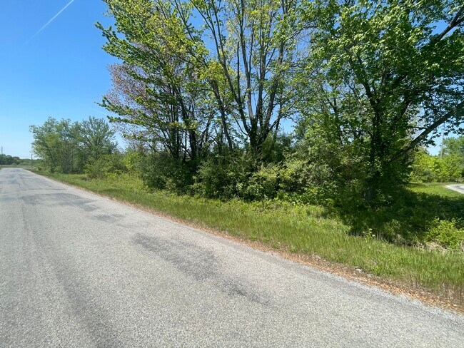
This Property Is For Sale
NEARBY LISTINGS FOR SALE OR LEASE
Property Detail
Los Angeles Rd
05-07-365-017
CRAB ORCHARD ESTS UNIT 1 LOTS 32 & 33
Residentialacreage
Williamson
X
Illinois
17199C0150D
32-33
2024
Marion/I-64 & South
2025
Other Market Areas
021400
Carbondale-Marion, IL
DEMOGRAPHICS near Los Angeles Rd
1 Mile
3 Mile
5 Mile
2024 Total Population
1,190
5,654
29,157
2029 Population
1,192
5,580
28,961
Pop Growth 2024-2029
+ 0.17%
(1.31%)
(0.67%)
Average Age
39
38
36
2024 Total Households
514
2,423
13,240
HH Growth 2024-2029
0.00%
(1.53%)
(0.67%)
Median Household Inc
$65,714
$66,889
$35,305
Avg Household Size
2.30
2.30
2.10
2024 Avg HH Vehicles
2.00
2.00
2.00
Median Home Value
$161,052
$175,362
$146,577
Median Year Built
1986
1985
1980
Nearby Places
- Restaurants
- Banks
- Shops
- Fitness
- Groceries
PUBLIC TRANSPORTATION
COMMUTER RAIL
Carbondale (City of New Orleans - Amtrak, Illini - Amtrak, Saluki - Amtrak)
DRIVE
WALK
Distance
Carbondale (City of New Orleans - Amtrak, Illini - Amtrak, Saluki - Amtrak)
9 min
5.2 mi
Freight Ports
Port Milwaukee
DRIVE
WALK
Distance
Port Milwaukee
466 min
412.4 mi
Nearby Properties
Address
Land Use
TOTAL SIZE
Lot Size
Zoning
Address
Land Use
TOTAL SIZE
Lot Size
Zoning
Address
Land Use
TOTAL SIZE
Lot Size
Zoning
84,270 SF
6.50 AC
Address
Land Use
TOTAL SIZE
Lot Size
Zoning
17,700 SF
18.37 AC
Address
Land Use
TOTAL SIZE
Lot Size
Zoning
17.78 AC
Address
Land Use
TOTAL SIZE
Lot Size
Zoning
6,750 SF
4.53 AC
Address
Land Use
TOTAL SIZE
Lot Size
Zoning
119,175 SF
2.84 AC
Address
Land Use
TOTAL SIZE
Lot Size
Zoning
79,800 SF
2.50 AC
Address
Land Use
TOTAL SIZE
Lot Size
Zoning
Address
Land Use
TOTAL SIZE
Lot Size
Zoning
14,040 SF
2.37 AC
Address
Land Use
TOTAL SIZE
Lot Size
Zoning
88,081 SF
11.29 AC
Address
Land Use
TOTAL SIZE
Lot Size
Zoning
61,600 SF
6.99 AC
Address
Land Use
TOTAL SIZE
Lot Size
Zoning
3.88 AC
Address
Land Use
TOTAL SIZE
Lot Size
Zoning
84,810 SF
7.50 AC
Address
Land Use
TOTAL SIZE
Lot Size
Zoning
63,000 SF
2.62 AC
Address
Land Use
TOTAL SIZE
Lot Size
Zoning
1.64 AC
Address
Land Use
TOTAL SIZE
Lot Size
Zoning
2,800 SF
3.58 AC
Address
Land Use
TOTAL SIZE
Lot Size
Zoning
4,080 SF
0.85 AC
Address
Land Use
TOTAL SIZE
Lot Size
Zoning
5,532 SF
7.93 AC
Address
Land Use
TOTAL SIZE
Lot Size
Zoning
3,768 SF
2.01 AC
Address
Land Use
TOTAL SIZE
Lot Size
Zoning
4,400 SF
3.03 AC
Address
Land Use
TOTAL SIZE
Lot Size
Zoning
Address
Land Use
TOTAL SIZE
Lot Size
Zoning
1.86 AC
Address
Land Use
TOTAL SIZE
Lot Size
Zoning
1.48 AC
Address
Land Use
TOTAL SIZE
Lot Size
Zoning
Address
Land Use
TOTAL SIZE
Lot Size
Zoning
6,458 SF
1.37 AC
Address
Land Use
TOTAL SIZE
Lot Size
Zoning
2.72 AC
Address
Land Use
TOTAL SIZE
Lot Size
Zoning
Address
Land Use
TOTAL SIZE
Lot Size
Zoning
3.59 AC
The World's #1 Commercial Real Estate Marketplace
Connect with us
© 2025 CoStar Group
The information above has been obtained from sources believed reliable. While we do not doubt its accuracy we have not verified it and make no guarantee, warranty or representation about it. It is your responsibility to independently confirm its accuracy and completeness. Any projections, opinions, assumptions, or estimates used are for example only and do not represent the current or future performance of the property. The value of this transaction to you depends on tax and other factors which should be evaluated by your tax, financial, and legal advisors. You and your advisors should conduct a careful, independent investigation of the property to determine to your satisfaction the suitability of the property for your needs.