Property Record
E Springfield Rd, Saint James, MO 65559
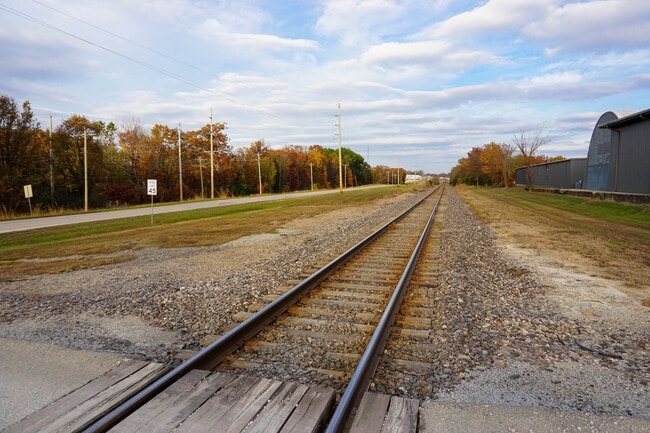
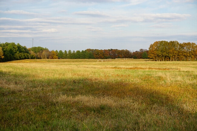
This Property Is For Sale
NEARBY LISTINGS FOR SALE OR LEASE
-
-
View all Saint James listings for sale on LoopNet.com
Property Detail
E Springfield Rd
71-02-4.0-20-001-023-001.000
FRACTIONAL PART E/2 NE1/4 SEC 20 TWP 38 N RNG 6 W
Agriculturalland
Phelps
X
Missouri
29055C0150D
27 AC
2024
Missouri South Central Area
2025
Other Market Areas
890200
Rolla, MO
DEMOGRAPHICS near E Springfield Rd
1 Mile
3 Mile
5 Mile
2024 Total Population
2,344
5,567
7,364
2029 Population
2,389
5,663
7,502
Pop Growth 2024-2029
+ 1.92%
+ 1.72%
+ 1.87%
Average Age
41
41
41
2024 Total Households
901
2,226
2,915
HH Growth 2024-2029
+ 2.11%
+ 1.89%
+ 1.99%
Median Household Inc
$51,616
$55,169
$57,754
Avg Household Size
2.30
2.30
2.40
2024 Avg HH Vehicles
2.00
2.00
2.00
Median Home Value
$186,812
$189,708
$209,966
Median Year Built
1972
1974
1978
Nearby Places
- Restaurants
- Banks
- Shops
- Fitness
- Groceries
Nearby Properties
Address
Land Use
TOTAL SIZE
Lot Size
Zoning
Address
Land Use
TOTAL SIZE
Lot Size
Zoning
200,070 SF
11.80 AC
Address
Land Use
TOTAL SIZE
Lot Size
Zoning
24,156 SF
11 AC
Address
Land Use
TOTAL SIZE
Lot Size
Zoning
6,400 SF
19.50 AC
Address
Land Use
TOTAL SIZE
Lot Size
Zoning
42,160 SF
11.70 AC
Address
Land Use
TOTAL SIZE
Lot Size
Zoning
31,600 SF
26.30 AC
Address
Land Use
TOTAL SIZE
Lot Size
Zoning
7,200 SF
23.70 AC
Address
Land Use
TOTAL SIZE
Lot Size
Zoning
5,394 SF
2.20 AC
Address
Land Use
TOTAL SIZE
Lot Size
Zoning
34,762 SF
2.20 AC
Address
Land Use
TOTAL SIZE
Lot Size
Zoning
54,250 SF
6.60 AC
Address
Land Use
TOTAL SIZE
Lot Size
Zoning
9,172 SF
23.30 AC
Address
Land Use
TOTAL SIZE
Lot Size
Zoning
48,631 SF
8.90 AC
Address
Land Use
TOTAL SIZE
Lot Size
Zoning
28,116 SF
1.20 AC
Address
Land Use
TOTAL SIZE
Lot Size
Zoning
25,838 SF
5 AC
Address
Land Use
TOTAL SIZE
Lot Size
Zoning
9,137 SF
2.60 AC
Address
Land Use
TOTAL SIZE
Lot Size
Zoning
5,589 SF
2.90 AC
Address
Land Use
TOTAL SIZE
Lot Size
Zoning
16,122 SF
10.60 AC
Address
Land Use
TOTAL SIZE
Lot Size
Zoning
7,652 SF
1.40 AC
Address
Land Use
TOTAL SIZE
Lot Size
Zoning
4,396 SF
2.10 AC
Address
Land Use
TOTAL SIZE
Lot Size
Zoning
15,340 SF
0.60 AC
Address
Land Use
TOTAL SIZE
Lot Size
Zoning
6,347 SF
89 AC
Address
Land Use
TOTAL SIZE
Lot Size
Zoning
6,018 SF
0.40 AC
Address
Land Use
TOTAL SIZE
Lot Size
Zoning
6,000 SF
5.50 AC
Address
Land Use
TOTAL SIZE
Lot Size
Zoning
28,211 SF
1.30 AC
Address
Land Use
TOTAL SIZE
Lot Size
Zoning
12,697 SF
1.90 AC
Address
Land Use
TOTAL SIZE
Lot Size
Zoning
5,071 SF
2.10 AC
Address
Land Use
TOTAL SIZE
Lot Size
Zoning
6,412 SF
0.80 AC
Address
Land Use
TOTAL SIZE
Lot Size
Zoning
15,240 SF
7 AC
Address
Land Use
TOTAL SIZE
Lot Size
Zoning
10,596 SF
1.60 AC
Address
Land Use
TOTAL SIZE
Lot Size
Zoning
8,402 SF
2.30 AC
Address
Land Use
TOTAL SIZE
Lot Size
Zoning
688 SF
1.20 AC
The World's #1 Commercial Real Estate Marketplace
Connect with us
© 2025 CoStar Group
The information above has been obtained from sources believed reliable. While we do not doubt its accuracy we have not verified it and make no guarantee, warranty or representation about it. It is your responsibility to independently confirm its accuracy and completeness. Any projections, opinions, assumptions, or estimates used are for example only and do not represent the current or future performance of the property. The value of this transaction to you depends on tax and other factors which should be evaluated by your tax, financial, and legal advisors. You and your advisors should conduct a careful, independent investigation of the property to determine to your satisfaction the suitability of the property for your needs.