Property Record
Wortham Bend Rd, Waco, TX 76708

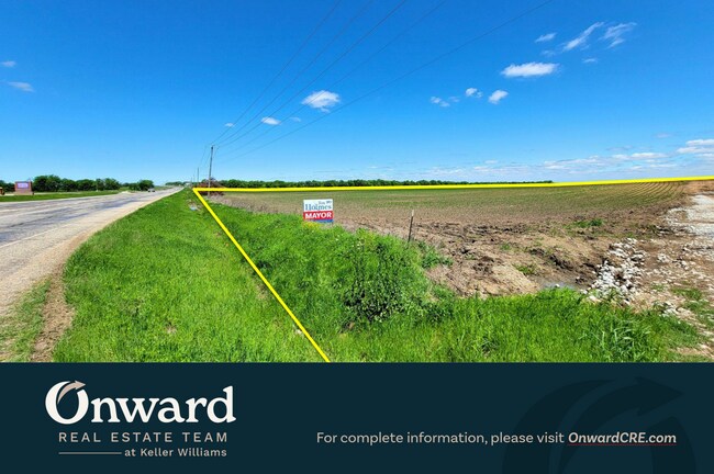
This Property Is For Sale
Property Detail
Wortham Bend Rd
18-000200-004100-0
BARRON T H ACRES 50.0
Privatepreserveopenspacevacantlandforestlandconservation
MCLENNAN
R
Texas
B and X Area of moderate flood hazard, usually the area between the limits of the 100-year and 500-year floods.
50 AC
2024
Waco
2025
Other Market Areas
003000
Waco, TX
NEARBY LISTINGS FOR SALE OR LEASE
DEMOGRAPHICS near Wortham Bend Rd
1 mile
3 mile
5 mile
2025 Total Population
2,383
10,581
16,583
2030 Population
2,499
11,038
17,245
Pop Growth 2025-2030
+ 4.87%
+ 4.32%
+ 3.99%
Average Age
34
36
38
2025 Total Households
800
3,583
5,766
HH Growth 2025-2030
+ 4.75%
+ 4.33%
+ 3.99%
Median Household Inc
$112,801
$103,636
$99,887
Avg Household Size
3.00
2.90
2.80
2025 Avg HH Vehicles
2.00
2.00
2.00
Median Home Value
$272,323
$306,799
$316,849
Median Year Built
2006
2005
2003
Nearby Places
Map Layers
Map Styles
 Street
 Aerial
Transit
 Traffic
 Biking
Places
Listings with unknown addresses are not visible on the map
- Restaurants
- Banks
- Shops
- Fitness
- Groceries
PUBLIC TRANSPORTATION
AIRPORT
Waco Regional
Drive
Walk
Distance
Waco Regional
8 min
3.2 mi
Freight Ports
Port of Houston
Drive
Walk
Distance
Port of Houston
232 min
197.0 mi
Nearby Properties
Address
Land Use
TOTAL SIZE
Lot Size
Zoning
Address
Land Use
TOTAL SIZE
Lot Size
Zoning
319,291 SF
51.81 AC
R1B
Address
Land Use
TOTAL SIZE
Lot Size
Zoning
155,710 SF
86.36 AC
R
Address
Land Use
TOTAL SIZE
Lot Size
Zoning
346,987 SF
146.01 AC
C
Address
Land Use
TOTAL SIZE
Lot Size
Zoning
163,937 SF
11.09 AC
R1B
Address
Land Use
TOTAL SIZE
Lot Size
Zoning
113,795 SF
7.38 AC
C-3
Address
Land Use
TOTAL SIZE
Lot Size
Zoning
83,212 SF
4.92 AC
Address
Land Use
TOTAL SIZE
Lot Size
Zoning
7,772 SF
2.18 AC
Address
Land Use
TOTAL SIZE
Lot Size
Zoning
15,060 SF
3.88 AC
R1B
Address
Land Use
TOTAL SIZE
Lot Size
Zoning
18,724 SF
1.91 AC
C-2
Address
Land Use
TOTAL SIZE
Lot Size
Zoning
0.65 AC
R1B
Address
Land Use
TOTAL SIZE
Lot Size
Zoning
28,278 SF
256.39 AC
R1B
Address
Land Use
TOTAL SIZE
Lot Size
Zoning
65,960 SF
16.60 AC
Address
Land Use
TOTAL SIZE
Lot Size
Zoning
5,500 SF
2.57 AC
Address
Land Use
TOTAL SIZE
Lot Size
Zoning
50.29 AC
R1B
Address
Land Use
TOTAL SIZE
Lot Size
Zoning
1,006.08 AC
M2
Address
Land Use
TOTAL SIZE
Lot Size
Zoning
12,874 SF
1.55 AC
Address
Land Use
TOTAL SIZE
Lot Size
Zoning
2,772 SF
0.95 AC
Address
Land Use
TOTAL SIZE
Lot Size
Zoning
11,495 SF
2.25 AC
Address
Land Use
TOTAL SIZE
Lot Size
Zoning
10,750 SF
9.79 AC
R1B
Address
Land Use
TOTAL SIZE
Lot Size
Zoning
3,704 SF
0.94 AC
C-2
Address
Land Use
TOTAL SIZE
Lot Size
Zoning
13,400 SF
1.51 AC
C-2
Address
Land Use
TOTAL SIZE
Lot Size
Zoning
53,050 SF
3.72 AC
R
Address
Land Use
TOTAL SIZE
Lot Size
Zoning
12,700 SF
2.12 AC
C-2
Address
Land Use
TOTAL SIZE
Lot Size
Zoning
37.09 AC
Address
Land Use
TOTAL SIZE
Lot Size
Zoning
10,080 SF
1.39 AC
O-3
Address
Land Use
TOTAL SIZE
Lot Size
Zoning
10,302 SF
1.70 AC
C-2
Address
Land Use
TOTAL SIZE
Lot Size
Zoning
3,798 SF
0.91 AC
Address
Land Use
TOTAL SIZE
Lot Size
Zoning
6,704 SF
1.34 AC
C-2
Address
Land Use
TOTAL SIZE
Lot Size
Zoning
8,981 SF
15.97 AC
R
Address
Land Use
TOTAL SIZE
Lot Size
Zoning
8,979 SF
2.23 AC
The World's #1 Commercial Real Estate Marketplace
Connect with us
© 2026 CoStar Group
The information above has been obtained from sources believed reliable. While we do not doubt its accuracy we have not verified it and make no guarantee, warranty or representation about it. It is your responsibility to independently confirm its accuracy and completeness. Any projections, opinions, assumptions, or estimates used are for example only and do not represent the current or future performance of the property. The value of this transaction to you depends on tax and other factors which should be evaluated by your tax, financial, and legal advisors. You and your advisors should conduct a careful, independent investigation of the property to determine to your satisfaction the suitability of the property for your needs.